GORDON DOHERTY, AUTHOR
  • Home
  • Books
    • Legionary
    • Empires of Bronze
    • Strategos
    • Rise of Emperors
    • Assassin's Creed
    • Free short stories >
      • Eagles in the Desert
      • Day One
      • The Guardian
      • The Hill
      • Redemption
      • Even Tide
      • City of the Blind
      • The Pict
      • Into the Breach
    • BUY SIGNED COPIES!
    • Bibliography
  • Blog
  • Contact

Searching for the Battle of Adrianople

7/25/2019

2 Comments

 
Picture
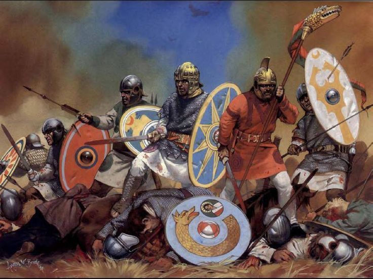
The last stand of the legions at one of histories most notorious clashes.
On 9th August 378 AD, under a blistering-hot Thracian sun, two-thirds of the Eastern Roman Army was slaughtered. Emperor Valens fell along with his legions. It was the day of the Goths... it was the Battle of Adrianople.

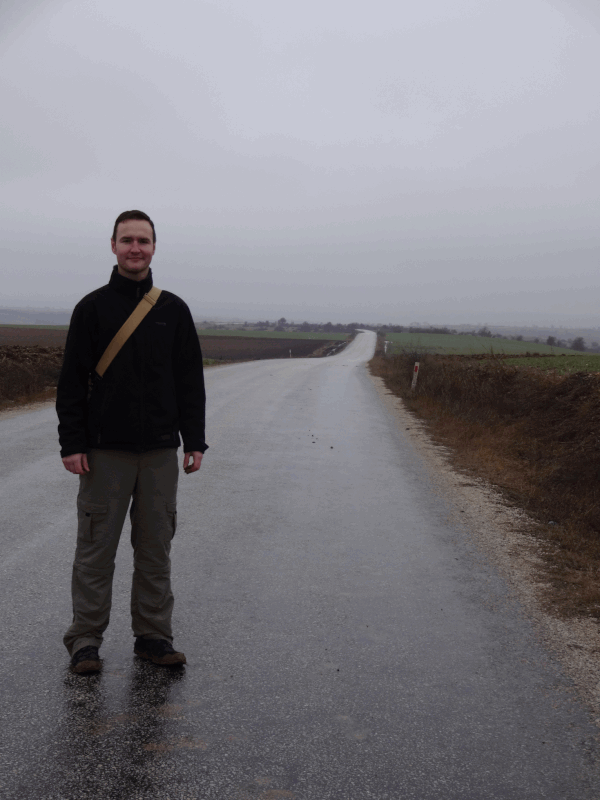
The time-period has had me in its talons for nearly a decade. The Legionary series is entrenched in the brutal chain of events of those times: the coming of the Huns, the flight of the great Gothic tribes into Roman territory and the colossal upheaval and destruction that ensued in what was known as ‘the Gothic War’. The Battle of Adrianople was one of the bloodiest encounters of that savage conflict, and one that remains surrounded by unanswered questions and misconceptions. 

So when I had the chance to visit the ancient Roman city of Adrianople (modern Edirne in northwest Turkey) and explore the countryside nearby where the clash is thought to have occurred, I set my mind to exploring and investigating in an attempt to answer what is probably the battle's greatest riddle: where exactly did it occur?

That's right, we still don't know. Anything between 20,000-80,000 men died on that fateful day. Legionary bodies, banners, helms, swords, spears, shields and Gothic equivalents would have been strewn all across the blood-soaked soil. Most of this would have been cleared away or scavenged in the immediate aftermath, but surely a great deal of it must remain where it fell. Somewhere outside Edirne, there must be a wealth of archaeological remains, fixed forever underneath the modern topsoil. Yet there has never been a positive identification of the battle site. There have, however, been two main candidate locations proposed by modern historians. 

So, armed with a camera, chewing gum, a hire car totally unsuited to the mud-track roads (white and shiny when we picked it up, mud-brown with bald tyres when we returned it) and a very understanding wife, I set about exploring these two sites. The first part of this blog is a narrative of the Gothic War and the battle itself, which should help provide a frame of reference for my findings, further down the page.

I have to stress that I am merely an amateur historian – but an obsessively enthusiastic one nonetheless. I expect some readers may appreciate the concise nature of my investigation, others may feel I am not delving deeply into certain aspects, but I hope all can enjoy the journey with me.

Finally, beware that this discussion contains some spoilers to the fifth book in the Legionary series – Gods & Emperors… I’ve heard it’s a must-read ;)
Picture
The fate of the East rests on the edge of a sword as the legions and the Goths march to war…

Part 1: The Road to War

​So why did the Romans and the Goths meet in battle on that fateful day? One man - a contemporary of the brave legionaries and Goths who died on the plains of Thracia - is best placed to explain...

A Voice from History

​There are many fine books discussing the Gothic War and the Battle of Adrianople, but all of them draw from one primary source: Ammianus Marcellinus’ ‘Roman History’, written in or before 391 AD, is a gold mine but a labyrinthine one that delivers as many dead ends as it does precious finds. Detail is rich one moment then fleeting the next, and putting shape to times, places, and events is a bit like nailing jelly/garum to a tree. Ammianus was a military man but this is not a strictly military chronicle, which perhaps explains the patchiness of his accounts in places. Another explanation is the suspicion that Ammianus is not thought to have been an eye witness to the battle, but is likely to have visited Thracia after the Gothic Wars to assess and understand the events (I wonder if he hired a pristine, white wagon and handed it back in a muddy mess to a raging trader?).

I should point out that I am not fluent in Latin, so I rely upon the translations of Ammianus and subsequent investigative work performed by many esteemed historians including N.J.E. Austin, Hans Delbruck, Peter Donnelly, Ian Hughes, Noel Lenski, Simon MacDowall, F. Runkel and Herwig Wolfram amongst others.

Thracia: a Land in Turmoil

Ammianus describes how the Roman Diocese of Thracia bore the brunt of the Gothic War. This land is well-trodden by the legionaries of the XI Claudia in my Legionary series, and here’s a map of that region with some of the key locations mentioned in this blog:

Timeline of Events Leading up to the Battle of Adrianople

376 AD
  • Pressurised by the growing Hun threat north of the Danube, Fritigern’s Thervingi Goths – thought to number more than one hundred thousand people – successfully plead with Emperor Valens for entry into and sanctuary within imperial territory.
  • The Goths cross the Danube and end up clustered in Roman Moesia in a refugee camp, near the XI Claudia legionary barracks by the river town of Durostorum. Starvation soon sets in. Added to this, the Roman officers Lupicinus and Maximus resort to barbaric measures, offering scraps of dog meat in return for Gothic children who will serve as slaves/hostages.
377 AD
  • Lupicinus invites Fritigern to a banquet at Marcianople then makes a botched attempt to assassinate the Gothic leader. This is the final straw that incites a Gothic revolt. They rampage around the Roman countryside, shattering the river forts and plundering and looting towns.
  • Worse, the Greuthingi Goths, led by Alatheus and Saphrax, flood across the now undefended Danube, bringing their huge cavalry forces with them and forging an alliance with Fritigern and his army.
  • Soon afterwards, this Gothic alliance meets a patchwork Roman army – consisting of the Moesian limitanei and a cluster of legions sent from the Persian frontier. The battle, at an as-yet unidentified place known as Ad Salices (“The town by the willows”), is a bloody stalemate. Afterwards, the Goths pull back to northern Thracia/Moesia, while the legions withdraw to southern Thracia.
  • The shattered remnant of the Roman forces resort to blocking the Haemus Mountain passes (which divide southern and northern Thracia) in an effort to contain the Goths in the north. But the Goths break through and all Thracia – right up to Constantinople’s walls, comes under threat. 
  • The Roman general, Frigeridus, manages to contain a spike of attempted Gothic expansion towards the Western Empire, at the Succi Pass (near modern Sofia in Bulgaria). It is a small but important victory, keeping the Goths within Thracia.
378 AD
  • Fritigern realises he can't break the walls of the mighty imperial cities, but he can effectively seize control of the countryside and the road networks. Thus, he tasks his Gothic warbands with roaming far and wide, raiding smaller towns and destroying attempts at transporting food and supplies between the cities.
  • May 31st. Emperor Valens finally manages to extract his Praesental Army (his crack palace legions and specialist cavalry) from the Persian frontier and brings them to Constantinople, on Thracia's southeastern corner. More, Western Emperor Gratian has promised to bring his western army from Gaul to the scene of the trouble.
  • June 11th. Valens marches his army of roughly thirty thousand men from Constantinople to the Imperial estate of Melanthias where they prepare to tackle Fritigern’s numerous roaming warbands.
  • Magister Peditum (Master of the Infantry) Sebastianus is despatched north into the thick of the Gothic-held lands to wage a guerrilla war and weaken Fritigern’s morale.
  • The guerrilla war works, and by late July, it forces Fritigern to gather his distributed mini-armies into one great horde once again. The Goths assemble at Kabyle and they march south through the Tonsus valley towards Roman-held Adrianople and the nearby and vital waystation of Nike.
  • At the same time, Valens leads his army north from Melanthias, along the Via Militaris, towards Adrianople. Passing the fortified imperial waystation of Nike along the way.
  • Soon, Valens reaches Adrianople and sets up a moated camp outside the city’s walls. Gratian and his army are nowhere to be seen and reports indicate they are still a long way off arriving in Thracia. Valens knows Fritigern’s forces have by now spilled from the Tonsus valley and onto the plains north of the city. It is almost certain that Fritigern’s aim is not to assault Adrianople, but to skirt around it and hasten towards and take Nike. Valens faces the choice of waiting on Gratian or marching to face Fritigern alone.
  • Valens’ key men debate the wisdom of staying put or not. In the end, Valens decides not to wait on Gratian and marches out to engage Fritigern instead. Why? Well, popular theory points to the rivalry that existed between Valens and Gratian – this may have been responsible for Gratian’s infuriatingly slow progress (perhaps to anger Valens and demonstrate his own authority) and Valens eventual ‘hasty’ decision to end the wait for the western reinforcements (and snatch victory for himself alone). More likely, however, Valens was acutely aware of the implications of Fritigern taking Nike. The loss of this waystation would hamstring Valens’ campaign, depriving them of supplies and a supply/reinforcement route from Constantinople. And, surely clinching his decision, Valens’ scouts inform him that Fritigern’s forces lack any cavalry support – the formidable Greuthingi riders of Alatheus and Saphrax have abandoned the horde. Fritigern’s infantry are numerous and fierce, but surely defeatable.
  • On 9th August, Valens leads his army from the camp and on through the plains north of Adrianople. Due to the known closeness of the Goths, they march in full armour under a withering, dog-day sun. Thirst and fatigue soon take hold. Around noon, they sight Fritigern’s horde. The Goths have arrayed their wagons in a laager/wall atop a defensible area of high ground. A broad and deep line of spearmen and archers stand before the wagon wall, ready to defend their elevated position.

...the day of reckoning has arrived.

Part 2: The Battle - 9th August 378 AD

Numbers

Size estimates of the opposing forces’ vary, some arguing that each side fielded around fifteen thousand men, others claim it was more than sixty thousand warriors each. Most agree, however, that numbers would have been equal, or that maybe the Romans would have enjoyed a slight advantage. I discuss the legions of this era a little more, here and here.

Phases of Battle

  • Phase 1: the armies draw close, with the Romans ascending the baked slope towards the Gothic wagon wall on the crest of their high-ground.
  • Phase 2: once the Romans have halted near the top of the ridge, petty skirmishing (thrown rocks, insults and mock-charges) occurs while frantic last-minute negotiations take place between Valens and Fritigern.
  • Phase 3: Roman cavalry units on the right disobey orders not to engage and charge the Gothic spearmen.
  • Phase 4: Alatheus and Saphrax along with several thousand Greuthingi cavalry arrive unexpectedly at the scene of the battle (Ian Hughes argues the case well that the Greuthingi arrived on the Roman right), driving off the Roman cavalry there then surrounding and crushing the Roman infantry lines. By dusk, the broken remnants of the legions broke away, fleeing for their lives as the Goths cheered in victory.

The Battlefield

Based on the phases (above), the battle is likely to have taken shape as in the following illustration, with the decisive arrival of the Gothic cavalry happening at phase 4.
Picture
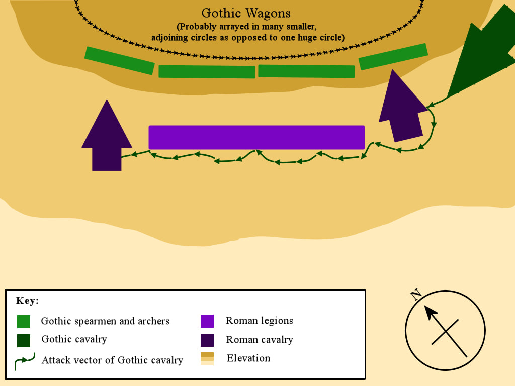
How the battle is likely to have unfolded.

Aftermath

With the Eastern Roman Army in ruins, Thracia was Fritigern’s in all but name. The 9th August 378 AD was supposed to be the day the Gothic War was won; instead, it became a black stain on Roman history, it ensured the Gothic War continued and – longer-term – gave rise to the Gothic confederation known as the Visigoths, who would one day sack Rome itself.

Some say the battle marked the end of the era of infantry dominance on the battlefield, but this is an exaggeration. Yes, this was the last time Rome's legions resembled anything like those of better days, but the forces that met outside Adrianople were primarily composed of infantry. From the late 4th century onwards, cavalry certainly grew ‘heavier’ but infantry still dominated armies, numerically at least, with an infantry:cavalry ratio of 3:1 or 4:1 commonplace well into late Byzantine times.

Part 3: ​Searching for the Battle Site

So where did this great clash occur? Well, let’s examine what evidence we have:

On the morning of the 9th August 378 AD, Valens and his army marched in a merciless heat (August temperatures regularly reach 40 °C in this part of the world). Ammianus states: “So after hastening a long distance over rough ground, while the hot day was advancing toward noon, finally at the eighth hour they saw the wagons of the enemy.”

This translation implies that the Romans had marched for eight hours, or as other translations have it to the eighth milestone outside the city, when they spotted the Gothic wagon laagers formed up in the distance. A later work, the Consularia Constantinopolitana, claims that the battle occurred twelve miles from Adrianople. So a rough radius of 10-12 miles seems to be a fair range within which to locate the battle site.

Ammianus also indicates where Fritigern halted his horde in reference to other, known locations: “The barbarians… arrived within fifteen miles from the station of Nike, which was the aim of their march… when the emperor… resolved on attacking them.”

Our historian also states that Fritigern and his horde halted three days after something. What that ‘something’ is remains unclear, but Donnelly argues convincingly that it refers to the Goths’ arrival at the southern end of the Tonsus valley. If this was the case, then we are looking for a site roughly three days’ march (at the lumbering pace a horde would move) from the southern end of the Tonsus valley, towards the Nike waystation. However, this wouldn’t be a direct route as such a path would take them past and dangerously close to Adrianople.

So, this means we are looking for somewhere located:
  • roughly ten to twelve miles north/northeast of Adrianople.
  • around fifteen miles from the waystation of Nike.
  • about three days southeast of the Tonsus valley’s southern end.

Added to that, we are looking for a spot with attributes which would have convinced Fritigern to halt his horde, i.e. somewhere:
  • defensible, most likely a piece of raised ground. The location was described as ‘secure’ by Sozomen.
  • capable of holding the reported 100,000 Gothic warriors and families who followed him.
  • that gave him control of the only nearby water source. Ammianus describes how Fritigern went on to use some resource – almost certainly water – as a bargaining chip/potential truce offering to the thirsty Romans. This would only be a viable strategy if the Romans themselves had no access to water to replenish their flasks (which were seemingly empty or close to empty by the time the two sides had drawn up to face one another).

And finally, given the pivotal moment in the battle occurred when the Greuthingi cavalry unexpectedly appeared, we have to ask how the terrain itself might allow for that. So, our last criterion is that the site should:
  • offer some means of disguising the approach of a large (possibly as large as ten thousand riders) cavalry wing.

The Candidate Sites

​Two sites in the 10-12 mile zone have been identified and long debated. MacDowall and Potter point to the ridge immediately south of Muratçalı (a farming village north of Edirne/Adrianople), while Donnelly, Runkel and Lenski insist the dominant ridge at Demirhanlı (another village northeast of Edirne) is the one. So, with the criteria outlined above, I visited each location.
Picture
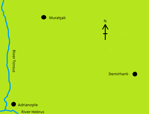
The two candidate battle sites in relation to the city of Adrianople: Muratçalı and Demirhanli.
Site 1 - Muratçalı
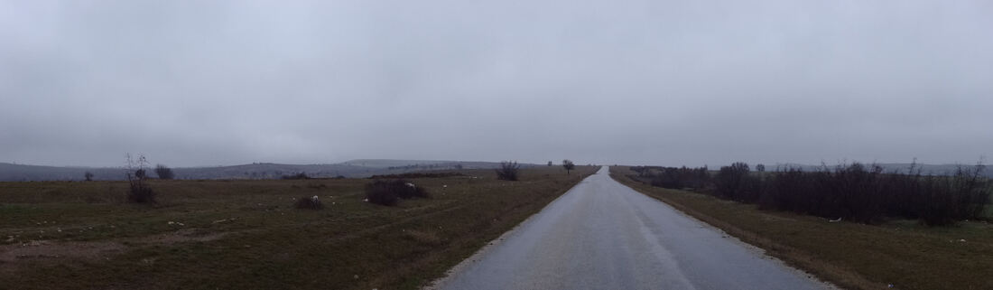
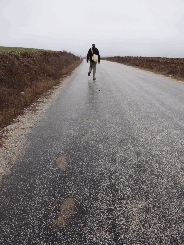
We drove north from Edirne, passing through the farming village of Boyuk Doluk – rumoured to be the site of the farmhouse where Emperor Valens retreated to after the battle, wounded, and then died. 
Upon exiting this village we saw, as MacDowall stated we would, the dominant ridge that rests a mile or so further north:
Picture
The ridge, as seen from our approach from the south.
Picture
The ridge as seen - on a far finer day - from the north.
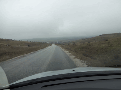
Next, we made our way up onto the ridge. It was incredibly still and utterly silent given how high and exposed we were. I must admit it was a rather poignant moment for me, bringing a touch of reality to the legend I’ve spent the last decade writing about:
Picture
Following in the footsteps of...Pavo, Gallus...Ammianus? That's me trudging northwards up the last stretch of the slope towards the flat ground atop the ridge; this is the route the Romans would have taken to engage with the Goths who were arrayed on the tip of the slope.
Picture
Now on top of the ridge, the camera is looking south. This is the vista the Goths would have had of the approaching Romans (who might have been even more devilishly handsome/frighteningly ugly than the fellow in this pic).
Picture
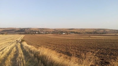
The ridge levels out onto a large-ish plateau. This photo is taken from the northern end/back of the plateau, looking south along the flat area (the point where road meets sky is where I was standing in the previous photo). While Fritigern's warriors would have been arrayed along the distant edge of the plateau, facing south, the rest of the families, tents and animals would have been encamped on this stretch of ground.
Picture
At the northern edge of the ridge, looking downhill to the modern village of Muratçalı (I've effectively turned 180 degrees from the previous pic).
So, how did Muratçalı fit the criteria for the battle site?

Located roughly ten to twelve miles north/northeast of Adrianople? 
  • The ridge is just over ten miles north and slightly east of Adrianople/Edirne. Verdict: positive
Located around fifteen miles from the waystation of Nike? 
  • The site is eighteen miles from the mooted location of Nike. A little bit of a stretch but an acceptable one. Verdict: positive
 Located about three days southeast of the Tonsus valley’s southern end? 
  • The distance from the Tonsus river valley to the Muratçalı site could be covered in a morning, even by a lumbering horde. Indeed, the Tonsus river is almost visible from the Muratçalı ridge. Verdict: negative
Offers some means of disguising the approach of a large (possibly as large as ten thousand riders) cavalry wing? 
  • This is a shaky ‘for’. If the Romans were approaching from the south of the ridge, then the ridge itself could indeed mask the Gothic cavalry, were they approaching from the north. One thing that no site could truly disguise, however, is the colossal dust cloud that approaching horsemen in this number would surely cast up. On a baking-hot afternoon, a golden plume would be visible for miles. Perhaps when the Goths took to lighting dry grass in the moments before battle commenced (as Ammianus describes it: “Our soldiers, already suffering from the summer heat, to become parched and exhausted by the conflagration of the vast plain; as the enemy had, with this object, set fire to the crops by means of burning faggots and fuel.”), they did so – as Donnelly suggests – In order to raise a literal smokescreen that would obscure the approach of their cavalry from behind the ridge? Verdict: neutral
Defensible? 
  • Clearly, this site offers a sound, defensible location. The ridge resembles an oppidum of sorts. Verdict: positive
Space for 100 thousand Goths? 
  • The Muratçalı ridge is maybe a tight squeeze for the reported 100k Goths, but not unfeasibly so. I'm basing this on an - admittedly layman's - comparison of the acreage of the ridge and the slope behind (running down to Muratçalı) which comes in at roughly 500 acres against the site of the modern Glastonbury festival (140k people, 900 acres). Verdict: positive
Water sources for Fritigern to control?
  • There is a significant stream running E-W immediately behind Muratçalı, though it is hard to tell if this is ancient or borne from modern cultivation. In places it looks very straight and elsewhere it has the look of a natural waterway. Verdict: positive
Picture
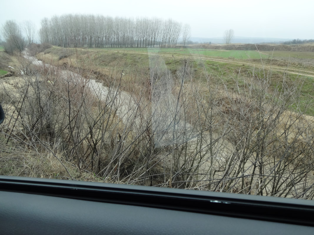
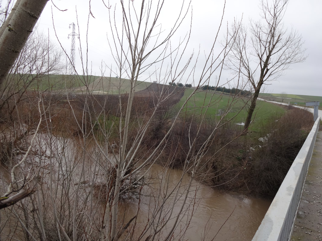
The waterway north of Muratçalı
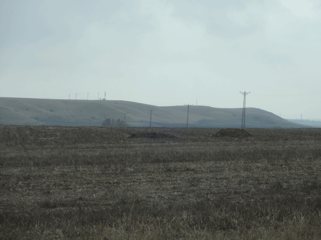
Site 2 - Demirhanli

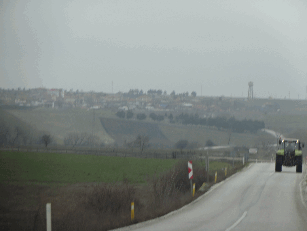
After a somewhat comedy navigational malfunction (involving the satnav on/off button falling off and the thing packing in), we spent the next few hours traversing quagmires and hair-whiteningly narrow dirt causeways with tarns/pools on either side but finally found our way back to Edirne. Topping up the car with diesel and our bellies with juicy lamb kebabs, we then set out to the east – presumably the route of a Roman march from Edirne to the Demirhanlı site. We crossed a series of small rises along the way, yet these were but false summits, because after about ten miles, we came over one gentle hill and sighted Demirhanlı, a small town perched on the edge of another formidable ridge.
Picture
The ridge at Demirhanlı, viewed from the west (as the Romans would have approached it).
Picture
The ridge is vast and quite imposing, almost like bluffs at its southern extent.
So overall, how did Demirhanli fit the bill as  a potential site for the Battle of Adrianople?

Located roughly ten to twelve miles north/northeast of Adrianople?
  • The ridge is just over nine miles east and slightly north of Adrianople/Edirne. Verdict: positive
Located around fifteen miles from the waystation of Nike?
  • The site is just eleven miles from the mooted location of Nike. Verdict: neutral
Located about three days southeast of the Tonsus valley’s southern end?
  • The location of the site fits with the distance the horde could have moved in the three days that passed between the raiding party’s movements and the morning of the battle. Verdict: positive
Offers some means of disguising the approach of a large (possibly as large as ten thousand riders) cavalry wing?
  • This, as with Muratçalı, is a shaky ‘for’. If the Romans were approaching from the west of the ridge, then Gothic cavalry atop and behind the ridge would be rendered invisible. The dust cloud remains though as an enigma. As well as the smokescreen theory, some have suggested that perhaps the cavalry approached along a damp stream bed, knowing far less dust would be cast up as a result. Verdict: neutral
Defensible?
  • Absolutely. The ridge resembles a rampart in places and is would oblige any encroaching Roman army to climb a far steeper slope than at Muratçalı. Verdict: positive
Space for 100 thousand Goths? 
  • The ridge at Demirhanlı is extensive and easily big enough to accommodate the Goths. Actually, the 'ridge' is really more like a beginning of a shelf, east and north of the town, that runs for miles and miles (all the way to Mons Asticus presumably). This would seem like a stronger position than Muratçalı (which could be more easily surrounded). Verdict: positive
Water sources for Fritigern to control?
  • MacDowall argues that there are none, Donnelly insists there are some. Indeed, there are water sources nearby. The pic below shows a broad stream outside Demirhanlı (running N-S). Verdict: neutral
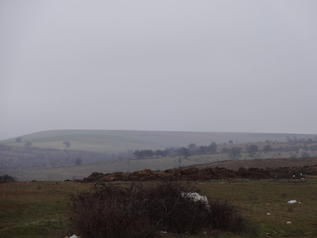
​Driving up through Demirhanlı, I noticed that this 'ridge' was in fact more like a shelf - the land behind it remained at a similar elevation for many miles.
Picture
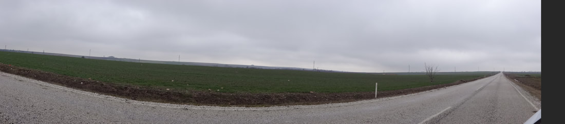
The vast expanse of flat, high ground north east of Demirhanlı - stretching for miles.
Picture
One of many waterways near Demirhanli.

Conclusion

As you can see from my findings above it’s hard to identify one clear candidate. Emotionally, I connected with the Muratçalı site more readily – perhaps because it was the first of the two I visited, and perhaps because I only recently read up on the Demirhanlı theory. But looking at it rationally, we have two flawed candidates. The paltry distance between the Tonsus and the Muratçalı site doesn’t make sense when you consider the sound argument that the Goths had been on the move for three days since leaving the Tonsus valley. Equally, the water source west of Demirhanlı weakens this site’s merits (as does its over-closeness to Nike). I have to reiterate that we are not dealing with an exact science here: the criteria of water sources, location relative to Nike etc are all based on the many educated but varying and sometimes contradictory Ammianus translations. Shifting sands, eh?

So how do we root out a definitive answer? Well, investigation using the latest imaging techniques and metal-detecting would seem like a logical next step (and certainly a step up from an inquisitive chap with muddy shoes, a muddy car, a camera and an over-active imagination). Muratçalı and Demirhanlı could be swiftly ruled out or hailed as the true site, or perhaps another site might come to light. Given the ambiguity of the eight hour/eighth milestone thing – perhaps the scope of exploration should be widened? But such ventures aren't on the cards as things stand. The Turkish people seem to underplay their magnificent Byzantine and Roman heritage, while funding and permissions remain a constant barrier to an in-depth search. And that is such a shame, because there is a treasure out there, waiting to be discovered. In any case - and you can call this cheesy or overly poetic if you like - I certainly found my treasure out there.


I hope you enjoyed the pics and musings. If you fancy having a look at my time in Istanbul as part of the same research trip, you can do so here.

And, of course, if you fancy reliving the fraught lives of the legionaries in the time of the Battle of Adrianople...you can! My Legionary series will take you there!​
Picture
Buy LEGIONARY now!
Sign up to my newsletter
2 Comments
Ogontion
3/8/2020 10:10:58 pm

Thank you Gordon, for all of your excellent research around this fascinating campaign. I really enjoy the background you provide and I hope that you can eventually share some of the answers to your questions. I'm now reading and very much enjoying your 2nd book of the Legionary series.

Reply
John Parry
10/7/2021 12:21:43 pm

Really interesting piece. Thank you. It is the first time I had considered the obvious dust cloud the Gothic cavalry must have made as they rode towards the battle.
So, could they have been there all the time? All the articles and existing history follows the same narrative, i.e. Fritigern draws out negotiations with Valens as he is waiting for the cavalry reinforcements. However, how could the Romans have been surprised by these cavalry as the dust cloud must have been visible for miles?
Mr Doherty’s thesis that Demirhanli could have been the site of the battle, makes the theory that the cavalry were already in place also possible, as is a flat pkain behind the front ridge? Fascinating stuff. Thank you again.

Reply


Leave a Reply.

    Author

    Gordon Doherty: writer, history fan, explorer.

    Picture
    Subscribe to my Newsletter

    My Latest Book

    Picture
    Buy DEVOTIO

    Archives

    April 2025
    March 2025
    March 2023
    February 2023
    January 2023
    September 2022
    July 2022
    June 2022
    May 2022
    April 2022
    March 2022
    November 2021
    October 2021
    September 2021
    July 2021
    May 2021
    April 2021
    March 2021
    December 2020
    November 2020
    October 2020
    September 2020
    June 2020
    May 2020
    February 2020
    January 2020
    July 2019

    Categories

    All

    RSS Feed

Contact  |  Subscribe
  • Home
  • Books
    • Legionary
    • Empires of Bronze
    • Strategos
    • Rise of Emperors
    • Assassin's Creed
    • Free short stories >
      • Eagles in the Desert
      • Day One
      • The Guardian
      • The Hill
      • Redemption
      • Even Tide
      • City of the Blind
      • The Pict
      • Into the Breach
    • BUY SIGNED COPIES!
    • Bibliography
  • Blog
  • Contact