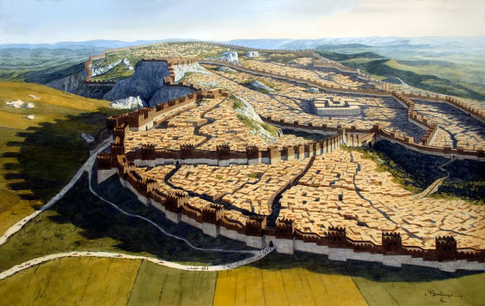
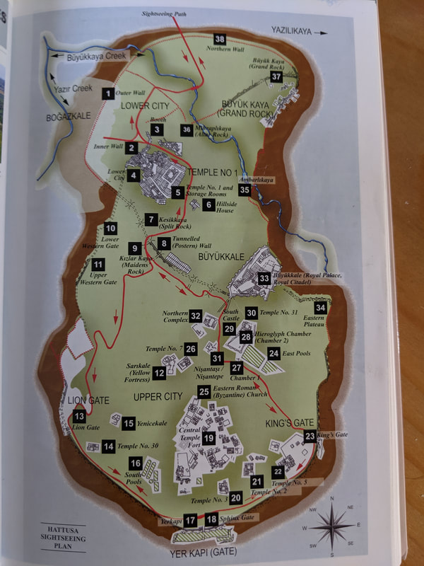
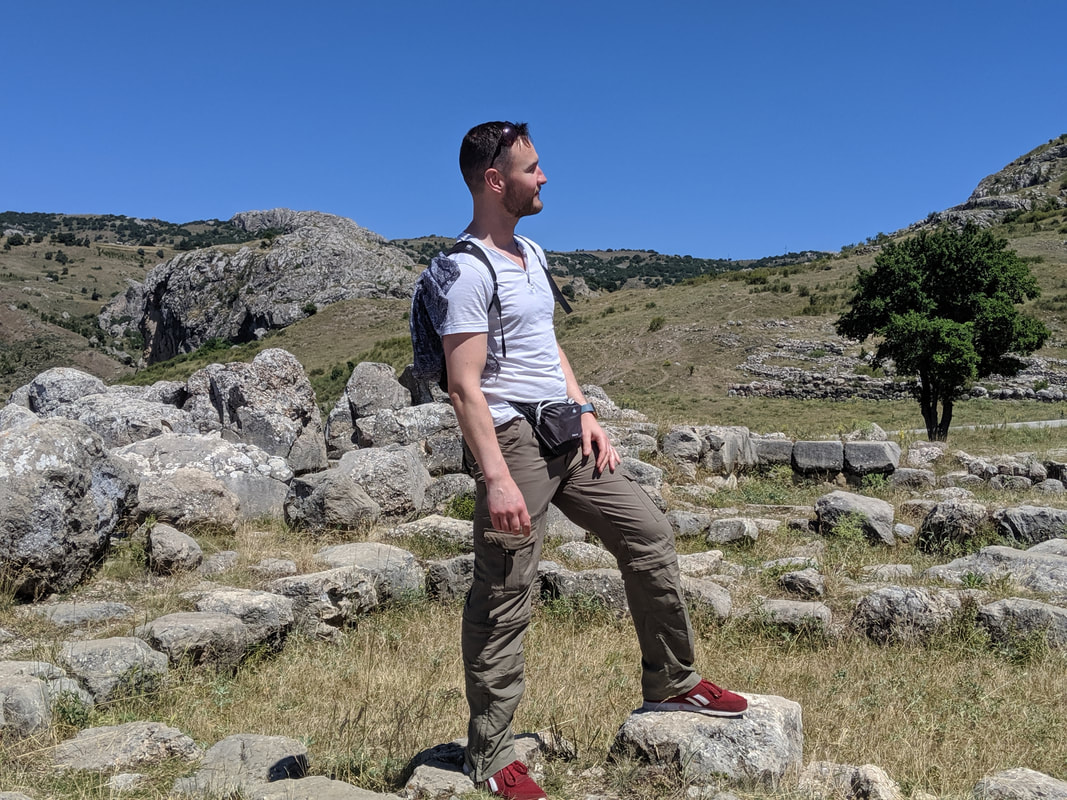
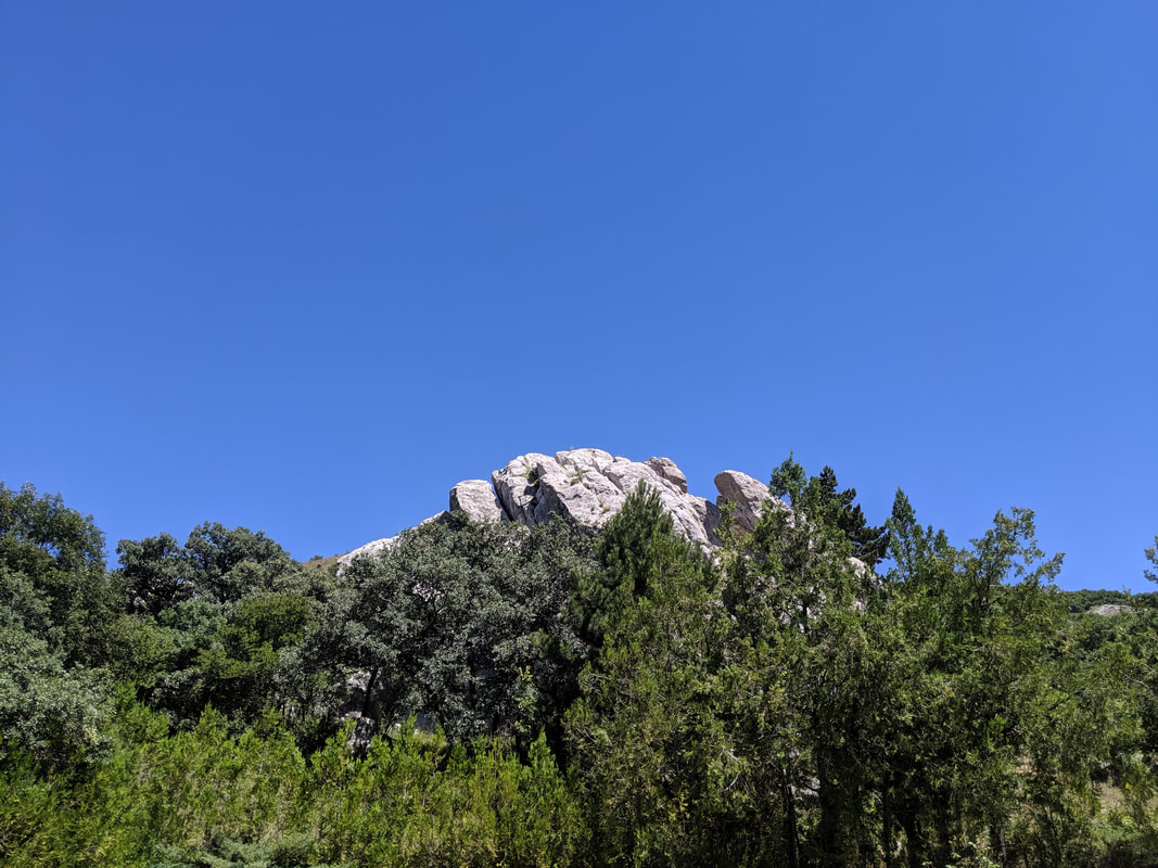
 Hattusa in its pomp, as seen from the north. Hattusa. This place had haunted my days and dreams for over six years. I had pieced it together mentally thanks to a variety of maps and photographs online, but I had craved this moment, to be here where 3,000 years ago the Hittite Empire flourished. All the way on the 3 hour bus from Ankara to Sungurlu, then again during the dolmus ride towards the town of Boğazkale, I scoured the horizons, waiting, eager, watching sierras and cliffs rise then peel away as we sped closer and closer. Would I even recognise the mountainside of Hattusa amongst this highland region? But the moment the rolling, rocky masif arose from the eastern skyline, I felt a hot thrill of recognition - a great sense of arrival. 'That's it!' I proclaimed - somewhat startling the elderly Turkish gent in the dolmus seat in front of me. 'Look, see the ravine - that's cut by the Ambarlikaya river. The tor on the right - that's the acropolis. And on the left, that's Tarhunda's Shoulder!' I gibbered away to anyone who was interested. 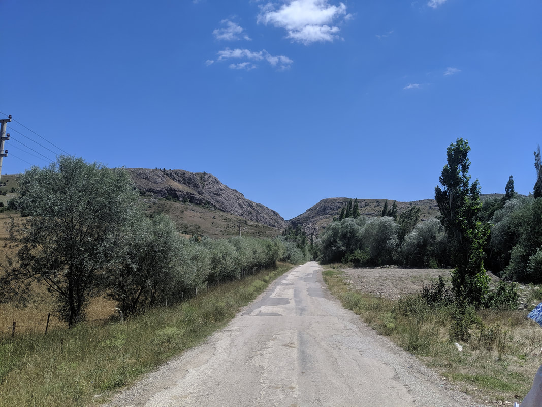 My first glimpse of the UNESCO World Heritage Site of Hattusa - 3,000 year old Capital of the Hititte Empire. The dolmus pulled into the small town of Boğazkale, situated at the western foot of the mountain ruins. I hopped out, dropped my bags into the excellent Hittite Houses hotel. Sitting in the leafy shade of the hotel gardens, I wolfed down a quick lunch of bread and tomatoes, before arming myself with my backpack - water, headscarf, camera being the usual essentials. And there was one other thing vital to this walking tour: the guide book I had bought in the Ankara Museum of Anatolian Civilizations. It's perfect - containing a route map and concise but informative explanations of the ruins on show at every step.
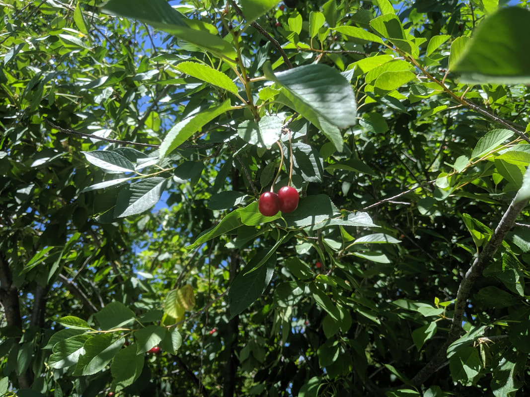
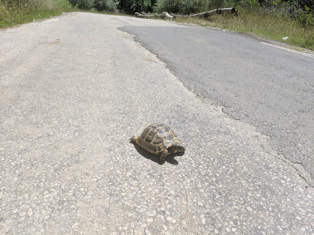
Off I went on the short (~1km) walk up the quiet country road that leads to the ruin site. But like all adventurers, I was waylaid by two almost impassable obstacles. First: a wild cherry tree, heavy with fat, glinting, red and ripe fruit. I simply had to stop and stuff my face with these. Never in my life have I tasted cherries as pleasant as these ones. Next up, I was assailed by a ferocious monster! Not quite. It was actually a wild tortoise, ambling across the middle of the road. I don't know how often traffic passes along this road, but I wasn't minded to leave the wee fella like that, so I lifted him over to the side of the track he was headed for. 
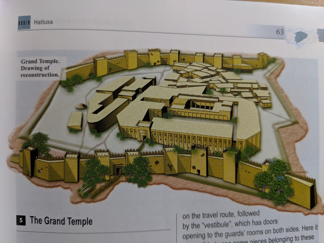
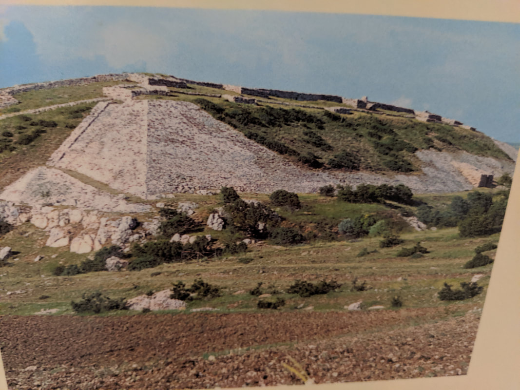
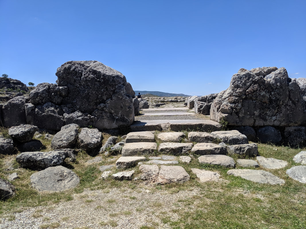
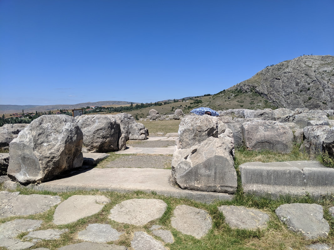
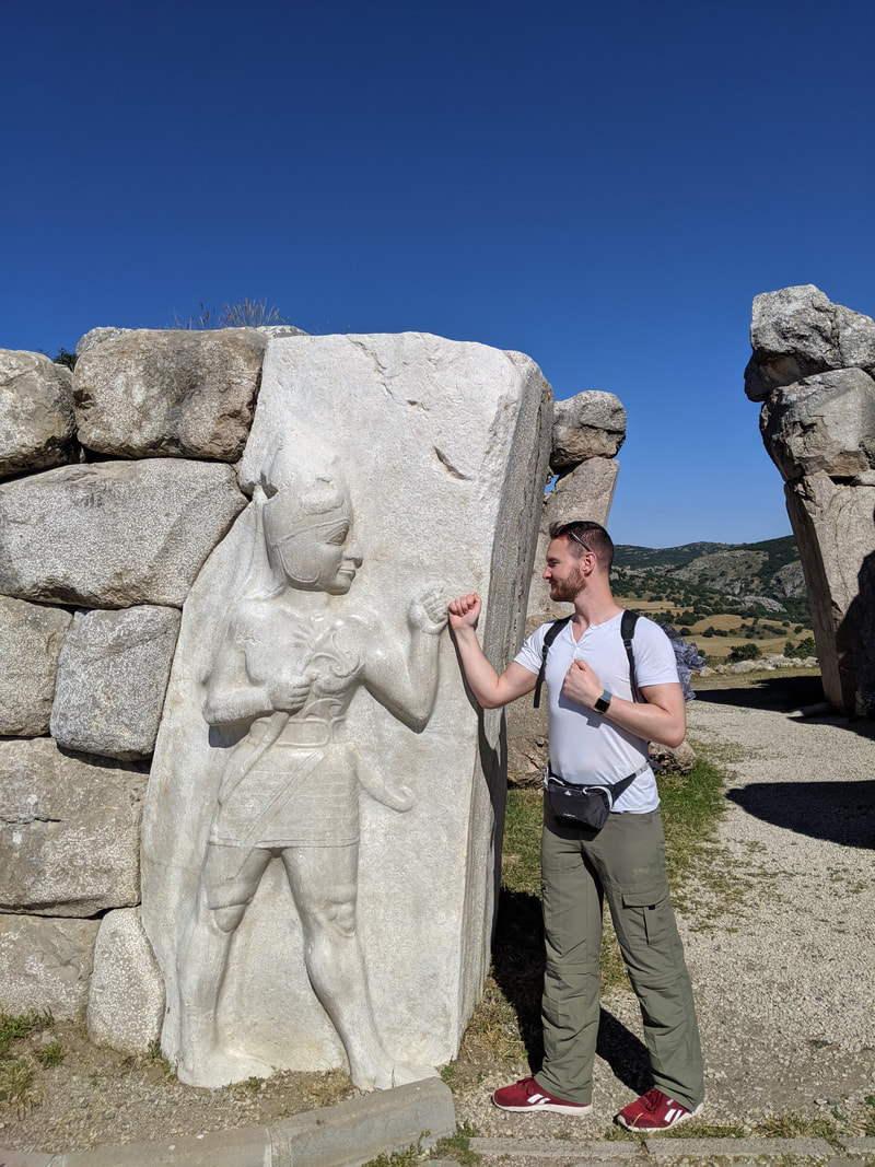
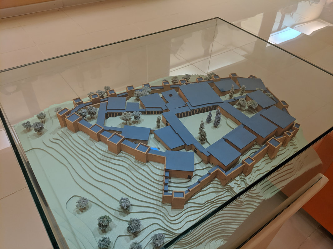
Tortoises tamed and cherries guzzled, I rounded the bend in the track and entered a pleasant stip of shade cast by a stand of pine and birch trees. The sound of a high breeze, sussurating through the branches provided an extra sensation of coolness. But then I heard something else: running water. I knew what this was before I saw it - the Ambarlikaya (or River Ambar, as I call it in Empires of Bronze). This was the waterway - sacred to the Hittites - that ran through their capital all those years ago and still does even now. This is where Prince Hattu and his brother Muwa, swam and played as children. This is where the Wise Women of the Hittite Empire would have prayed and divined. 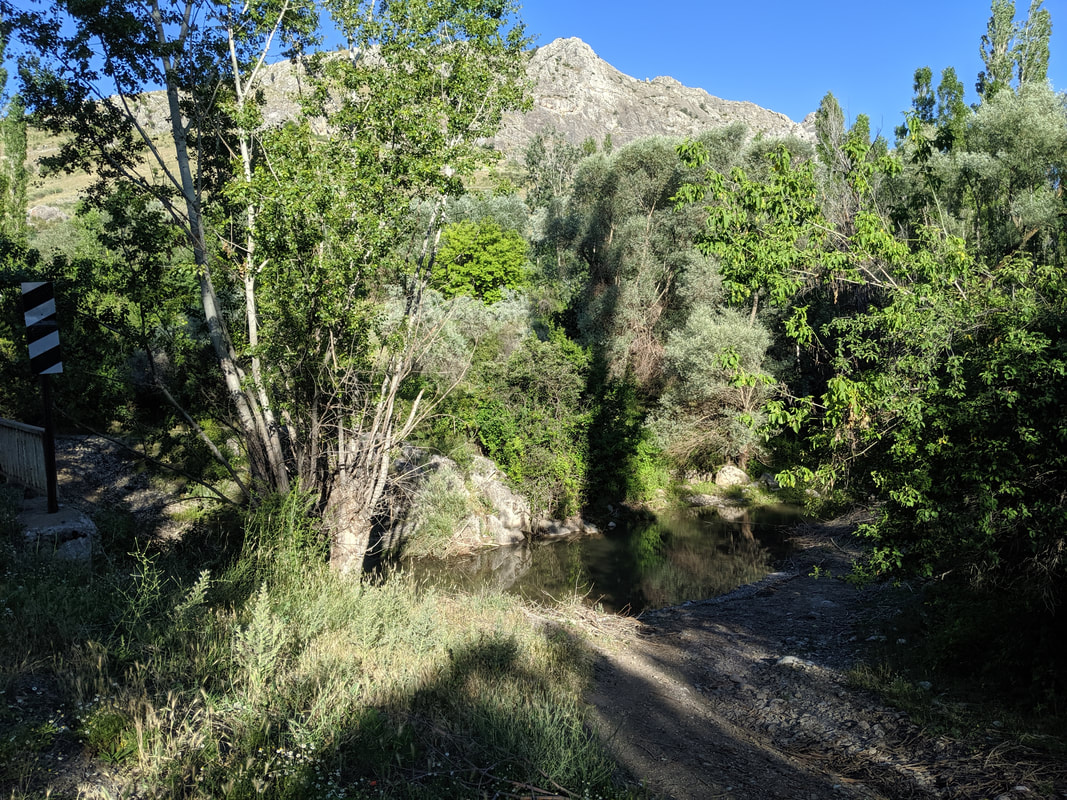 The River Ambar: sacred and ancient. A few hundred yards on the trees opened up and I once saw the site before me. Dominant in the foreground was the stretch of reconstructed lower town walls. These stout defences would have run for some 7 miles all around the mountainside. 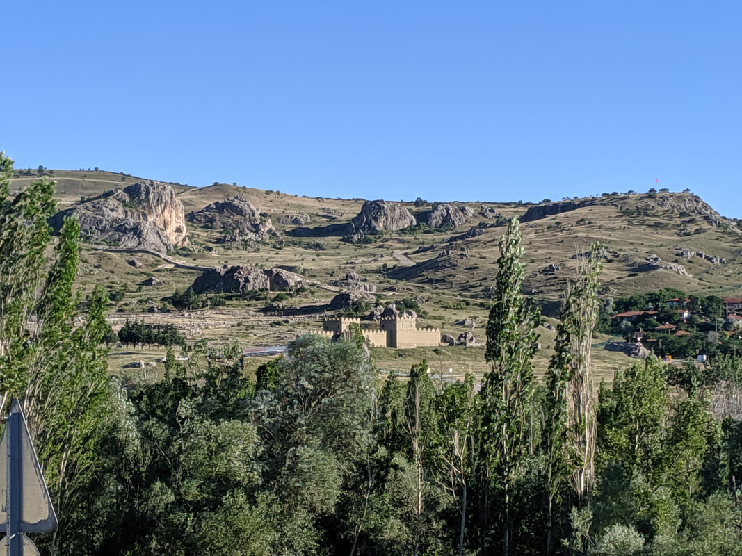 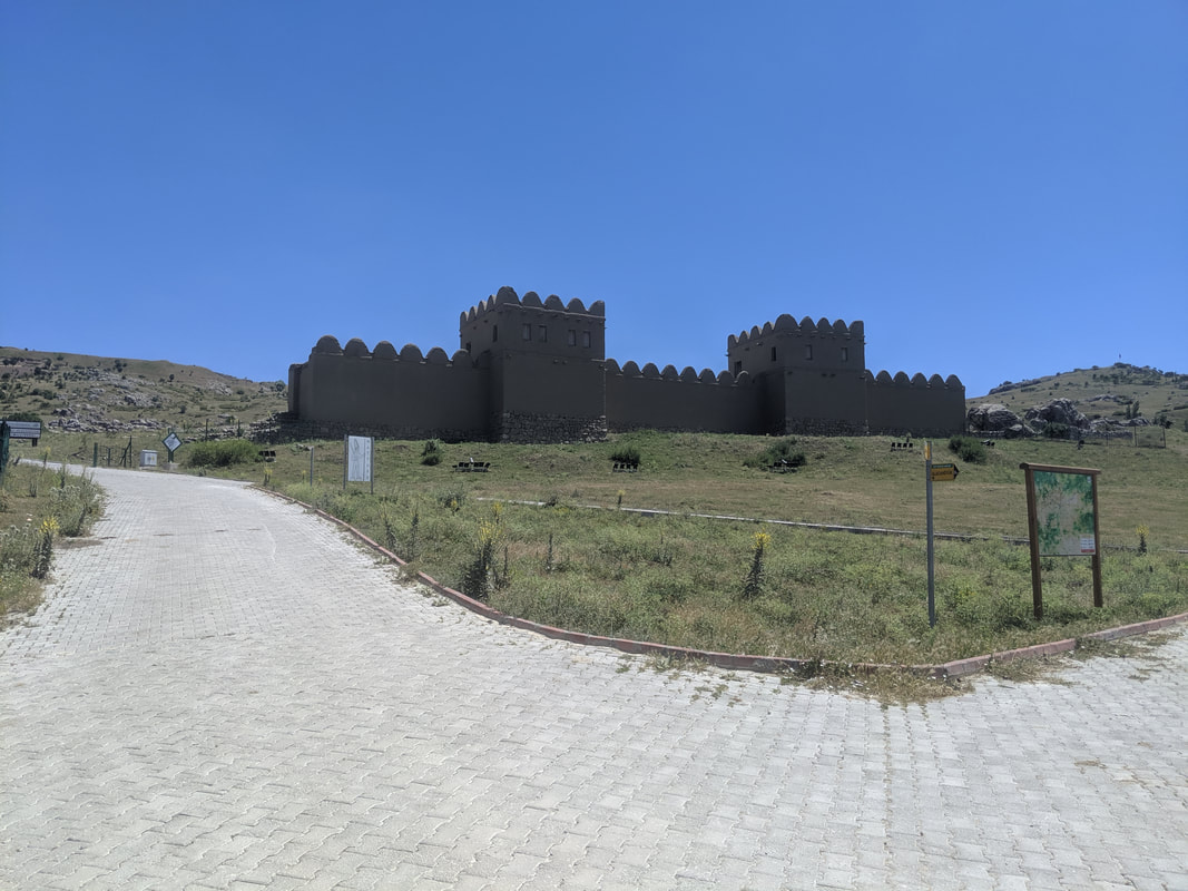 The walls: faithful to the Hittite design, with a foundation of cyclopean rocks to stand strong against flooding, and a high, mud-brick upper. Walking around HattusaSo here I was! Hattusa was first 'discovered' by Charles Texier in 1834. Seemingly he was stunned by the place and it's sheer scale and architectural ambition - and I could see why: the interior wards and fortifications of the city are built on the most precipitous of rocks and crags, and the expanse of the place simply blew me away. Here's a vid of my first impressions: I got my bearings then began to follow the route map in my guide book. First, I came past the Storm Temple - the greatest and most sacred of the many Hittite temples. This one was - as the name suggests - built to honour the Hittite Storm God, Tarhunda. Like all Hittite temples, the focal point was an open-air central plaza, at the corners of which niche-rooms housed statues of Tarhunda himself and his divine wife Arinniti, Goddess of the Sun. More, the temple was ringed by a huge ward of warehouses and workshops, where the clergy and temple artisans lived and worked.
 An artist's impression of the Storm Temple as it might have looked in its heyday.
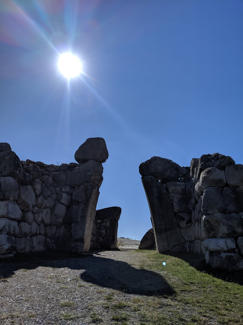
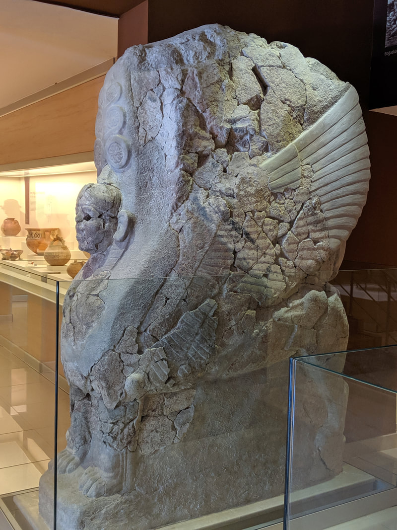
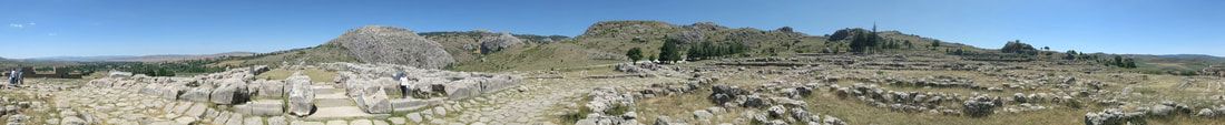 A panoramic from the centre of the Storm Temple ruins. After the Storm Temple, the path leads steeply uphill, through the foundation ruins of the original city's outer walls and ascending to the later 'Upper City'. All the way, the Hititte fondness for ultra-ambitious architecture stunned me. There were gates perched on bluff edges and forts planted up on towering rocky pillars like eagle's eyries. Rather stirring was the sight of a falcon soaring up on the thermals. I felt a true frisson of emotion then, wondering if Hattu might have watched his pet falcons fly like this, right here. 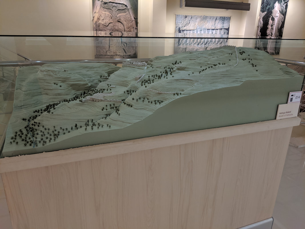 A 3D terrain map of Hattusa. The Ambarlikaya ravine on the left splits the original city, while the right hand of the map is dominated by the Upper City. This map gives a great impression of the absurdness of the terrain. How ambitious were the Hittites for building their capital here?! 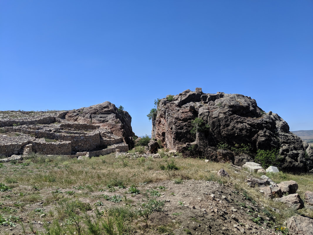 'The Split Rock'. This was used as a quarry in Roman times, but the upper surface still shows evidence of the Hittite structures that once stood there. 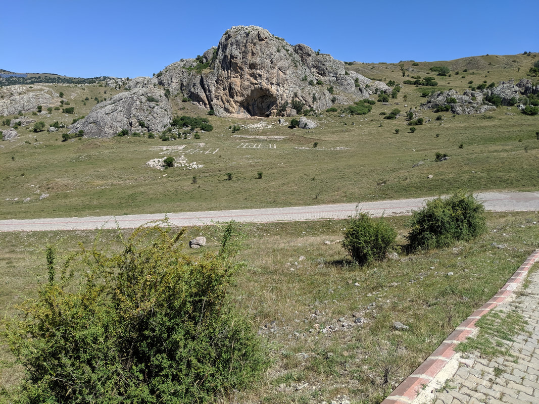 Sarikale - the "Yellow Castle" (so-called because of the yellowish hue of its rock). Which sports the foundations of a Hittite fortress on its apex. One of several fortresses *within* the city. What level of threat did the Hittites foresee? Approaching the high-point of the Upper City's southern reaches, I came to a run of three mighty gateways that took the breath away (or maybe that was just because I was a bit out of puff!) The wind at this height was buffeting but pleasant at least in that it took the edge from the blistering heat of the sun. 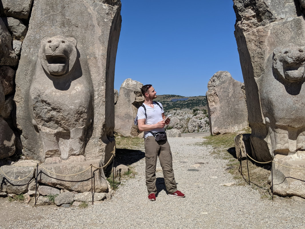 The Lion Gate! Two more of those Hititte lions, roaring out into the countryside from the Upper City's western walls. 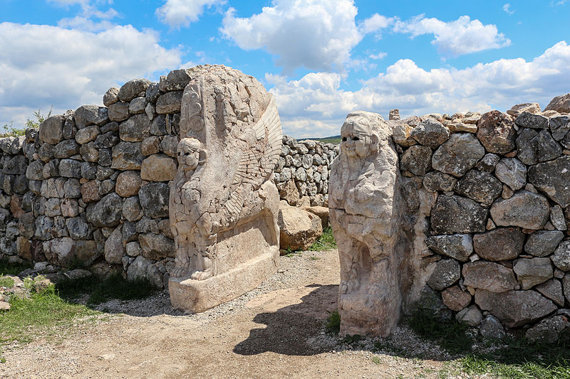 The Sphinx Gate - perched on the highest point in the entire city. interestingly, although the sphinx imagery might have been an influence from Egypt, these Hittite sphinxes are female and winged.
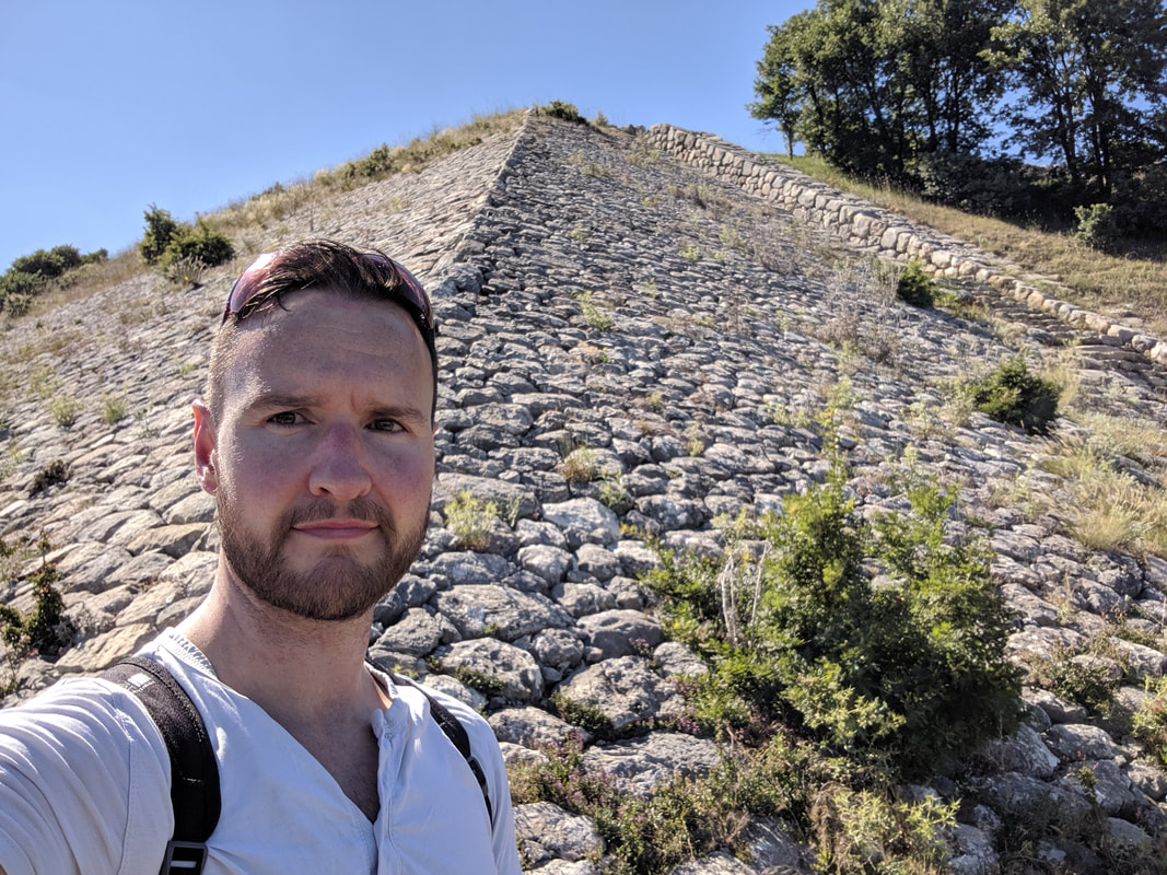 The massive ramp upon which the Sphinx Gate sits.
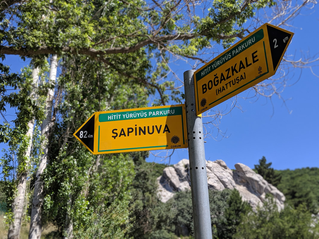
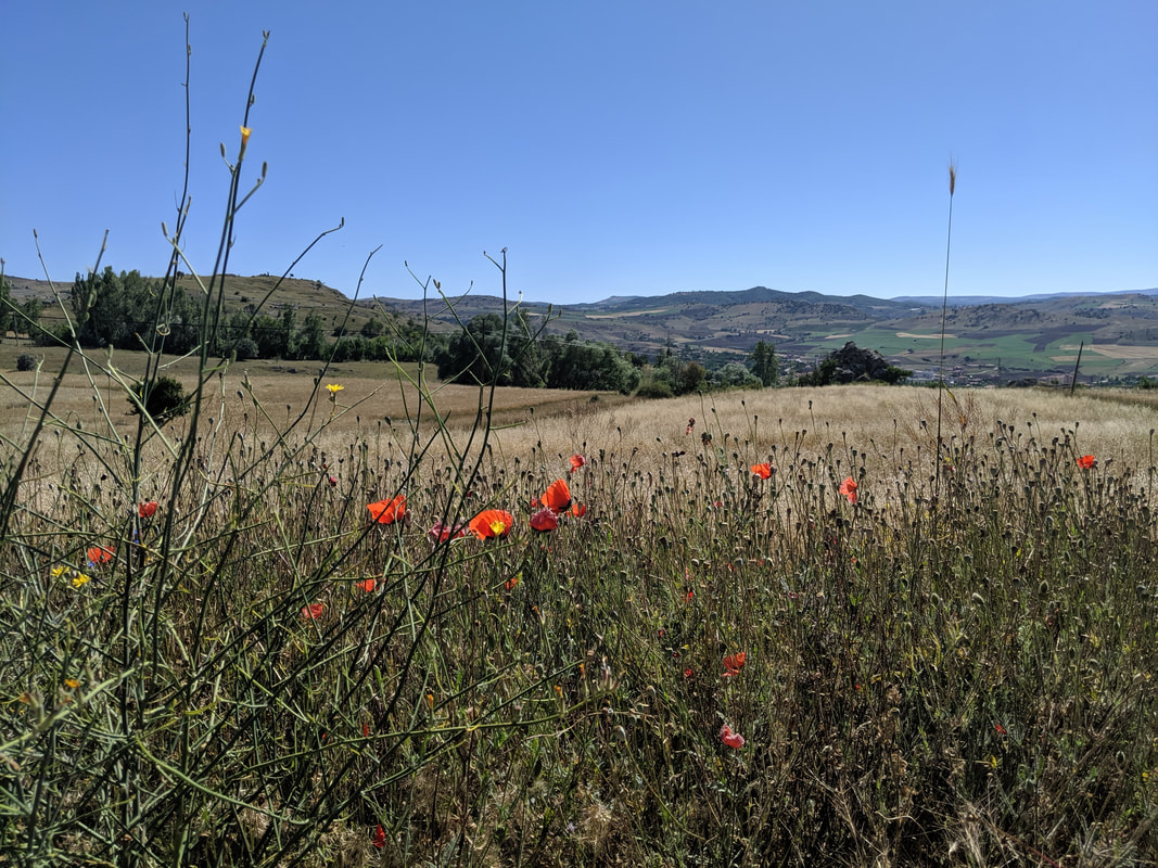
The 'Upper City' was built in the time of our hero, Hattu from Empires of Bronze. This extension to the capital was spread all across the sprawling heights to the south of the original city, doubling the size of the place. The strange thing is, the new ward is comprised almost entirely of temples. Scores of them. And atop the high outcrops of rock between the temples, the Hittites built lofty fortresses. Yerikale and Sarikale (yellow castle) are the two most impressive of these. And the whole Upper City region was encompassed in massive buttress walls - double-layered in places. So why the many temples and fortresses? Why the sudden need to double the city's size? Those are the questions I examine in this next video: Down through past the Upper City's eastern walls we came, past hieroglpyh chambers and more temple ruins, back into the original city before finally approaching the acropolis. This was the centre of the capital - the fortified residence of the Hittite Labarna. Here, foreign kings would have come to pay homage to their Hittite master in a grand hall. Here, Hattu, his ancestors, father, brothers and children would have lived. 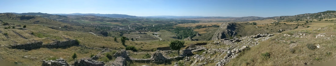 A panoramic from the acropolis' royal palace ruins, looking west over the lower town, out onto what would have been grain fields (now the modern town of Boğazkale). 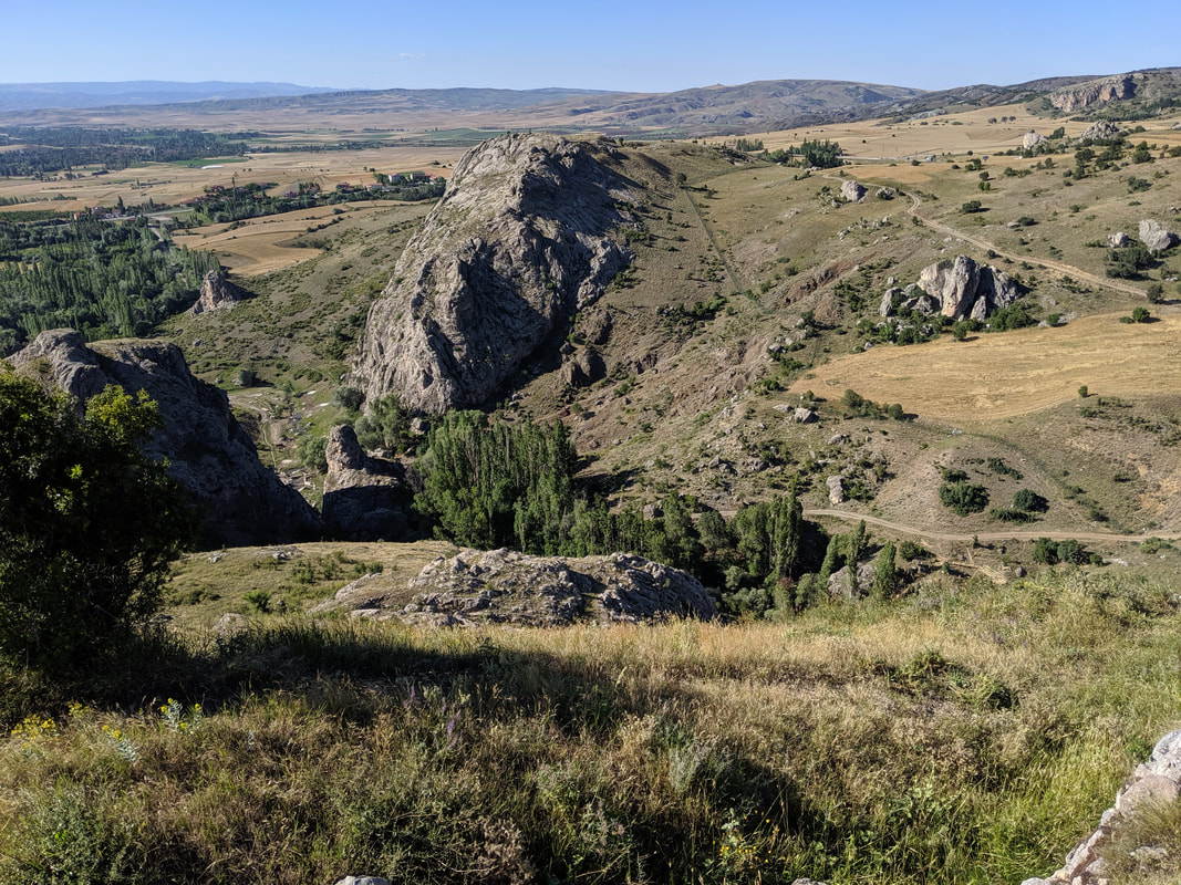 Looking north, across the Ambarlikaya ravine, to the northern and matching tor known in Empires of Bronze as 'Tarhunda's Shoulder'. The photo does not do the sheer height of this acropolis justice. 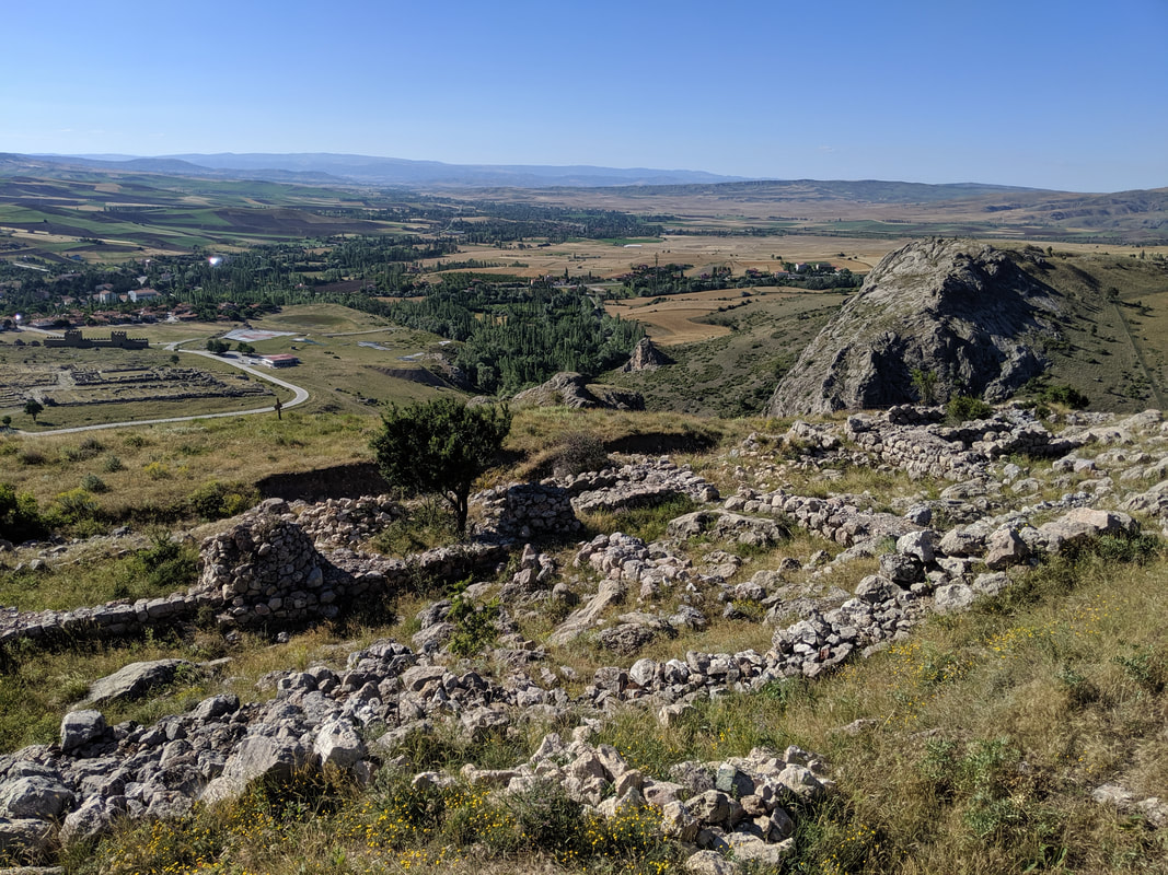 The Hititte Royal Palace ruins in the foreground. Here's my video, taken up on the acropolis. I try to summarise my thoughts and feelings about the place on what had been an incredible day. After so long, I had finally walked the same ground as Hattu and the line of Hittite Kings! After nearly 15k of walking - most of it steeply uphill - I felt surprisingly fresh, But on the way back to my hotel - probably once the adrenalin started to subside - my legs began to ache. When I reached the hotel, Denis, the owner, was running a birthday party for his young son. I sat down in a quiet part of the restaurant, ordering and enjoying a delicious meal of doner and rice with an ice-cold beer. Then Denis came over, kindly bringing me a bowl of popcorn and a giant slice of birthday cake to enjoy :) Off to bed I went, replete, exhausted... and exhilarated. Yazilikaya - The Great Rock ShrineThe next day, I awoke feeling stecky (a Scottish term meaning stiff) but well-rested, I sat on the porch of my room in the morning sunshine, enjoying a traditional Turkish breakfast of tomatoes, cucumber, olives and cheese, along with fresh apricots from Denis' orchard and a super-strength coffee! I was due to leave later on in the day after this all-too-short visit, but I still had time to see two more close-by and crucial Hittite sites. First up, Yazilikaya - the ancient Rock Shrine out in the nearby countryside. The walk from Boğazkale to Yazilikaya is about 3km. not too bad, but in 30 degree heat and with zero shade... and all sharply uphill, you'd be advised to take the usual hat, water and good walking shoes. All that aside, the trek there is pretty special. I did it on a perfectly still summer's day, along the winding tarmac road that rises past Hattusa's northernmost promontory (Tarhunda's Shoulder), giving excellent views of the precipitous battlements on that end of the city, and then splendid vistas across the countryside near Hattusa. I did this in July, and the land to the west was a patchwork of rolling green, gold and hazy terracotta and grey nearer the horizon. The fields were freckled with poppies, buttercups and tulips and misted with a haze of butterflies. East and south was dominated by the Hattusa massif... but northwards was strange - a green and constantly rising land, studded with silvery warts of rock. One of which stood proud, and I knew - just as I knew when I saw Hattusa from a distance - that I had arrived at the famous rock shrine.
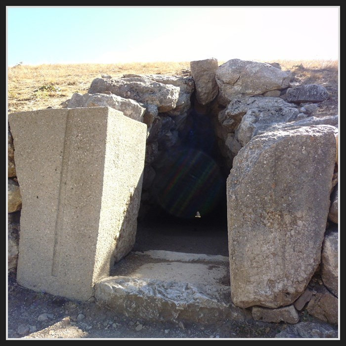
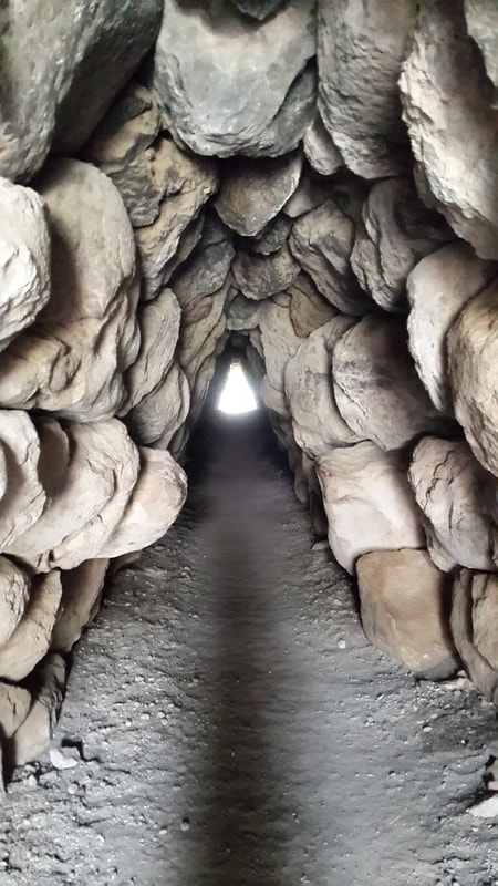
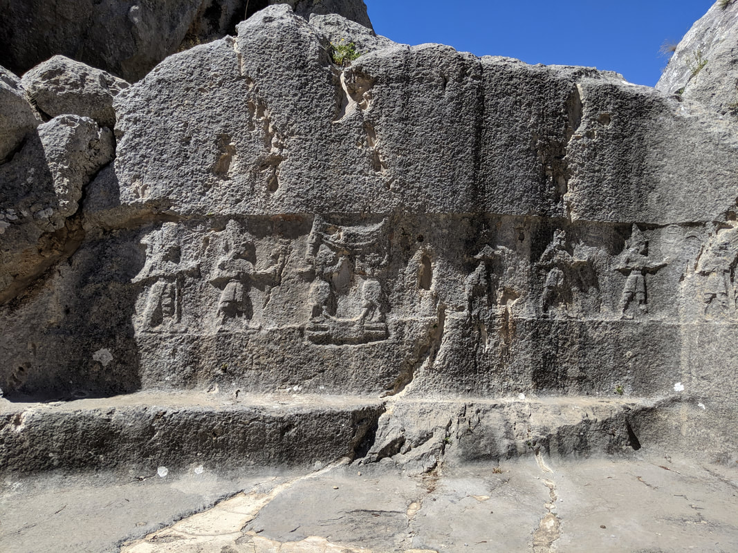
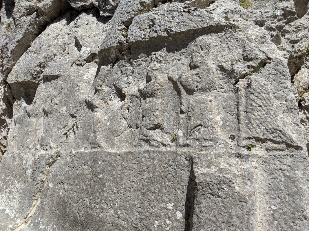
 Archaeological signposts marking out the distance to the nearest Hittite cities! In the background: Yazilikaya - the ancient Hittite Rock Shrine. 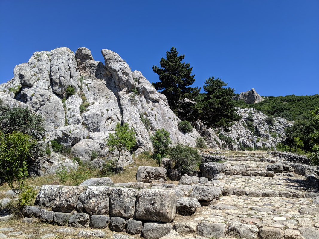 The entrance to Yazilikaya. 3,000 years ago, the Hittites would have trooped here in great processions to celebrate their many religious festivals. Yazilikaya, literally 'The Written Rock' is rather aptly named, for some of the finest extant Hittite reliefs are to be found here. They venerated this place almost as much as the great Storm Temple in Hattusa. During Hittite times the steps (see the image, above) would have been covered with a vestibule of sorts which would have led right up to the jagged 'crown' of rock on the left of the pic. Inside the 'crown' sit two roofless chambers (known as A & B), adorned with images of Hittite Gods, Kings and legends. The place was embellished throughout the reign of the Hittites, with some of the final modifications dated to the very last of the Hittite Kings. 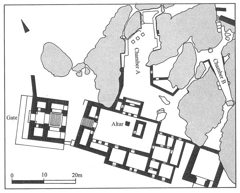 A map of the rock shrine. Here's my video of 'Chamber A', along with some 'Haga-spotting' :) ... and then some pics from within the shrine. 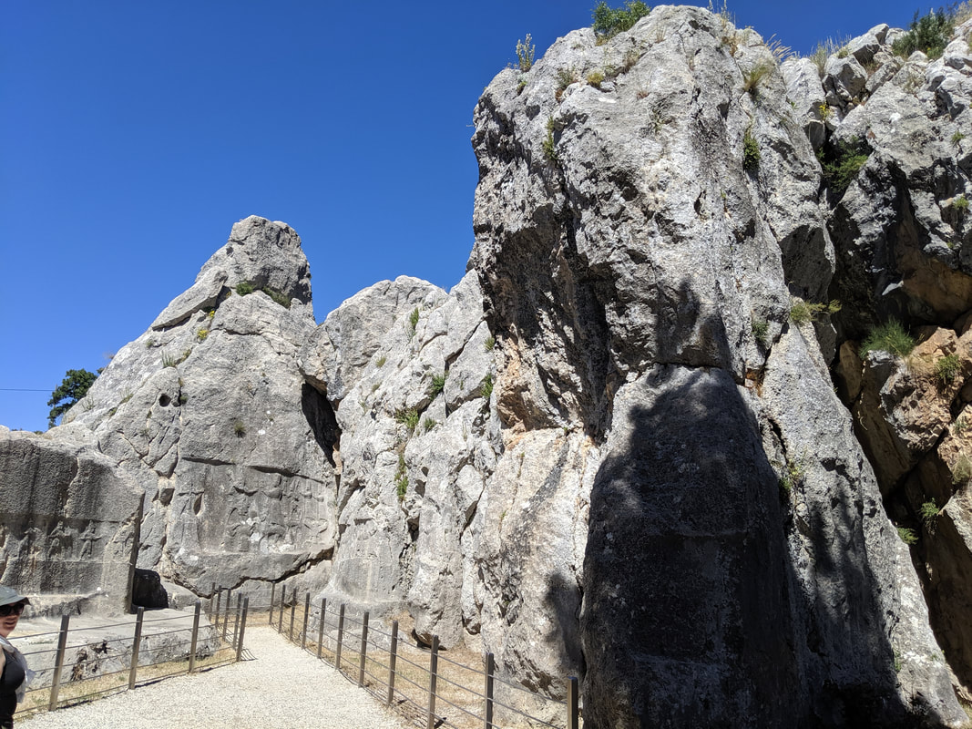 Chamber A, with the main relief at the end and smaller reliefs on the side walls 'walking' towards it.
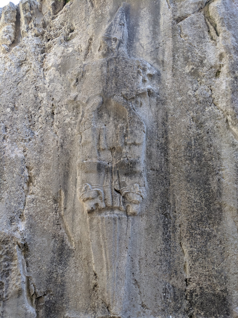
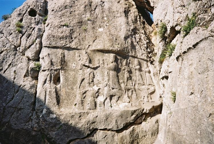 The 'main' relief, showing Tarhunda God of the Storm (L), walking on the backs of Mountain Gods, meeting Arinniti, Goddess of the Sun (R), who walks on the backs of panthers. The Haga is on the bottom right! 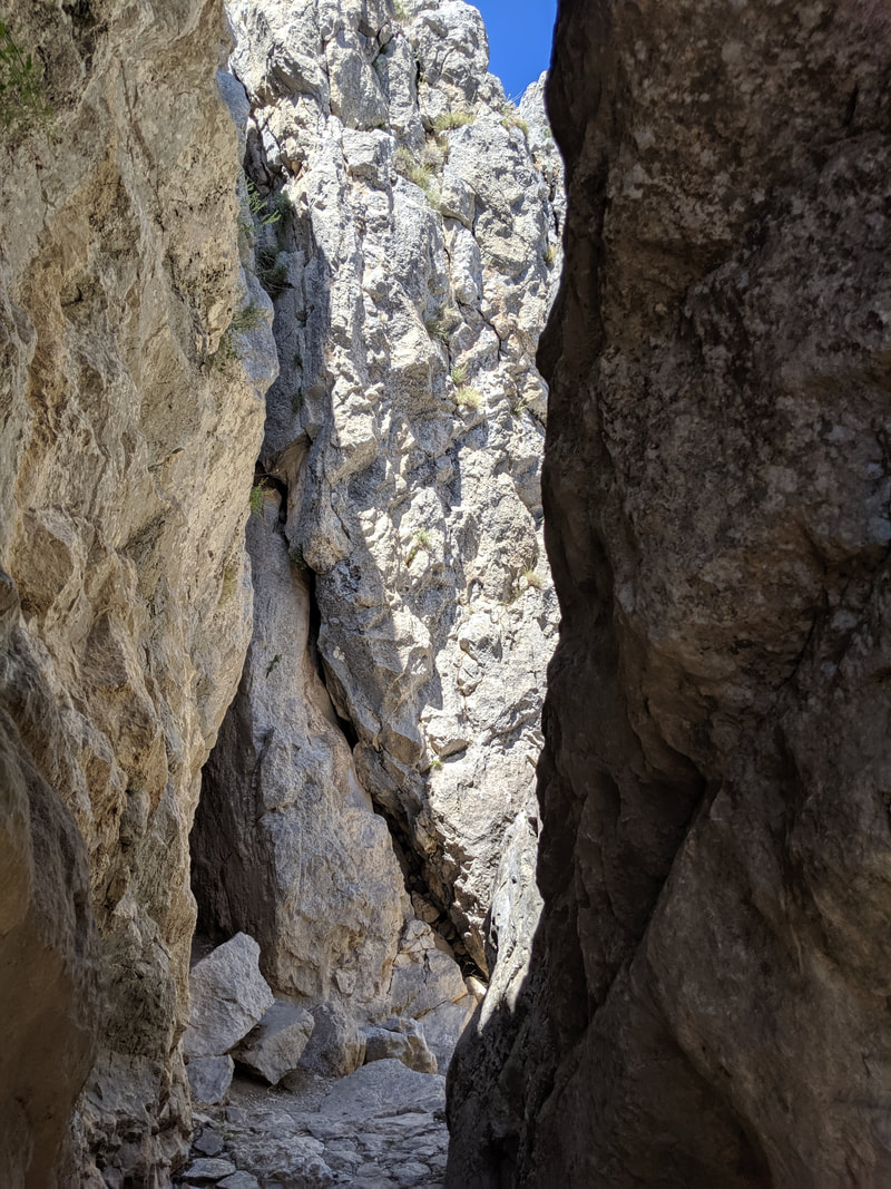 The narrow passageway leading into Chamber B. I will admit I did feel a bit 'Indy' at this point :)
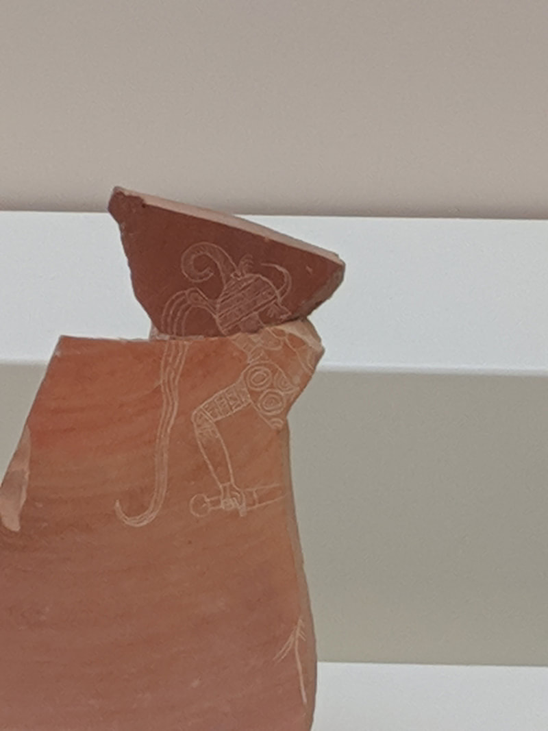
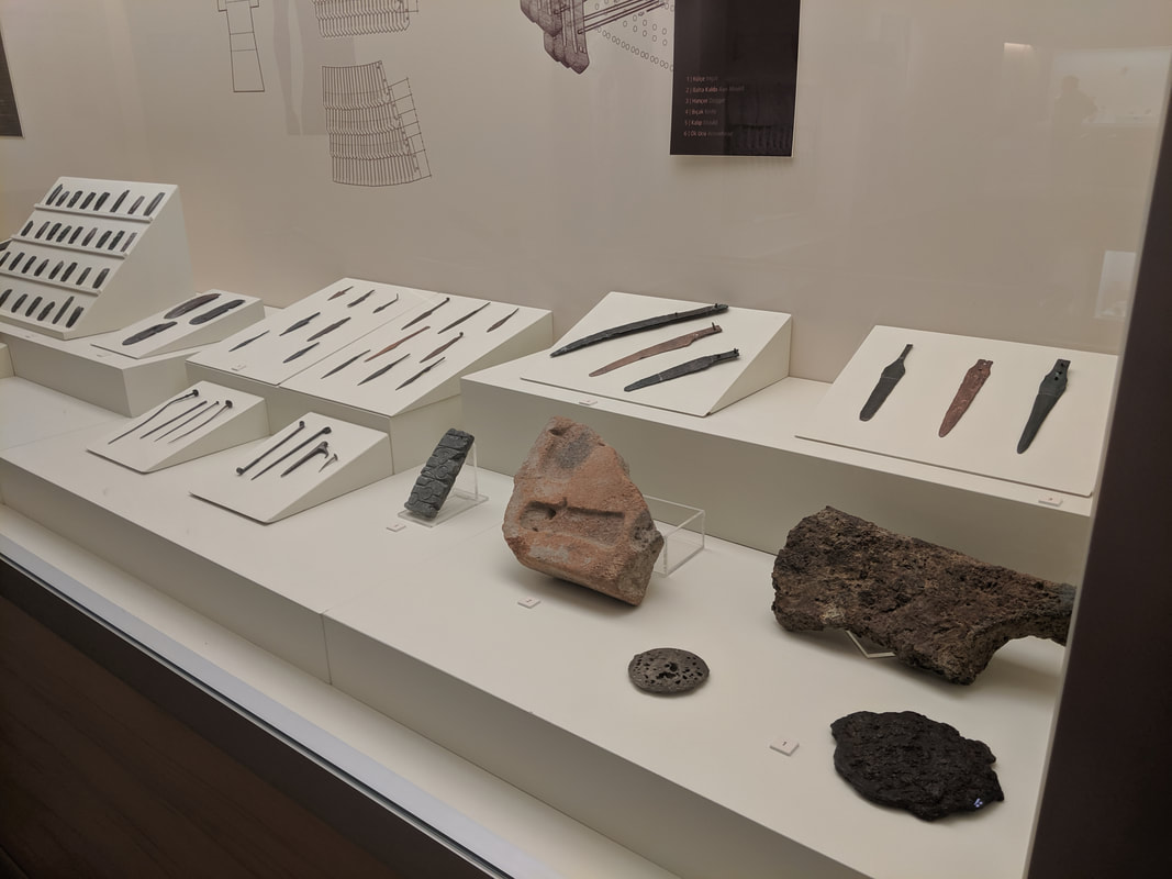
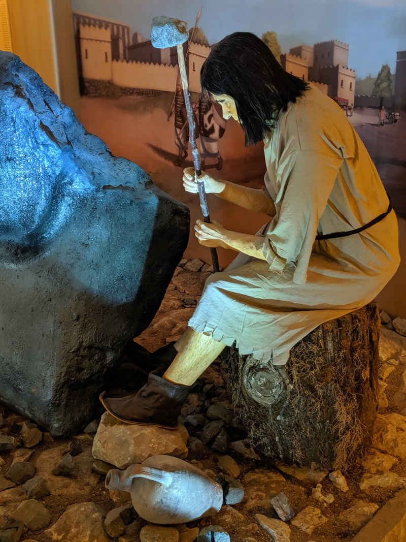
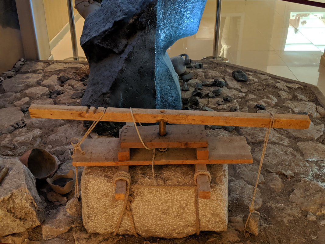
 Chamber B's famous 'Twelve Gods' relief. The Hattusa MuseumAfter Yazilikaya, I headed back into Boğazkale, and to the Hittite Museum there. It is small-ish but thoughtfully laid out inside, and it does a fine job of telling the Hittite 'story' It also houses Roman, Byzantine and Phrygian finds from the local area, but it is first and foremost a Hittite exhibition. Here are some of my best pics:
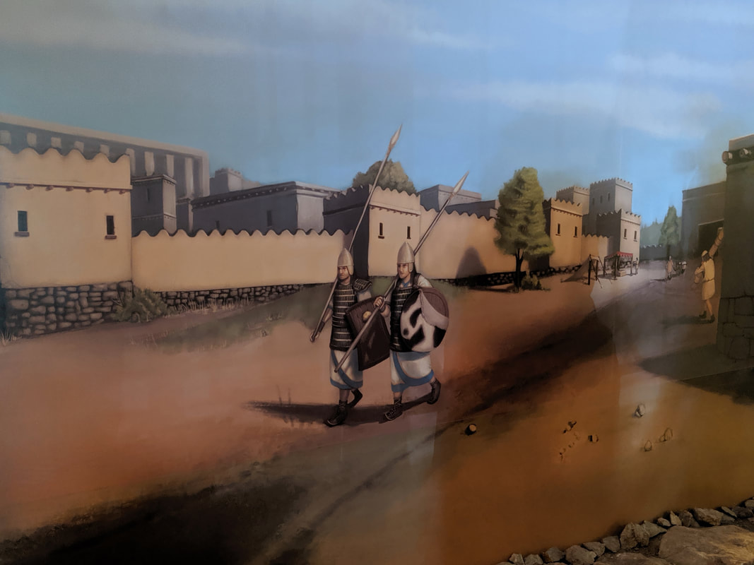 Some evocative artwork showing two Hittite guards on partol around the streets of Hattusa.
 An aerial photograph of the ramp below the Sphinx Gate. Imagine you were an envoy from a rival empire approaching this. How small would you feel? Brimming with facts and ideas, I left the museum behind (dropping off more of my bookmarks on the way out!) and caught a lift to the nearby town of Yerköy, where I was scheduled to catch the famous 'Eastern Express' sleeper train that would take me across Turkey - right through the ancient Hittite heartlands - and to the country's eastern edge. The next part of this blog series will chart my rail-based adventures! Hattusa Travel Tips
A full gallery of my visit to Hattusa is available here on Facebook (Like and follow, please!) Quick navigation:
9 Comments
Gordon
2/7/2024 03:41:25 am
Thanks! I have added a 'quick navigation' section at the foot of the article!
Carlos
1/13/2024 09:40:08 am
Hi! I have read your post about Hattusa and I found it very interesting and enlightening. I will visit Hattusa this year and I ask you where I can get a map of the ruins with the location of the points of interest?
Gordon
2/7/2024 03:44:23 am
Hi Carlos,
Carlos
1/13/2024 09:55:48 am
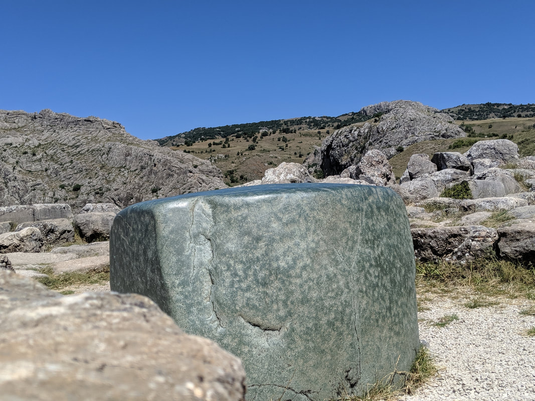
Sorry, I hadn't seen your excellent map of Hattusa in your post. Anyway, I read that you say that the green stone is inside the Storm Temple. Which of all the temples that appear on your map? They are all numbered.
Gordon
2/7/2024 03:45:25 am
All walking! No car.
Olaf
1/18/2024 01:03:40 am
Hi Gordon
Gordon
2/7/2024 03:45:57 am
Thanks Olaf. It makes me smile too to remember my trip. Happier, simpler times (pre-2020!)
Belem
7/2/2024 03:48:37 pm
Hi Gordon, you say "Hattusa was first 'discovered' by Charles Texier in 1834". Leave a Reply. |
AuthorGordon Doherty: writer, history fan, explorer. 
My Latest Book
Archives
March 2023
Categories |

 RSS Feed