0 Comments
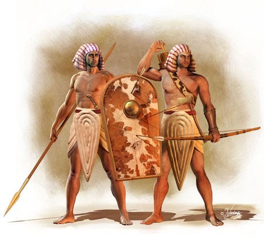
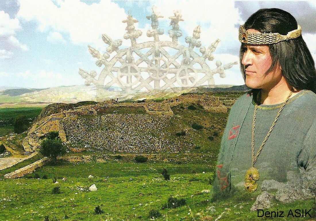
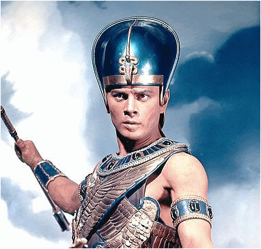
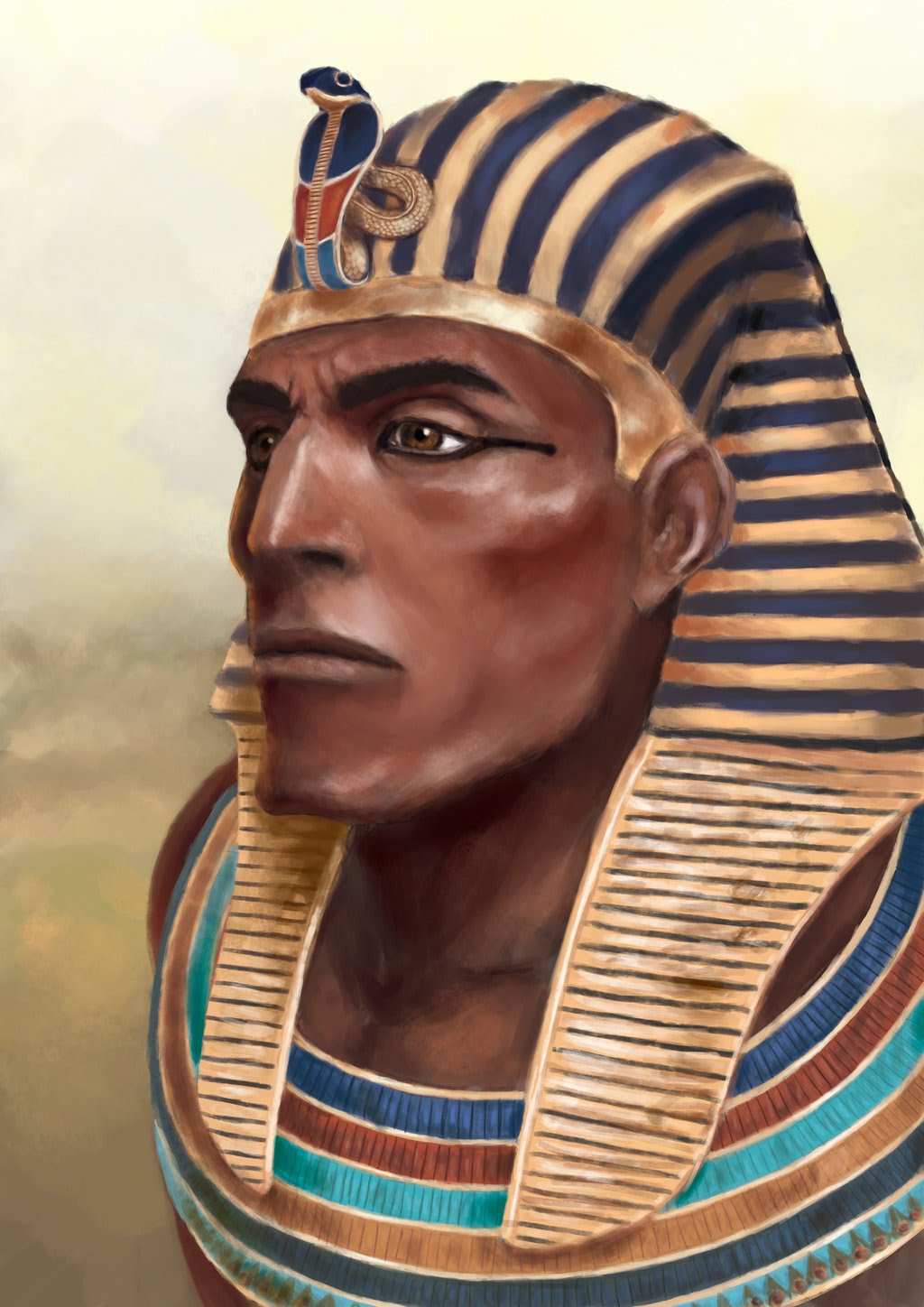
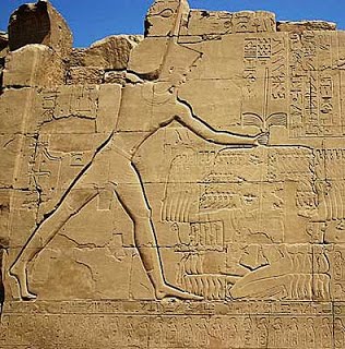
 Pharaoh in his chariot, readying for battle with his armies lined up behind him. And, wait: who is that fellow with the horned helm by Pharaoh's right-hand side? A Sherden mercenary! :-). Artwork by Giuseppe Rava. The Egyptian New Kingdom, lasting roughly from 1550 BC to 1077 BC, exploded into being when the last of the hated Hyksos Kings was deposed. The people of the Nile never forgot that shameful period of occupation. Determined never to show such weakness again, they adopted a militaristic, expansionist and aggressive stance - far more so than the Middle Kingdom or Old Kingdom. As such, they reinvented their armies, dispensing with simple levy troops and establishing a standing army of professional soldiers, the ranks swollen by the abundant populace living along the fertile banks of the River Iteru (Nile). Population estimates of 3-4 million indicate that they certainly were never short of manpower (unlike the Hittites), and could field up to or even more than 40,000 men. Here, I take a look at the make-up of this fearsome Egyptian 'war machine'... 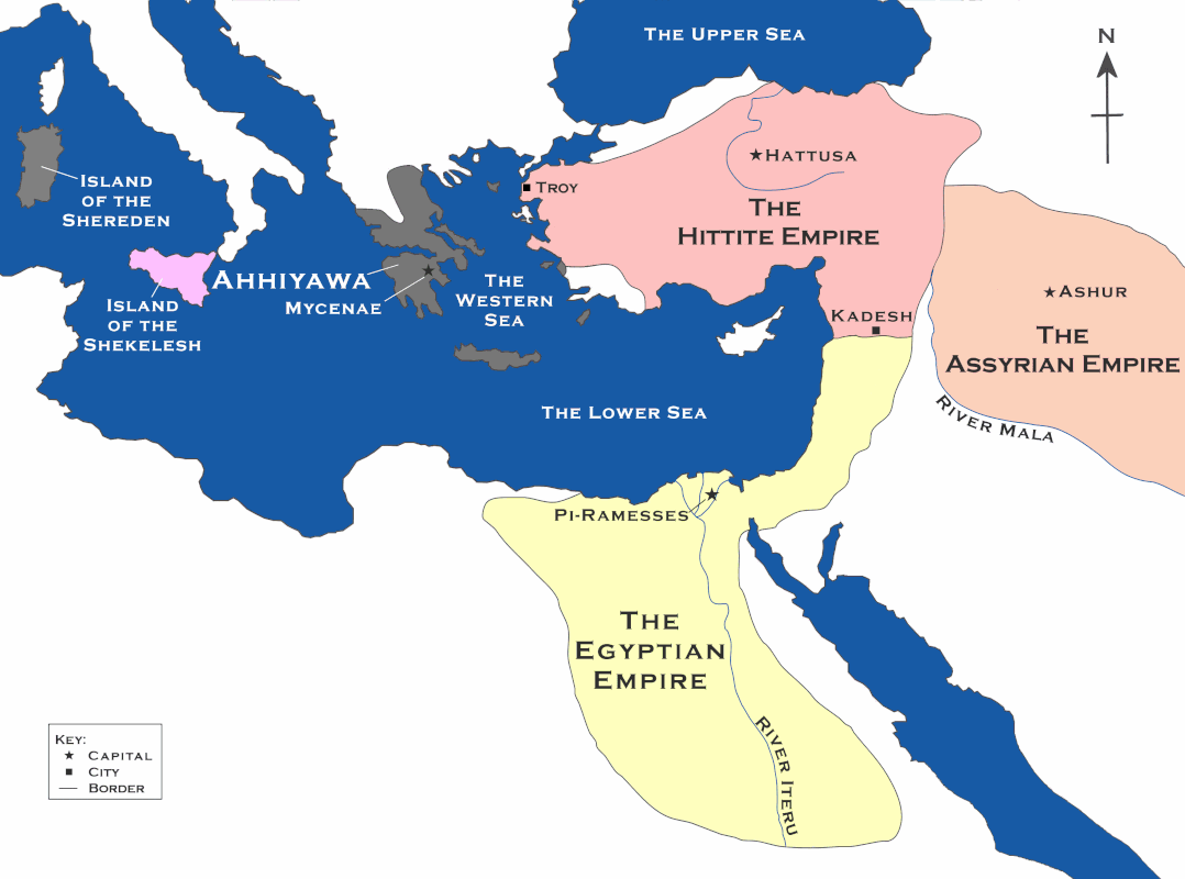 The Great Powers of the Late Bronze Age circa 1294 BC. The Egyptians were masters of the south. The PharaohsNew Kingdom Pharaohs were protectors of their lands and people and direct appointees of the Gods. Let's have a look at Seti I, the lord of Egypt in Dawn of War: Seti was certainly quite fond of gathering up honourific titles. . He was addressed as: "Falcon King, He of the Two Goddesses, Horus of Gold, King of Upper and Lower Egypt, Use-mare, Son of Ra, He who rages like a panther". (He who rages like a panther? Reminds me of the time I stepped on an upturned plug.) Seti was a warrior too, personally commanding their armies and leading them into battle. Pharaohs of the New Kingdom took to wearing the distinctive and majestic blue 'kepresh' crown when they went to war. They would also wear a lion's tail in their belt and carry a sceptre and flail, both probably ceremonial - or perhaps practical depending on how battle was going! 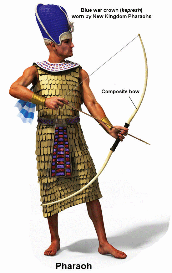 A New Kingdom Pharaoh in his battle-garb. The DivisionsThis new professional army was so vast and had to cover such a huge territory that it had to be split into divisions. Estimates of these divisions' sizes vary from 5,000 to 10,000. Each division was housed in huge barracks at a particular city in the Nile homelands, and each was devoted to a particular god (much like the Hittites). Also, each division was entirely self-sufficient with its own wing of chariots, archers, medics, priests, mules and wagons.
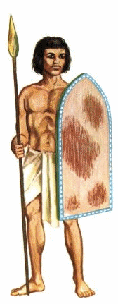
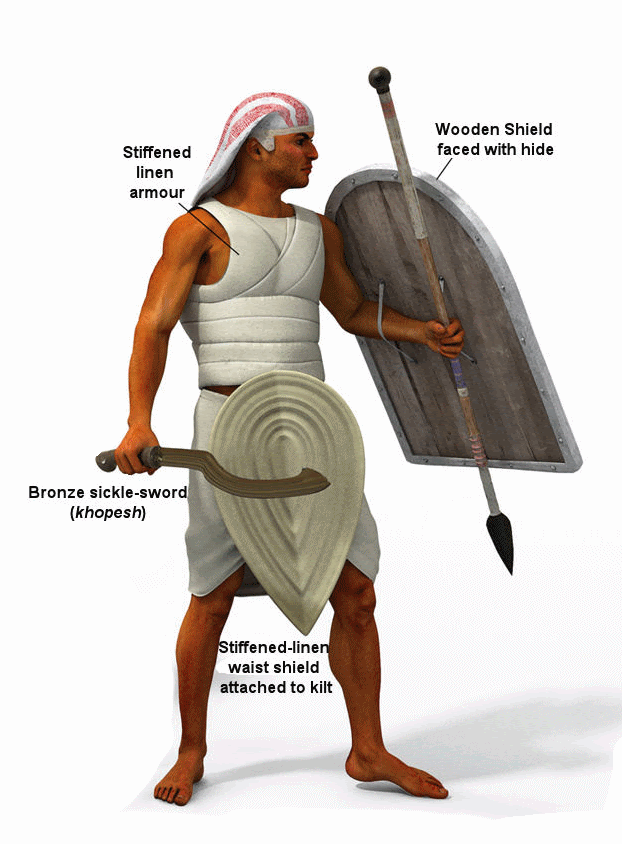
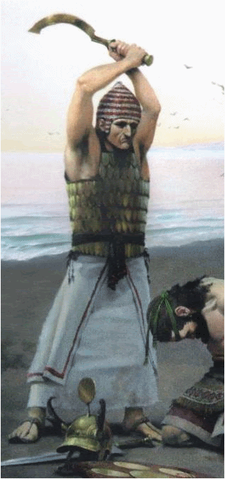
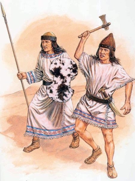
*The Ptah Division was formed a little later that the first three - probably in response to the ramping-up of tensions with the Hittites. 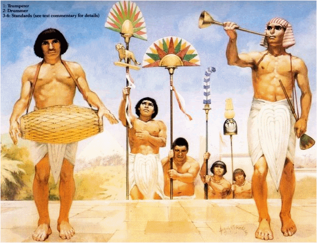 The trumpeters, drummers and standard bearers that would lead each division. Artwork by Angus McBride. The Command StructureEvidence of rank and structure in the New Kingdom Egyptian army is rather thin and at times contradictory. We know for certain that Pharaoh was top of the tree. He would either lead the army on campaign or appoint a royal relative or otherwise trusted man to do it for him. Indeed, while still a prince, Seti served as battle master for his ailing father, Pharaoh Ramesses I. Below Pharaoh there would have been a deputy and a raft of 'Overseers', 'Commanders' and 'Captains' in charge of thousands, hundreds and even tens of men. 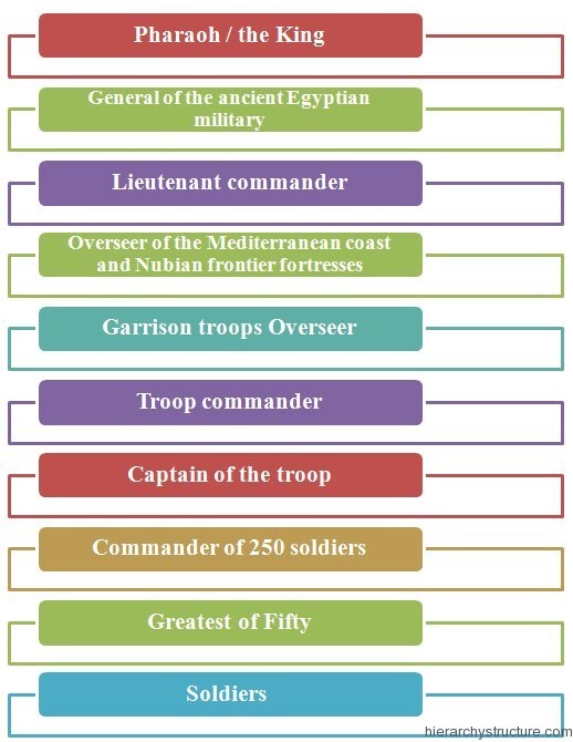 One theory on how the Egyptian army was organised. The InfantryA foot soldier would have lived day-to-day in a 250-strong unit known as a 'Sa'. Egyptian infantrymen were typically either spearmen or archers. The spearmen came in a few forms:
The archers of the New Kingdom armies were just as lethal as the spearmen. There were many native Egyptian bowmen, but there were also plentiful foreign archer regiments too - especially Nubians and Libyans.
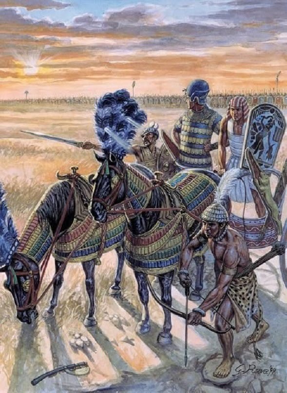
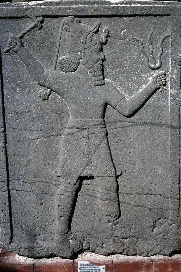
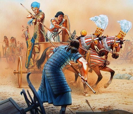
ChariotsThe Chariots were to the New Kingdom armies what lancers were to the Normans, or tanks to the soldiers of WW2. They were swift and terrifying to behold: imagine two snorting horses bedecked in bronze and leather thrashing towards you, a warrior and a driver aboard intent on piercing your heart with a spear or arrow, all while the ground under your feet shudders as if the world is about to end! The Egyptian chariots were honed for speed. The cabins themselves were feather-light and the steering mechanisms deft and nimble. Typically, a 25-strong Egyptian chariot wing would be assigned to each infantry Sa. In battle they would rove across the battlefield, peppering enemy vehicles and foot soldiers with arrows, veering clear of attempted counter attacks or plunging into vulnerable enemy ranks. Ironically, these devices were only introduced to the Egyptian world thanks to the earlier Hyksos occupation! In total, Pharaoh could muster as many as 5,000 chariots 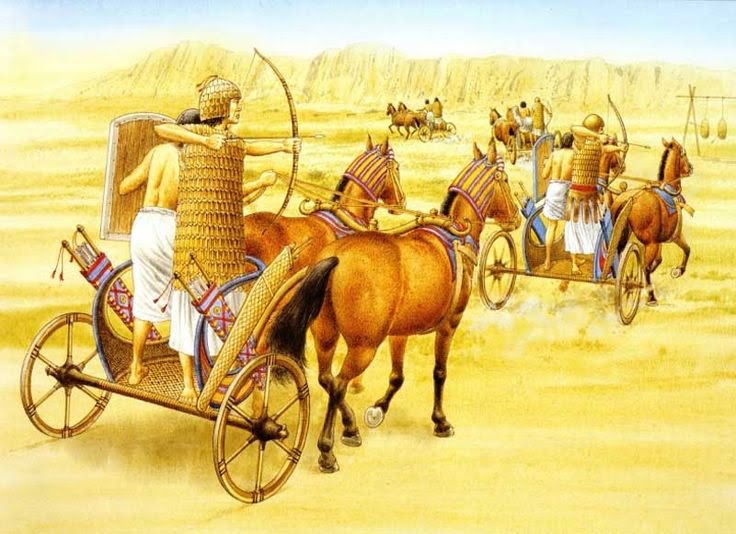 The chariots in training. Artwork by Brian Delf. 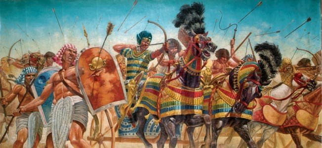 Pharaoh charging to battle on his chariot, his soldiers massed around him. Artwork by Giuseppe Rava. The NavyThe Egyptians maintained a powerful navy - vital to control trade and piracy and to allow its armies to sail up the coast of Retenu (the modern Levant) and reinforce any trouble spots or to launch a campaign. The Nile delta served as a perfect Naval launching point, and there was a giant royal dockyard near Memphis. Naval tactics were much like chariot tactics: sail past the enemy at speed, showering them with arrows, avoiding contact. 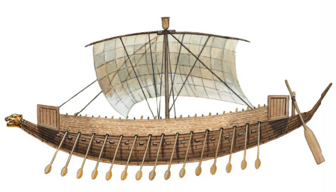 A typical New Kingdom Egyptian vessel. Note the papyrus sails and the lion-headed prow. So, I hope that sheds some light on the military capacity of the New Kingdom. Do leave a comment or get in touch if you have any further questions. Thanks for reading! Many thanks to Osprey Publishing for their continued excellence in illustrating long-gone eras. If you'd like to experience life in the era of the New Kingdom and the Hittite Empire, why not try my Empires of Bronze series? Book 2, Dawn of War (banner below) is out now!  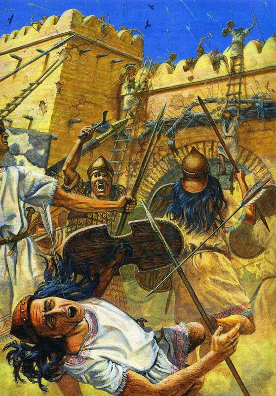 Over three thousand years ago, before iron had been tamed, before Rome had risen, before the ashes from which Classical Greece would emerge had even been scattered, the world was forged in bronze. It was an age when Great Kings ruled, when vast armies clashed for glory, riches and the favour of their strange gods. In the south there was Egypt; in the east, Assyria; in the west, Ahhiyawa (Homer’s Greece); and in the north... the Hittites. The Hittites held sway for nearly five hundred years, spanning roughly 1650 BC - 1200 BC, ruling from the high, rugged plateau at the heart of modern-day Turkey, commanding a ring of vassal states (most notably Troy) and boasting a dauntless army that struck fear into the hearts of their rivals. This article dives into the dark and mysterious world of the Hittite Army... The LabarnaThe Hittite King, also known as The Sun or Labarna, was venerated as the deputy of the Storm God, Tarhunda and the Sun Goddess, Arinnitti. Much of his time was spent in his secondary role as High Priest of the realm, attending the many religious festivals all across the Hittite realm, draped in blue robes. But he also served as commander-in-chief of the Hittite army, and in this guise he would wear bronze and leather.
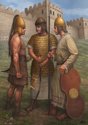
The Royal Guard The King enjoyed the protection of two elite units: The Mesedi were his bodyguards. A detachment of them would be ever-present at home or abroad, on the march, in battle, in camp (and maybe even in the latrine - who knows?) They would have been a small unit - perhaps a few hundred strong. Their leader, the Gal Mesedi, not only commanded these soldiers, but also served as a deputy to the king - organising affairs of state security and such matters. Most often, the Gal Mesedi was a trusted relative of the king. The Golden Spearmen - named after their gilt lances - were a small (maybe as few as fifty) guard unit tasked with watching over the acropolis of Hattusa. When the king went on campaign, the Golden Spearmen would remain in the city. 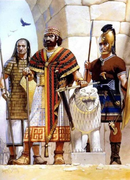 Ignoring the King in the middle, who - incorrectly my opinion - sports a beard (a Hittite no-no), the two figures either side of him are plausible depictions of how a Golden Spearman (left) and a Mesedi (right) might have looked. The ArmyAt their peak, the Hittites could muster around 20,000 soldiers from their barracks, cities and farms. Based on this figure, and the evidence that they seemed to have four senior generals, I suspect that they would have organised these men into four infantry 'divisions'. There would also have been a chariot wing - the equivalent of a Bronze Age tank division! - and the aforementioned royal guard units. 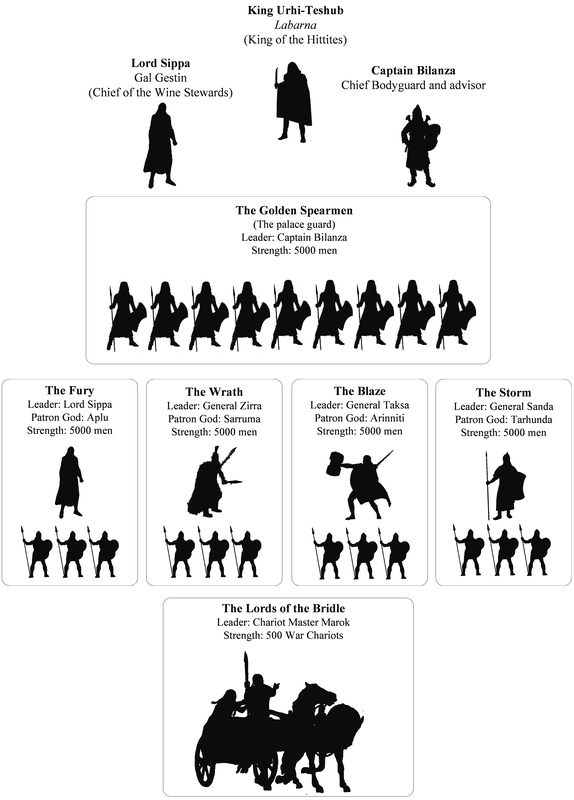 Speculative structure of the Hittite Army. The Infantry DivisionsThe king would choose his divisional generals carefully, usually selecting those he trusted implicitly and often they were blood-relatives. King Muwatalli II (Muwa) clearly rated his younger brother, Prince Hattusili (Hattu). By the time of Dawn of War Hattu had been a leading figure in military campaigns since his mid-teens. Each division of footsoldiers would have been sub-divided into smaller units, probably 1,000-strong regiments. A standing regiment would remain in active service at all times, while the rest would tend to their crops and herds as needed. Each regiment would be further sub-divided into 100-strong companies. The soldiers tended to be archers or spearmen.
The spearmen were the spine of the army though. Each was armed with a short, curved sword, a spear, a wood and leather shield and a battle-axe. Whether they wore armour or not, we cannot be sure. They would certainly have worn bronze or leather helmets, and padded tunics/robes, possibly with baked leather armour vests. The more senior soldiers and commanders might have worn bronze scale - although some sources claim the mark of an officer was to go bare chested! And all soldiers would have worn leather boots, upturned at the toes in true Hittite style. Archers would have been dressed much like their spearmen comrades, but probably with minimal or no armour and likely without a shield too. They employed composite bows made of laminated ash, birch or cherry, with ibex horn glued to the inside of the bow.
Whether spearman or archer, a soldier could fall into one of three classes:
While the Hittite army was mostly composed of native Hittites (although they were not a genetically 'pure' people by any means), they often recruited from foreign climes. Kaskans from the northern mountains, Westerners, Assyrians, captured Egyptians even - were all at times formed into fresh companies and treated as an equal part of the army. They were barracked together and even allowed to retain their dress, weapons and customs, so long as they obeyed their Hittite commanders. 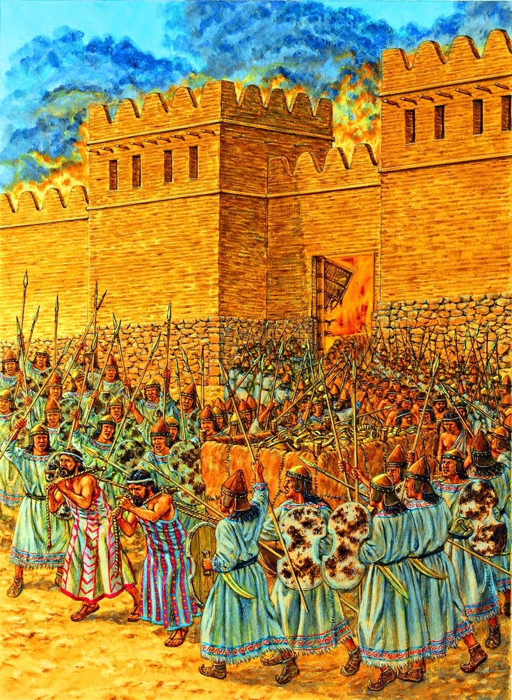 Enemy men being led from a city by their Hittite vanquishers. Such prisoners of war - or namra as they were known - would have been put to work in the Hittite fields or, on occassion, recruited as soldiers in the Hittite army. This must have been a delicate matter to handle, but they did it with aplomb, it seems. Indeed, the esprit de corps in the Hittite army as a whole seems to have been first class. In excavated tablets, we read of their enlistment ritual, where they are forced to choose between a frock and a mirror, or a sword; or of their oath of the army, where each man holds their fat-smeared hand over a fire until the fat runs off to show their strength and willingness to endure pain for one another. The (lack of) Cavalry Easy one this - there were no cavalry. Well, not in the way we would think of cavalry now (i.e. armed men fighting on horseback). Horses of the Bronze Age were smaller and had not yet been bred to produce the likes of medieval destriers or modern racehorses. They could not be expected to walk with armoured soldiers on their backs for any great distance, let alone charge with such a burden during battle. Horses were ridden, but only by light scouts or messengers. In the main, they were employed in chariotry... The ChariotsThe chariots were the elite wing of the Hittite army - each 'war car' a trophy of skill and craftsmanship. The construction of each chariot required expertise in metallurgy (bronze bits for the horses, copper nails to keep the 'tyres' on the wheels), woodworking, tanning and leatherwork, glue-production, boneworking and more. 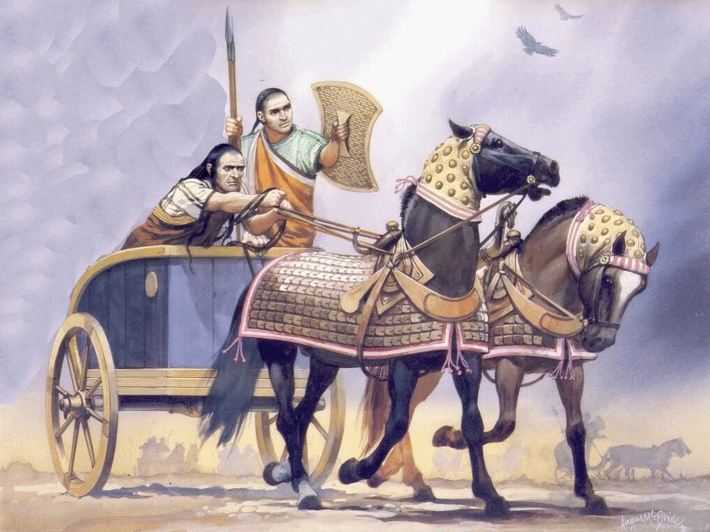 The Chariots charging to battle! Crewed by a warrior and driver (until the Battle of Kadesh, when things changed) and pulled by two steeds, these thundering war-cars were blunt and brutal. A shock weapon if ever there was one. While the Egyptian chariots were all about speed and spryness, the Hittite chariots were about brute force - for carving into enemy infantry ranks like a scalpel. Tablets record a Hurrian by the name of Kikkuli living with the Hittites and schooling them in the art of chariotry and horse breeding. Indeed, it seems he even went swimming with the herds and experimented with grinding salt into their fodder in order to trigger growth hormones (and thus bigger horses).
The NavyThe Hittites were not a seafaring people, mainly due to their heartlands being landlocked and the rivers of that regions being shallow and unsuitable even for serious river boating. But as they spread as a power and claimed coastal territories, it became vital to establish some sort of naval presence. It seems they did so by way of making alliances with and vassals of kingdoms which already possessed a fleet. One such kingdom was Ugarit (on the coast of modern Syria). The wealth of Ugarit was based on trade - their capital city being something of an international market hub - and so they maintained a strong flotilla of transport and war ships. Through Ugarit and other such arrangements, the Hittites could control the seas as they did the land. 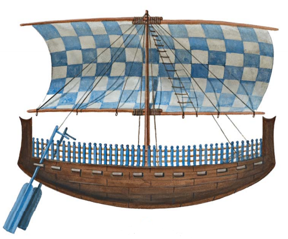 A Ugaritic ship. Note the rounded hull and the picket fence around the edge. So there's an overview of the Hittite Army. Hope you enjoyed the read. Any questions? Leave a comment below or get in touch - I'd be delighted to hear from you.
In the second half of the Late Bronze Age, four great powers dominated the international scene: The Hittites, the Egyptians, The Assyrians and the Ahhiyawans (Homer’s Greeks). Of these four, the Hittites and the Egyptians were the strongest. The Hittite armies were famed for their ferocity and skill, while the Egyptian 'New Kingdom' was expansionist, ambitious and fervently patriotic. The territories of these two superpowers abutted in a region known as 'Retenu' (roughly modern Syria & Lebanon). Retenu was effectively a patchwork of vassal kingdoms, answering to either the Hittite King (known as the Labarna) or the Egyptian Pharaoh. Vitally, Retenu was also arterial to the Bronze Age tin trade... A perfect tinderbox for war, eh? The lay of the land circa 1294 BC. Tensions mount...Circa 1294 BC, The newly-crowned Pharaoh Seti I is charged with ambition. He is desperate to attain military glory like his distant predecessor, Tuthmosis III. When he proclaims that all Retenu will fall to Egypt, his armies - vast and primed for conquest - explode with cries of hubris, rattling their spears and swords against their shields, In contrast, the Hittite King Muwatalli II (Muwa for brevity) and his second-in-command and best general, Prince Hattusilis (Hattu), are simply not ready for war. Their hands are already full with the business of governing the Hittite heartlands. There is the neverending pressure from the rebellious Kaskans who dwell in the mountains north of their capital, Hattusa. Added to that, a complex and dangerous situation is developing on the western fringes of the empire, where Troy - an age-old and firm ally - is suffering increasingly-regular raids by the Ahhiyawan city states across the Western Sea. So this new and massive threat to Retenu presents a seemingly impossible problem. "Why not send troops to all three locations?", you might say. Well it was an old Hittite Maxim, and one that lives on to this day, that it is folly to fight on more than one front. In any case, sending a strong force to more than one location was not always logistically possible, for the Hittite armies suffered a chronic shortage of manpower and were thinly-stretched at the best of times. When times were good, they could field somewhere in the region of 20,000 soldiers. But in times of strife, or in years of poor harvest when the farmer-soldier class were unable to leave the fields and herds untended, they could not hope to muster such numbers. Unfortunately for Muwa and Hattu, these were times of the latter type... Pharaoh Marches...
Seti marches north to make his name. He leads his campaign army through the Egyptian (southern) half of Retenu, crushing rebellious tribes including the Shoshu bedouins. When he strides on across the widely-recognised border between Egyptian and Hittite lands - probably at the River Eleutheros which separates modern Lebanon from Syria - it becomes the Bronze Age's 'Rubicon' moment, the point of no return. He goes on a rampage, seizing Hittite-allied Amurru and the city of Kadesh. War has arrived! 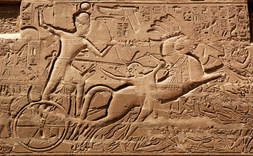 Pharaoh Seti on the warpath into Hittite lands. Back at the Hittite capital, King Muwa and Prince Hattu receive reports of the invasion with a sense of dread. With the other troubles discussed earlier, they simply cannot afford to send their understrength armies to Retenu in response. But something has to be done, lest the rest of their vassals there fall to Seti like stacked boards, allowing their greatest enemy to draw right up to the edge of the sacred Hittite heartlands. Perhaps Tarhunda the Storm God is watching out for Muwa, Hattu and their people, because deep in Egyptian lands, revolts break out. Seti has no choice but to leave garrisons in newly-won Amurru and Kadesh then turn back to the south with the majority of his forces to deal with these uprisings. But it will not take Seti long to deal with this trouble and once again return his attentions to Retenu. Still, it is a moment of welcome respite for the Hittites. A chance to initiate some sort response... 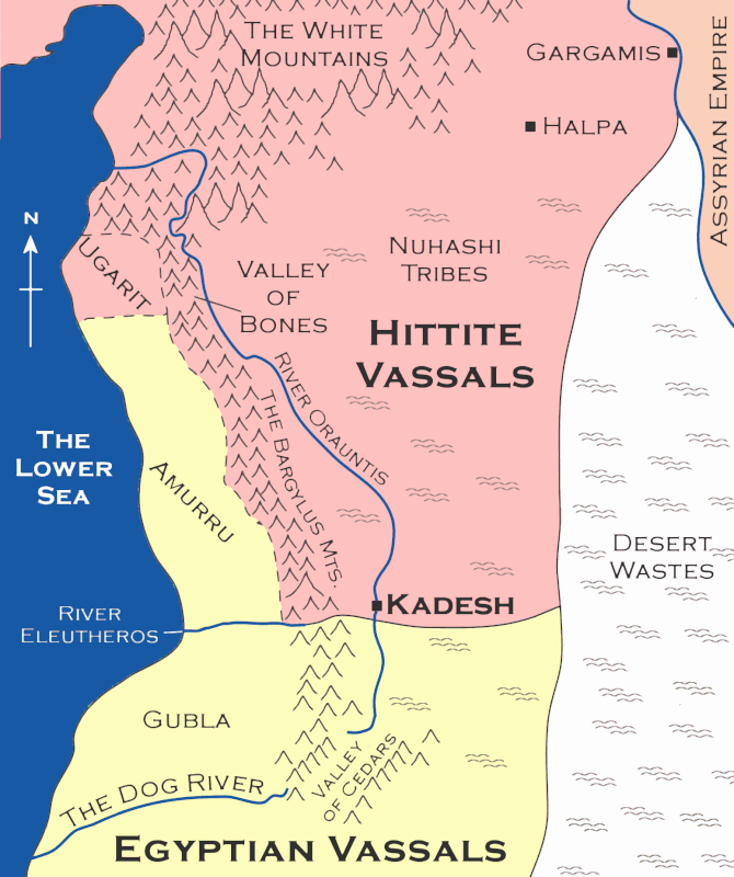 Retenu, the contested region. The map also shows some fictional landmarks visited by Prince Hattu and his force in Dawn of War.  The River Eleutheros - the 'Rubicon' of the Bronze Age. The Hittite ResponseSpoiler note: This section explores my speculative sequence of events from Dawn of War during Pharaoh Seti's brief absence from Retenu. It is during this hiatus that I chose to have Prince Hattu, venture into Retenu. Given the state of the Hittite armies, I don't think he would have led a military response. Instead, I think a mission of diplomacy might have been the only viable action - a journey to rally and reaffirm alliances with the remaining Hittite vassals of the troubled region. Specifically, he would have had good reason to visit Ugarit seeking assurances of continued allegiance. Why Ugarit? Firstly, it lay immediately north of conquered Amurru and would surely be next in line when Pharaoh inevitably resumed his conquests. Secondly, the Hittite alliance with Ugarit was a vital one. The kingdom controlled important routes in the dwindling tin trade. Tin ingots and other goods such as oil, wood, silver, waxes, honey, pottery, precious stones, grain and textiles changed hands in great volumes at this coastal market city. More, the Hittites had no real navy to speak of, and instead relied on Ugarit's fleet to serve as their watchmen of the waves. Simply put, if Ugarit fell into Egyptian hands, it would spell disaster for the Hittites.  Hittites on the march. Perhaps on Prince Hattu's (speculative) diplomacy mission to Retenu, he would have enjoyed a small soldier escort like this? Dawn of War follows Hattu's adventures in Ugarit and through the rest of Retenu. Throughout it all, he would have been haunted by the size and importance of his task and the limited time window in which he had to achieve it before Pharaoh Seti's return. For when Pharaoh did return, it would meant only one thing... Battle!The Egyptian reliefs at Karnak tell of a clash between an Egyptian army and a patchwork/vassal Hittite army in Retenu which took place shortly after Seti's punitive attacks upon his rebellious client kingdoms in the south. I won't go into too much detail/spoilers here, but here are a few teasers about what happened. "Mighty Bull, ready-horned, mighty-hearted, smiting the Asiatics, beating down the Hitittes, slaying their chiefs, overthrown in their blood, charging among them like a tongue of fire, making them that which is not…"
Sounds good? Well, you can live out the adventure in Dawn of War! Any questions? Leave a comment below or get in touch - I'd be delighted to hear from you. As the dust began to settle...In 382 AD, after 6 years of ruinous warfare between the Eastern Roman Empire and the Goths, the two powers finally struck a deal for peace. But history tells us that peace is a rare and short-lived phenomenon. As it proved, this period of accord served merely as a fermentation ground for new and world-changing conflicts.
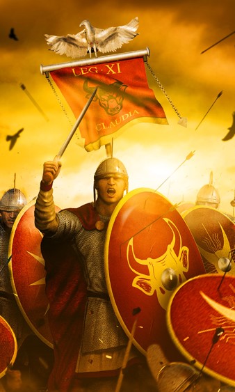
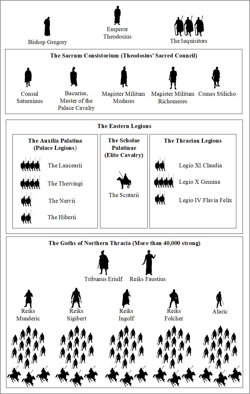
But, if we can take a moment to breathe deeply and cast an eye over the empire in this trice of tranquility, what did things look like? The lay of the landIn 382 AD, the Roman Empire had, for the best part of a century, existed in parts. Back in 285 AD, Emperor Diocletian split the empire into Eastern and Western halves. He further split each half in two to establish 'The Tetrarchy' - a system of two senior emperors, each known as Augustus, and two junior Caesars. It was supposed to establish a closer degree of imperial control over each quadrant and set in place a clear and undisputable system of succession. in practice, imperial control varied wildly and there was lots of dispute about succession. Fast forward through civil wars, religious unrest, Constantine's reunification of the empire and its subsequent return to separate halves and finally to the end of the Gothic War... and we arrive at the picture below. 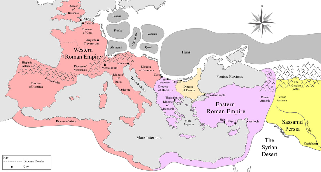 The two halves of the Roman Empire circa 382 AD, in the immediate aftermath of the Gothic War. 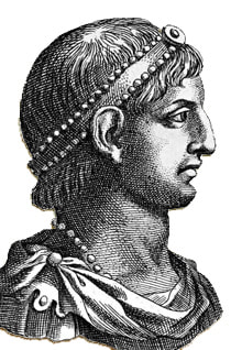 Gratian, Emperor of the West. Gratian, Emperor of the West. The Western Empire, ruled by Emperor Gratian, consisted of Britannia, Gaul, Hispania, Italia and Africa. While relatively stable, the westerners did have to keep a close eye on the Rhine river frontier, beyond which the many powerful Germanic tribes and confederations held sway. Worse, a strange new threat from the eastern steppes - the Huns - had catalysed the panicked westwards movement of these tribes. Previously happy to raid and retreat, the Germanic tribes were now set on breaking into the Roman Empire to stay, and to put the great rivers between them and the aggressive Hun threat. Fortunately, the Rhine frontier held good up to this point,  Theodosius, Emperor of the East Theodosius, Emperor of the East The Eastern Empire didn't fare quite so well. The Goths - one of the more easterly of the Germanic peoples - had been living north of the River Danube in roughly modern-day Romania and Ukraine. But the arrival of the Huns forced them to move, en-masse, across the great river and into the Roman Diocese of Thracia (highlighted sandy-yellow in the map above). The Romans were ill-prepared to handle this mass-migration, and indeed they handled it terribly, mistreating the Gothic peoples. The Goths revolted and six years of war ensued, including the Eastern Empire's most infamous reverse at the Battle of Adrianople which saw Eastern Emperor Valens slain. In the end, there was no victor, just the edgy peace deal which saw the Goths settle in Thracia with some degree of autonomy - granted in exchange for their vow to serve the new Eastern Emperor, Theododius, should he call them to arms. So that was how things were: the Goths planted in Roman Thracia, the Huns still at large in the north, continuing to drive tribal groups towards the perceived safety of imperial lands. Meanwhile, in the East, the Sassanid Persians remained strong and ominous on the desert borders. So many threats on the outside...With all of these potential foes around the Eastern and Western Empires, you might think it would be common sense for both halves to stand together and compose a strategy to keep the ancient imperial world safe. Unfortunately, common sense seems to have been a rare commodity, for it would not be long before the two halves turned upon each other. I won't go into the specific details of this - but you can read all about them in my latest novel Legionary: Dark Eagle, which gives a soldier's-eye view of the chaos that was about to come. But I can give you an illustration - partly speculative, but based as much as possible on historical records - of the military arsenals available to the Western and Eastern Empires.
We can see that Gratian's Western Empire retained a strong core of field legions and elite palace regiments (Auxilia Palatina), as well as a great number of cavalry troops from the African provinces to supplement the imperial cavalry schools (Scholae Palatinae). The Eastern forces might - at a glance - appear matched in number. but if we look closely at the legionary corps, we have only patchy remnants left over from the Gothic War. After all, it is thought that some two-thirds of the eastern army was destroyed at the Battle of Adrianople alone. Ironically, the bulk of the forces available to Emperor Theodosius at this point were the Gothic tribes settled in Thracia - a populous, proven force... but how reliable? And when it came down to it, could the Roman brothers of East and West really lift swords against one another? The next few decades were to serve as an answer. Those years would prove be the most torrid the Roman Empire had ever endured, with world-shaping wars and ancient cities ablaze, all to the plaintive death-cry of the old gods. Thanks for reading. I hope you enjoyed! You can find out more about my novel set in this era, below: 
 Onto the final leg of my Great Hittite Trail tour. I took a coach from Erzurum's out-of-town bus station, which zig-zagged northwards through the Pontic and then the Lesser Caucasus Mountains, rolling along precipitous mountain roads and giving great views of inland lakes and soaring peaks. I had planned this leg of the journey as best as I could, but the advice online and in books was sketchy, at times contradictory., and faintly worrying! ""You will have to cross the Turkey-Georgia border on foot, and be prepared to haggle with the squadron of taxi and dolmus drivers on the other side. They will take dollars or sterling. You can't get a hold of Georgian Lari until you're inside the country"" I had images of me crawling through a hole in a chickenwire fence then scuttling across a dusty car park, ducking every so often to hide from border guards. In fact, the border crossing was first rate - just like an airport without the planes. I will admit I was a little disappointed after all my imaginings :) A Dolmus into Batumi was an interesting experience. No seatbelts, 100+mph and 'take your life in your hands' overtaking on a single carriageway - yikes! The Georgian countryside was markedly different to that on the Turkish side: on my right rose the verdant, tree-lined Caucasus range whose peaks were shrouded in cloud, and on my left was the coast, sun-washed and sweltering. In many places, it reminded me very much of the carribean landscape, with hillside homes standing proud of the woods here and there, pitched on stilts.
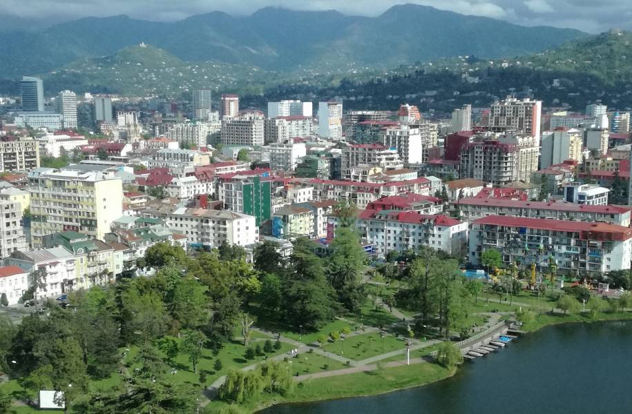 Batumi, with the Lesser Caucasus Mts. in the background. Upon entering Batumi and crawling through its traffic, I also noticed a rather unusual fashion amongst the men of the city: standing around on street corners with their t-shirts rolled up from the waist, right up to the armpits! Perhaps it was because Batumi was very hot and muggy. It was also very busy and from what I could detect on the way through, the air seemed to be quite polluted. Fortunate then, that I was not stopping here. Near Batumi's central train station, I hopped off the dolmus and into another taxi which sped me at warp speed along the highway up the Black Sea coast through fresh country air and towards a quiet little place known as Ureki Beach. I had picked this place at random as a good 'downtime' stop for a few days. Ureki Beach sports black, magnetic sand, and the perceived healing qualities of the sand make it a very popular destination for those with health problems, including bone and cardiovascular diseases. I checked into a very pleasant beach shack there and - after weeks of fast-paced travel - began to wind down. 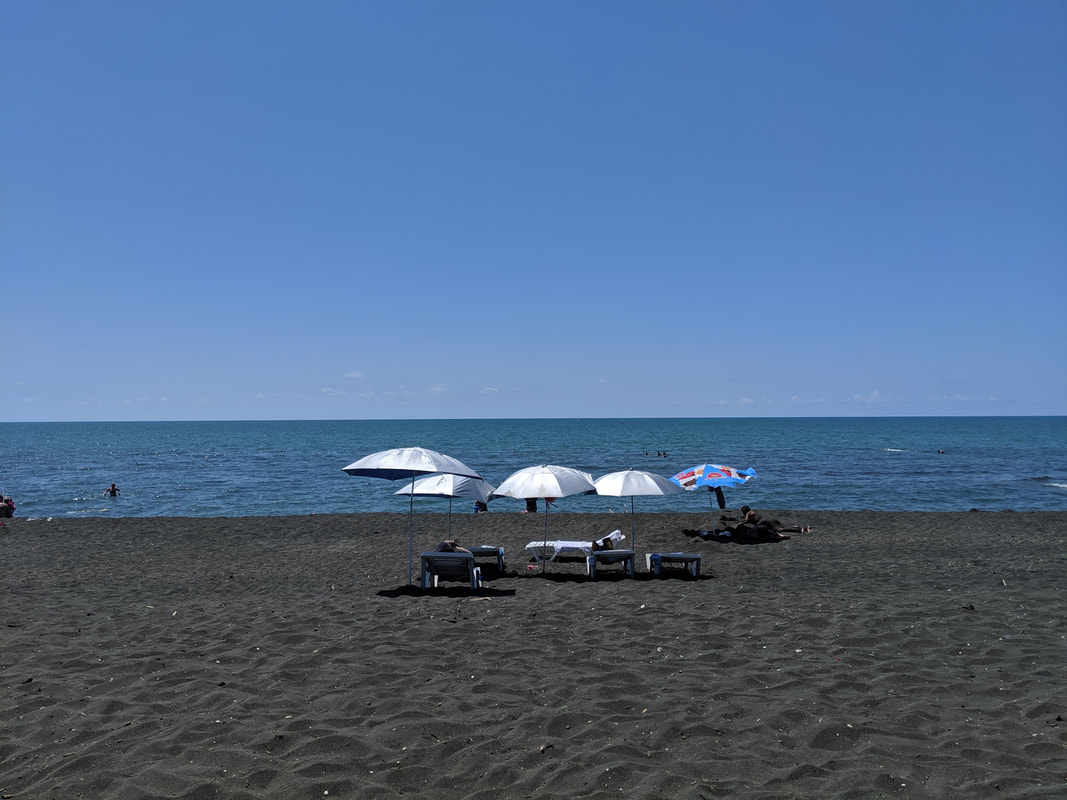 Ureki beach, looking onto the Black Sea. 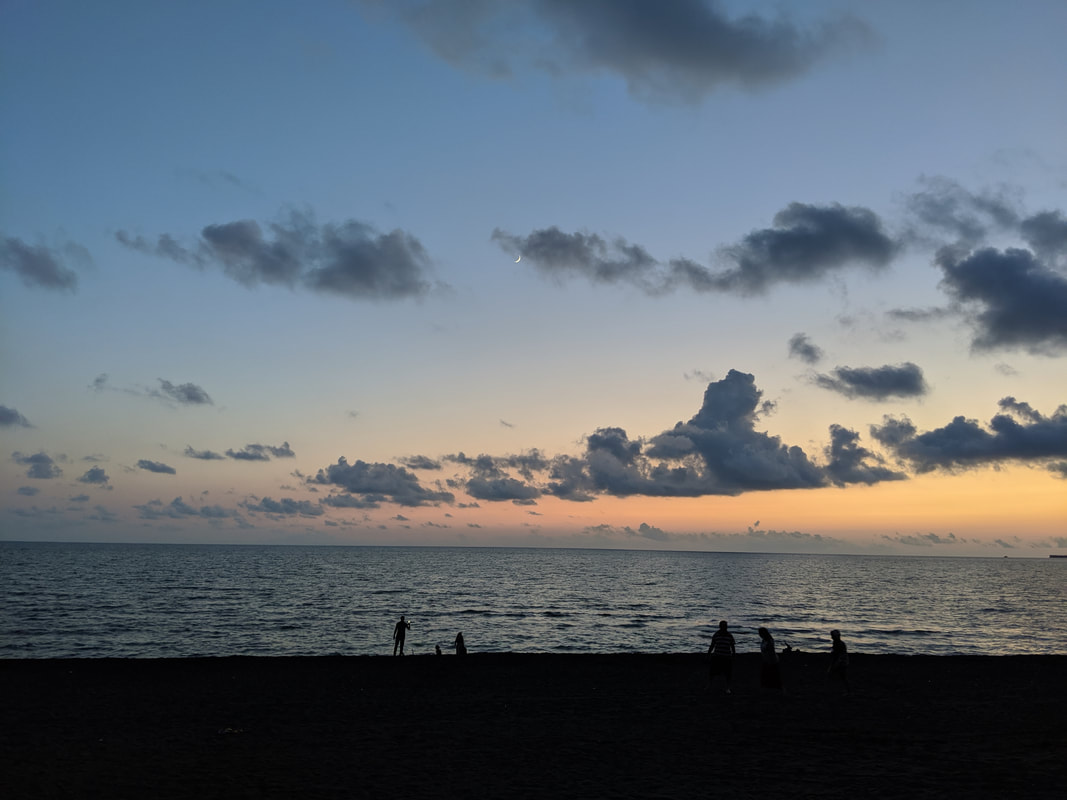 Ureki beach at dusk. Gorgeous!
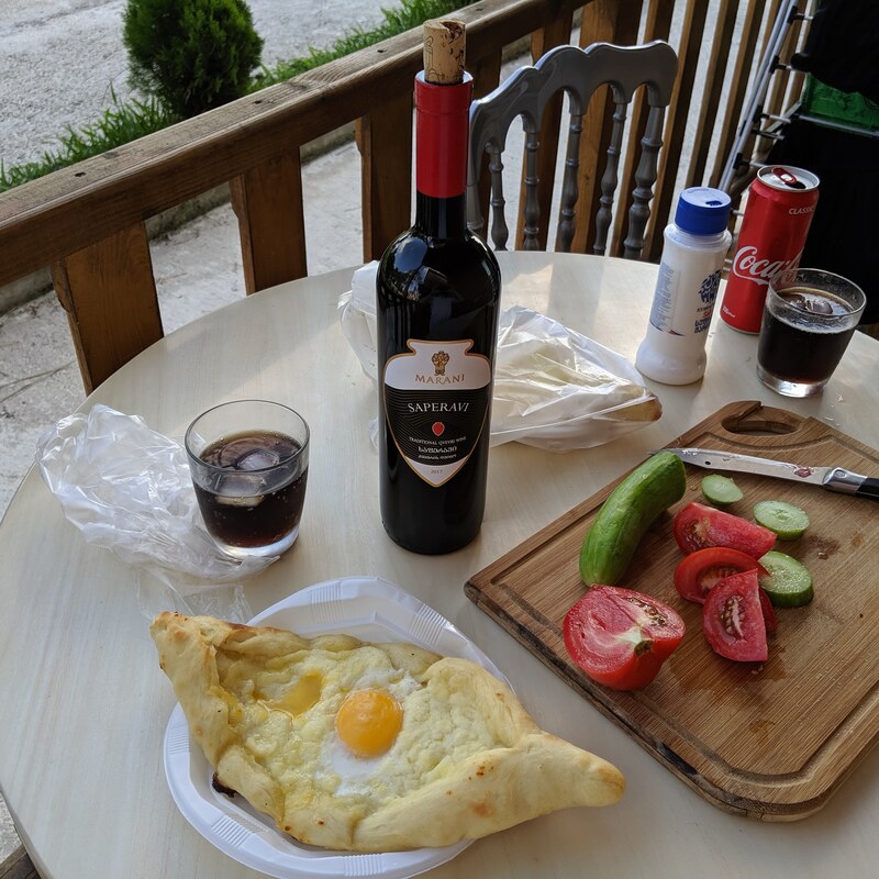
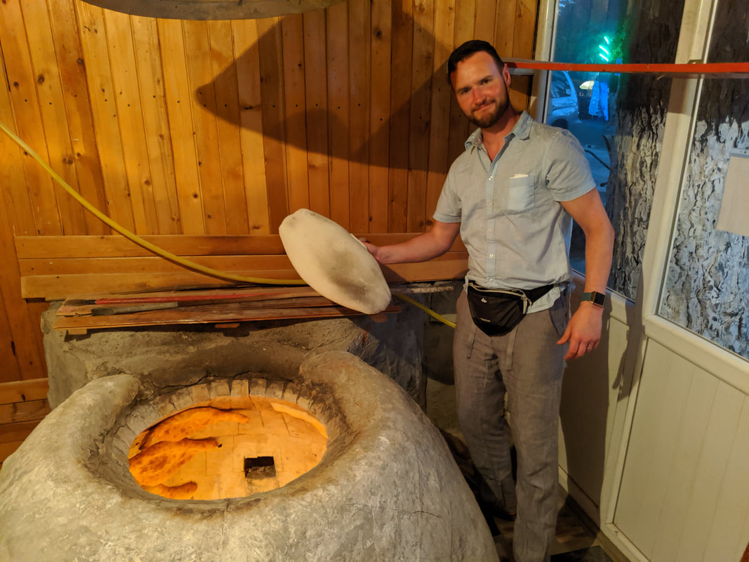
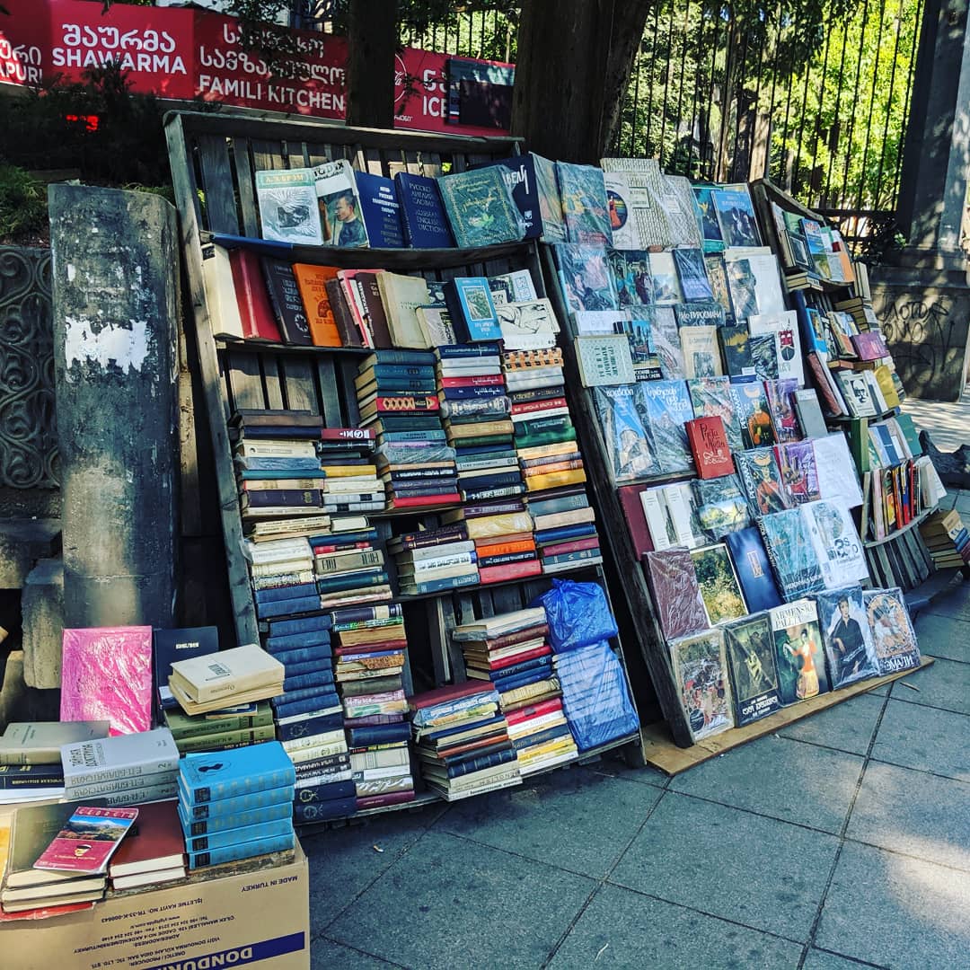
But why, I hear you ask, why Georgia? What has it to do with the ancient Hittite Empire? Georgia was, admittedly, a bit of a shot in the dark. I knew from my research that the rough region of the modern country was, 3,000 years ago, on the periphery of the Hittite realm. On the maps of the Hittite world that modern historians and archaeologists have put together, we know only of a people known as the Azzi-Hayasi living somewhere near the Georgia-Turkey border. Any further north than that (i.e. right where I was), and we're into the realm of legend. But legend has it that, during Hittite times, one of the grandest expeditions took place, taking a certain Greek hero to this region. I'll let my video explain (and it also gives a quickfire review of my travel reads): I thoroughly enjoyed my time here at Ureki, reading and contemplating history, swimming in the Black Sea, eating my own body weight in 'kachapuri' (and even gloriously-filthier version of trabzon pide!) and getting far too drunk on the 2.5l bottles of beer! I was taken by the local red wines: Mukuzani and Saperavi. I did pass, however, at the offer of some home-made vodka, packaged in repurposed coke bottles. In general, the prices here were a bit of a pleasant surprise. I struggled to spend more than £5 on a full meal with drinks. Not surprisingly, English speakers were few and far between, and I made the effort to establish a little Georgian (mainly 'cheers' and 'where is the...' kind of stuff). After a few days here, I was fully recharged, with a spare few inches on my waistline. Time to catch the cross-country train and head eastwards to Georgia's capital! 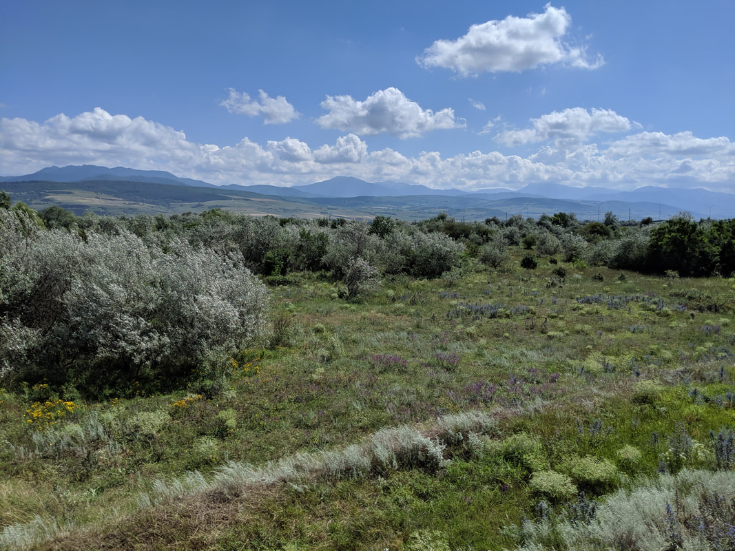 The view from the cross-Georgia train: vast plains with the Lesser Caucasus Mts. in the southern haze. Tbilisi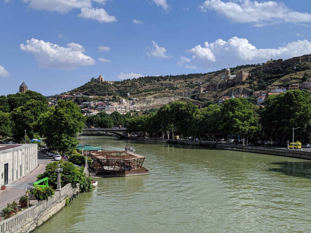 The train rolled into Tbilisi, and I stepped out onto the buzzing, bustling streets to find that - despite being even further east - the place had a distinctly 'western' air about it. Towering, almost baroque architecture, wide streets and glorious monuments. All this with a distinctly romantic and laid back - almost hippy-esque - vibe. Think Istanbul's vibe set to the backdrop of a mini Paris. English speakers chattering here and there meant I could largely retire my tortured Georgian skills, and I quickly got my bearings. Tbilisi is set in the floor of the Mt'k'vari river valley, whose sides rise like great walls immediately to the east and west. The city has has two core areas. First, Rustaveli Avenue, a monumental way named after the country's national bard, Shota Rustaveli, who lived in the 12th and 13th centuries. I will admit ignorance in this area, but I soon filled that gap, reading all about his life and works. More, I quickly added 'The Knight in the Panther's Skin' to my TBR pile, The avenue is the modern heart of the capital, lined with second-hand bookstalls, wine bars, boutiques, theatres and halls. Then there's old Tbilisi: a warren of lanes and markets, family kitchens, ultra-cool hippy tea rooms and ruins of the medieval walls, plus a spectacular 6th century AD fortress perched on a bluff commanding the Mt'k'vari River valley. 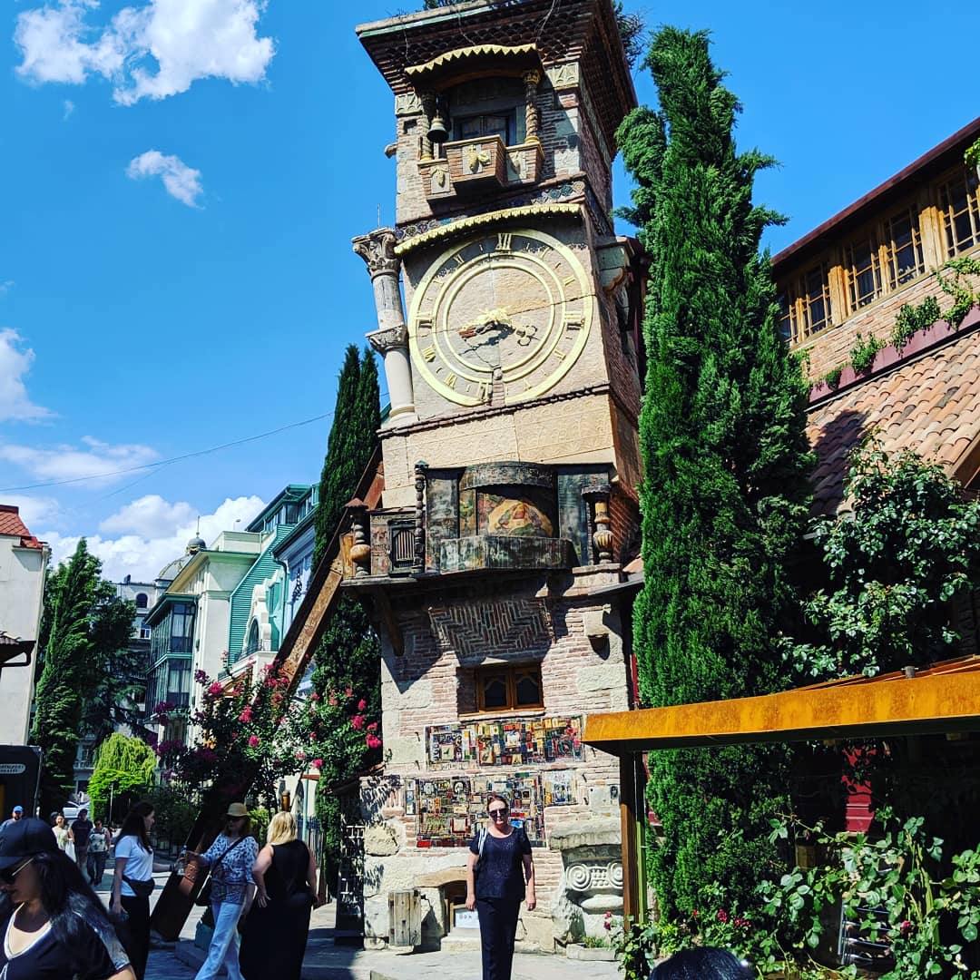 Here's the famous clock tower in old town Tbilisi. Modern and deliberately wonky, but very quirky and interesting all the same.
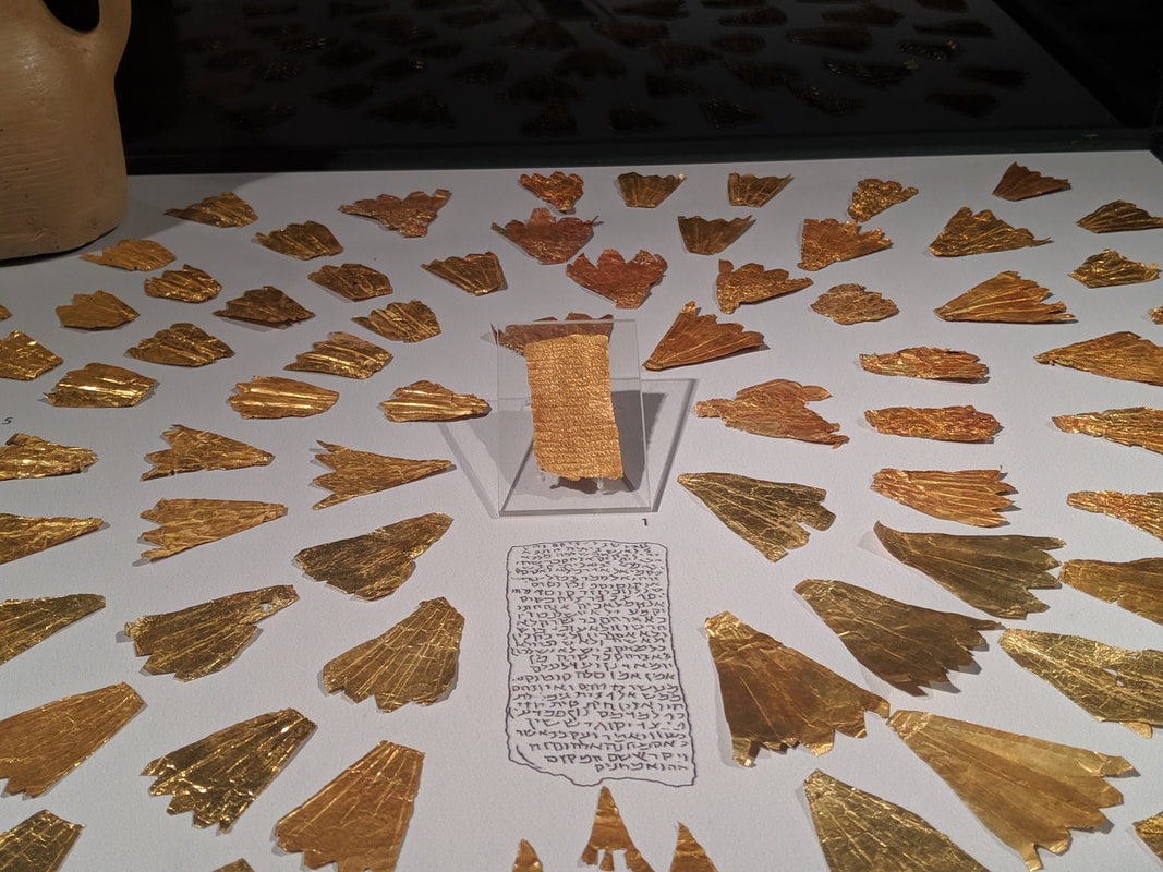
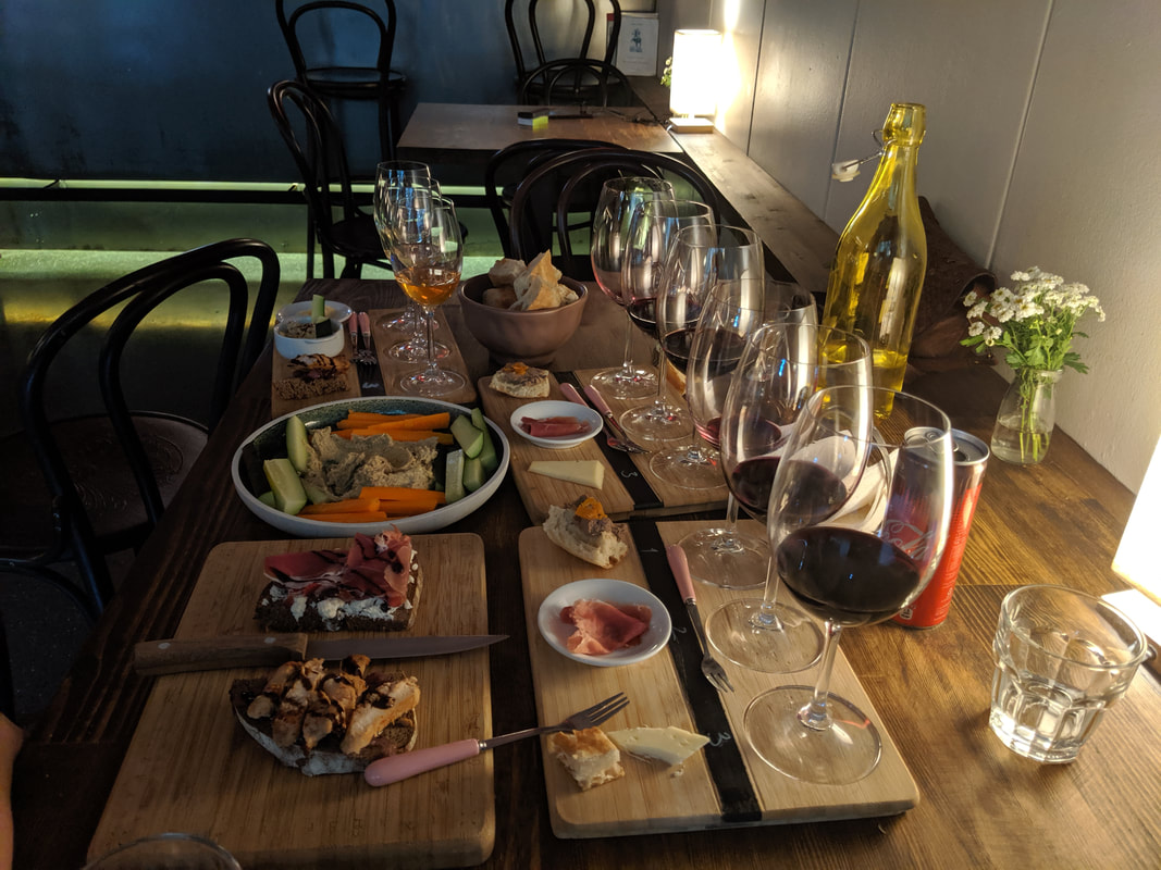
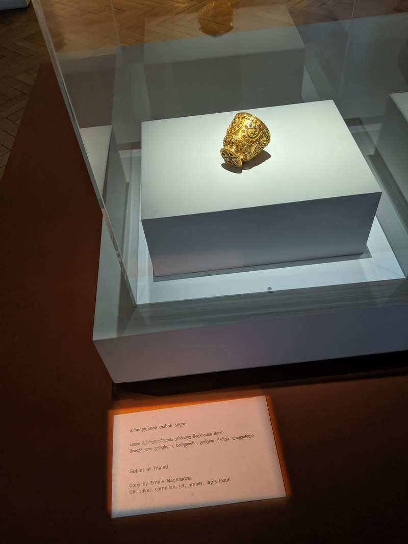
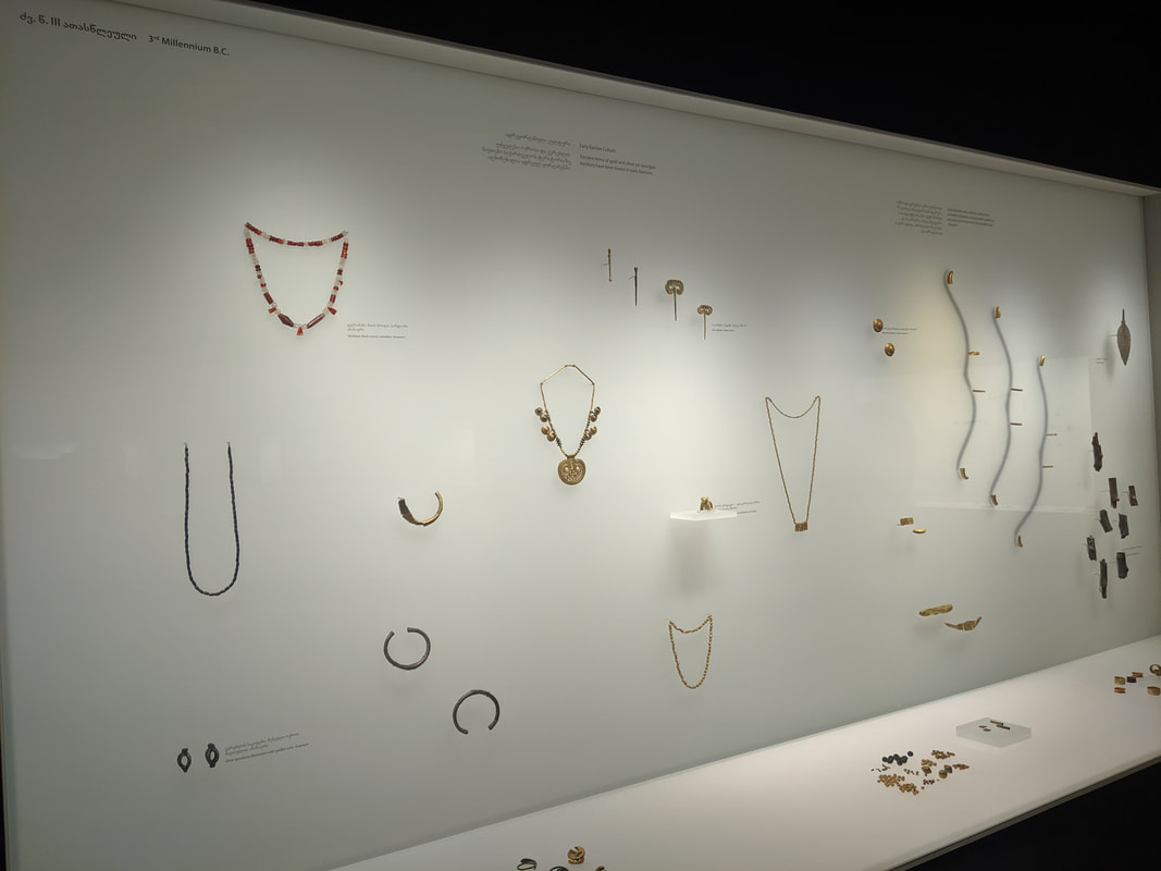
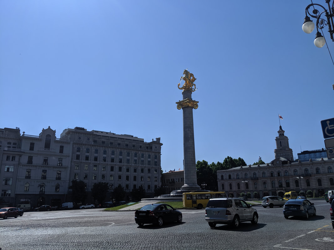 The Freedom Statue of St. George (and the pesky dragon). While navigating on foot to my apartment, I quickly found out just how precipitous the city streets were. I really should have packed crampons! But then something quite memorable happened. I arrived at my apartment (Jonjolly Apartments - highly recommended) and met Mariam, who was there to give me the keys. She greeted me with a warm smile and then an apology: the apartment wasn't quite ready yet - it'd be another half hour or so before they had it tidied up. I was quite happy to sit on the doorstep and read, but she insisted on taking me to sample some Georgian wine. I assumed this meant a quick taster glass in a bar across the road. But no, she drove me to her favourite wine bar in the city and proceeded to ply me with 12 wine tasters and a range of snacks and appetisers: walnut and aubergine dips, freshly toasted flatbread, hummus, cheeses, cured meats and olives. Drool! Mariam couldn't have been more friendly or welcoming, chatting about her country's history and politics and asking about how things were in Scotland. I really enjoyed the conversation, and came to understand the strength of spirit of the Georgian people, and their sometimes fractious relationship with their giant neighbour in the north, Russia. It's always a bit daunting when you arrive in a new city for the first time, especially in a foreign country, but this was easily the most enjoyable welcome I've ever experienced. Maybe if was because of the 12 glasses of wine, but I decided then and there that Georgia was abshulutely bril-hic!-liant... The next day I woke, dazed, confused and glad I had already mapped out my itinerary a few days previously. First up, I visited Tbilisi Museum, packed with exhibits from the dawn of man right through to recent centuries - covering the eras of Persia, Rome, Greece, the Ottomans and Seljuks. Tantalisingly, there was a special display covering ancient Georgia's Colchis era, and the wealth of gold and in particular its proliferation of expert goldsmiths. This tied right in with my Hittite interests and potential that the Golden Fleece legend happened at the time of Empires of Bronze. The exhibits were simply breathtaking. The level of skill and creativity from so long ago really shifted my perceptions of history. More, they sowed a dragon's tooth or two in my mind, which may well spring to life in the later books of Empires of Bronze :-).
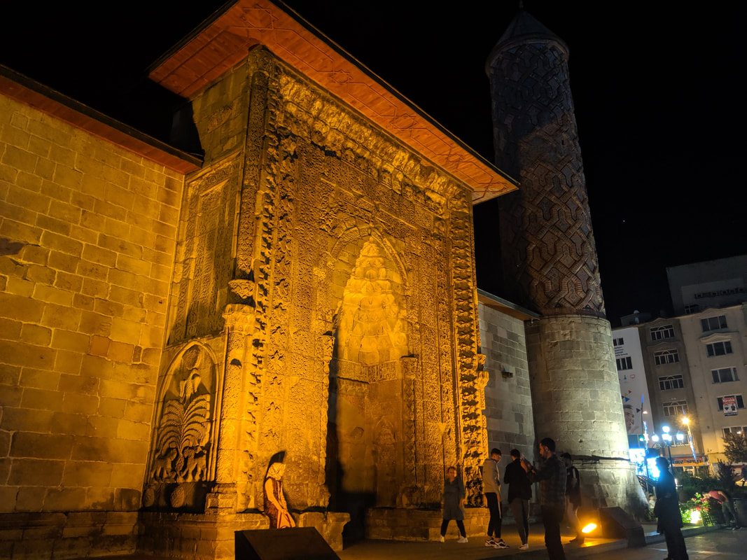
 Golden duck feet? :) 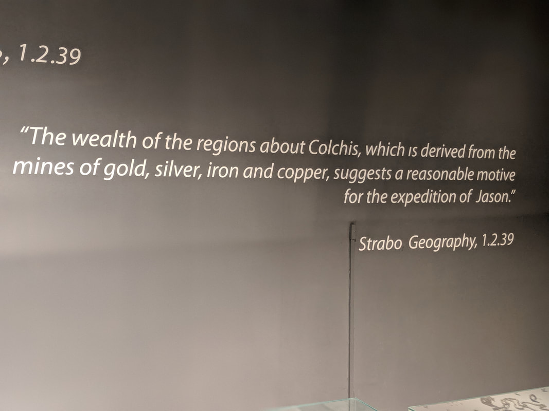 Back in the Bronze Age, Georgia was known as the Kingdom of Colchis, and it was famed for its reserves of precious minerals and metals - namely gold, which would have been mined from those mountains. More, this was the land which - legend had it - Jason and his Argonauts travelled to in search of the Golden Fleece. Intriguingly, this is thought to have happened in the decades prior to the Trojan War... exactly the time period in which Empires of Bronze begins (rubs hands excitedly). After the Museum, I sat in the 'Garden of the Republic' park and enjoyed a bit of shade, a sandwich and a read. I didn't realise just how much I would need the fuel... for the temperatures seemed to soar that afternoon, and the walk through the old town became steeper and steeper. And finally I saw the short distance that would lead me to Narikala fortress - a Persian stronghold built in the 6th c AD. Unfortunately this short distance was almost perfectly vertical. Perhaps I might have clicked that there was an easy way of getting up there, given the funiculars and cable cars zipping around overhead. but it was hot and I was still hungover, Thus I began hiking up my own mini-everest. 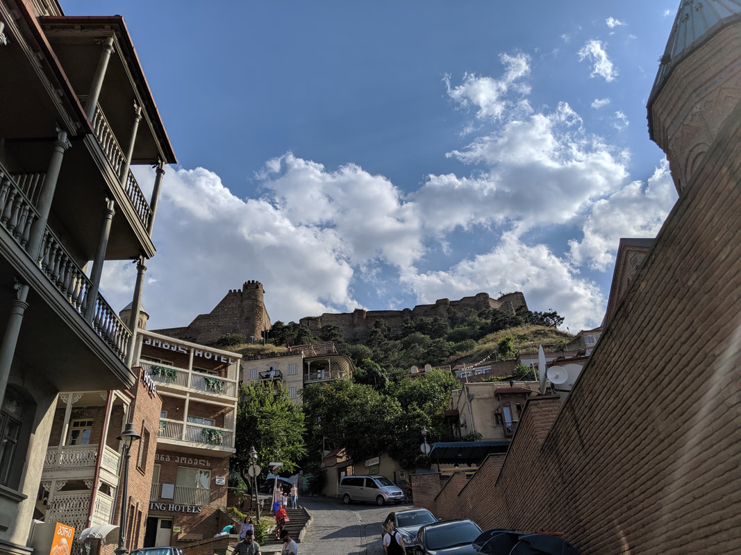 Tblisi's Narikala Fortress - originally a 4th century AD Persian stronghold - as seen from Old Tbilisi's market streets. Redefines steep. 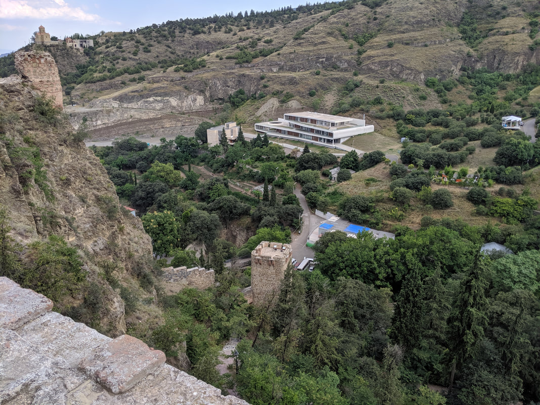 A view from one of the fort's towers. Wonderful, eh? And the views from up on the fortress were even better. Here's a video - the final video of my trip - from up on those heights: Georgia Travel Tips
A full gallery of my journey through Georgia is available here on Facebook (Like and follow, please!) Quick navigation:
And Finally......the Great Hittite Trail adventure was at an end. Thanks for reading and I hope you enjoyed and/or drew some inspiration from this. Now go... explore! And if you're looking for an exciting Hittite adventure to read along the way...
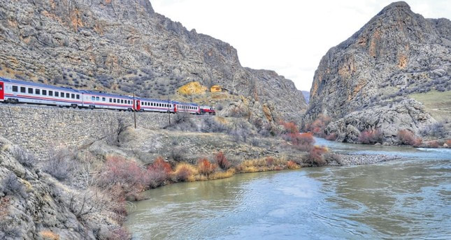 The Eastern ExpressInto the unknown! That's how this leg of the expedition felt. An 18 hour sleeper-train across Eastern Turkey? The idea had thrilled me since I first planned it. I had notions of waking, parting my cabin curtains and seeing dawn pouring across the snow-capped Pontic Mountains, then whiling away the rest of the day gazing out of the window with my notepad and letting the muse take me. The reality? Booking a cabin on this famous train is very, very difficult. You have to wait until a few weeks before the journey before you can book, and the few cabins are sold out within moments of becoming available. Anyway, enough whingeing, I still got a berth, but just a normal train seat. Truth be told I almost didn't even make it onto the train. When my taxi dropped me off at Yerköy station, I had no ticket or confirmation. The TCDD app had confidently told me I needed only produce my passport to get my tickets at the station. Ha! Yerköy is a small town and the station was pretty basic. The chap in the ticket office - who had the patience of a saint - didn't speak a word of English, and I only command a really basic Turkish vocabulary, Google translate rode to the rescue - kind of. There were a few comedy mis-translations (one involving me claiming "I have already burned my tickets"). Good job I had got there 2 hours before the train's arrival because it took over one and a half hours to search the TCDD system and prove that I had bought tickets. Me and the station master actually did an ecstatic high five once we found them :) Famished, and having read the advice that the train sometimes didn't have much food on board, I grabbed a lamb pide and a bottle of juice. I assumed it was some kind of soft drink... then I noticed it was actually 'hot black carrot juice'? Eh?! Well, try everything once, I say. I did, and I won't be trying it again. It tasted something like spicy dishwater. Urk! 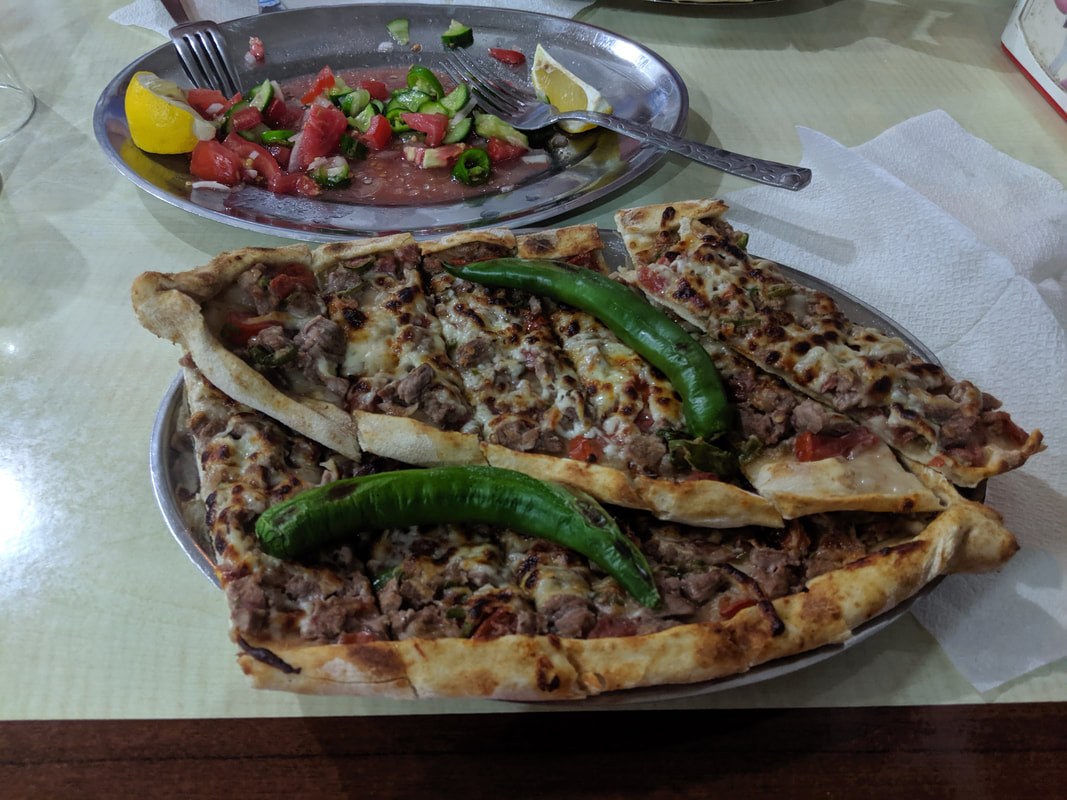 Lamb pide - yum! Hot black carrot juice? Yuck! Anyway, the train came, and I found my seat. Darkness had fallen by this point, so there was no sightseeing to be done. As the train moved off, I tried to make myself comfortable - the seats were big and comfy, but it was still above 20 degrees Celsius, and I knew 18 hours would be a test. So I flicked on my Kindle. About half an hour in, a voice stirred me from my reading. I looked up to see a smiling young woman, holding out a box towards me. 'For you' she said. Confused, I took it, opened it and beheld the cakes and pastries it contained. She was away before I could thank her. Just to be clear: she was not a member of the train staff - she was just being very, very kind. I saw other people doing similar things: offering each other food and drinks from their own personal stashes. Indeed, later on another family boarded at Kayseri station, and they proceeded to give me a potato! I think they thought this was quite funny because I'm from Britain and all British people are (apparently) crazy for potatoes! A while after this I spotted the kind cake woman and gave her a pack of haribo for her young daughter. This whole communal atmosphere really softened what was to be a tiring journey. With nothing but the darkness of night outside, time wound on lethargically, and - unable to lie down - I simply couldn't sleep. I was exhausted and on the edge of full grumpiness when something wonderful happened. Dawn. The Turkish sunrise. Beauty emerging from darkness like an amber teardrop. 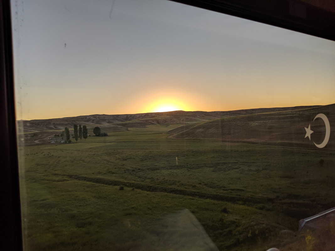 Eastern Dawn - mesmerising! 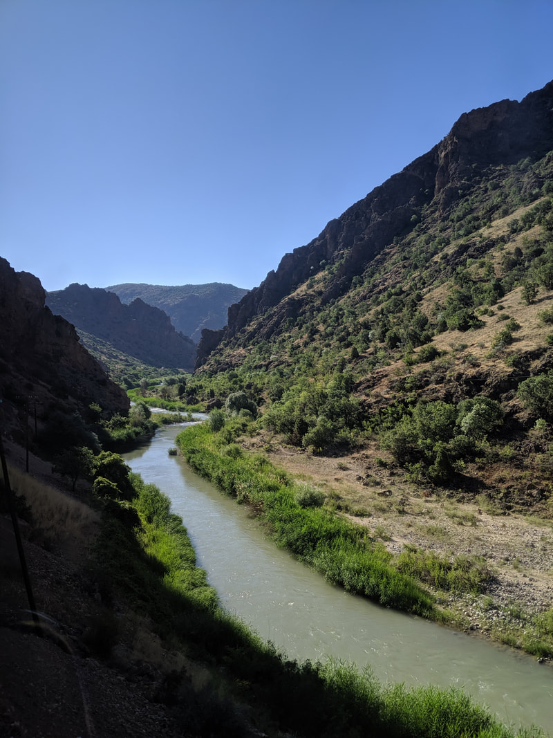 Into the mountains... and along the upper Euphrates! This was the vision I had been waiting for. Silhouetted hills, rolling dusty plains, Cliffs and crags. These were the lands that the Hittites once roamed, honouring the spirits of every rock, wood and vale. And the landscape changed after a time. The train plunged into mountainside tunnels, emerging into successively rockier and more lofty ranges - chiselled walls of terracotta that stretched for the sky - some capped with snow even though the ground-level heat remained sweltering. For every height there was a matching ravine, with opaque, emerald brooks, fed by toppling, silvery waterfalls. Now I was in my element! I left my seat behind and began patrolling the train in search of good windows from which I could take photos or simply observe (and wait for the muse to come!). It was simply magical, and at one point I was entranced by a green river and the way the sunlight was sparkling on its surface... then I realised (with a quick check of the map) that it was actually the upper Euphrates - one of the most famous and ancient rivers in the world. The highlight - by far - was my find of the mail carriage. It was deserted. No mail bags, no furniture - just an empty shell of a carriage... with huge doors on either side, lying wide open! So, with a form grip on the rail next to the door and my camera set to video mode, I tried to capture the moment... ErzerumMy train journey ended at the city of Erzerum, which deserves a special mention because - although it is small and not quite the 'beautiful' tourist city, it is very authentically Turkish, and that is what I was here to see. I only had a short overnight here, but I did manage to browse the historic city centre and its very wonderful mosque and medrese. Even better, I was introduced to a Trabzon Pide here - a deliciously calorific cheese, egg and bread concoction that went wonderfully with a chilled pint of Efes :)
 A Trabzon Pide - yes please! Just before I left to catch the bus onwards to Georgia, I had a moment of reflection, and realised that a few of my books had criss-crossed this ancient city, as my video will try to explain: Eastern Turkey Travel Tips
A full gallery of my journey through Eastern Turkey is available here on Facebook (Like and follow, please!) Quick navigation:
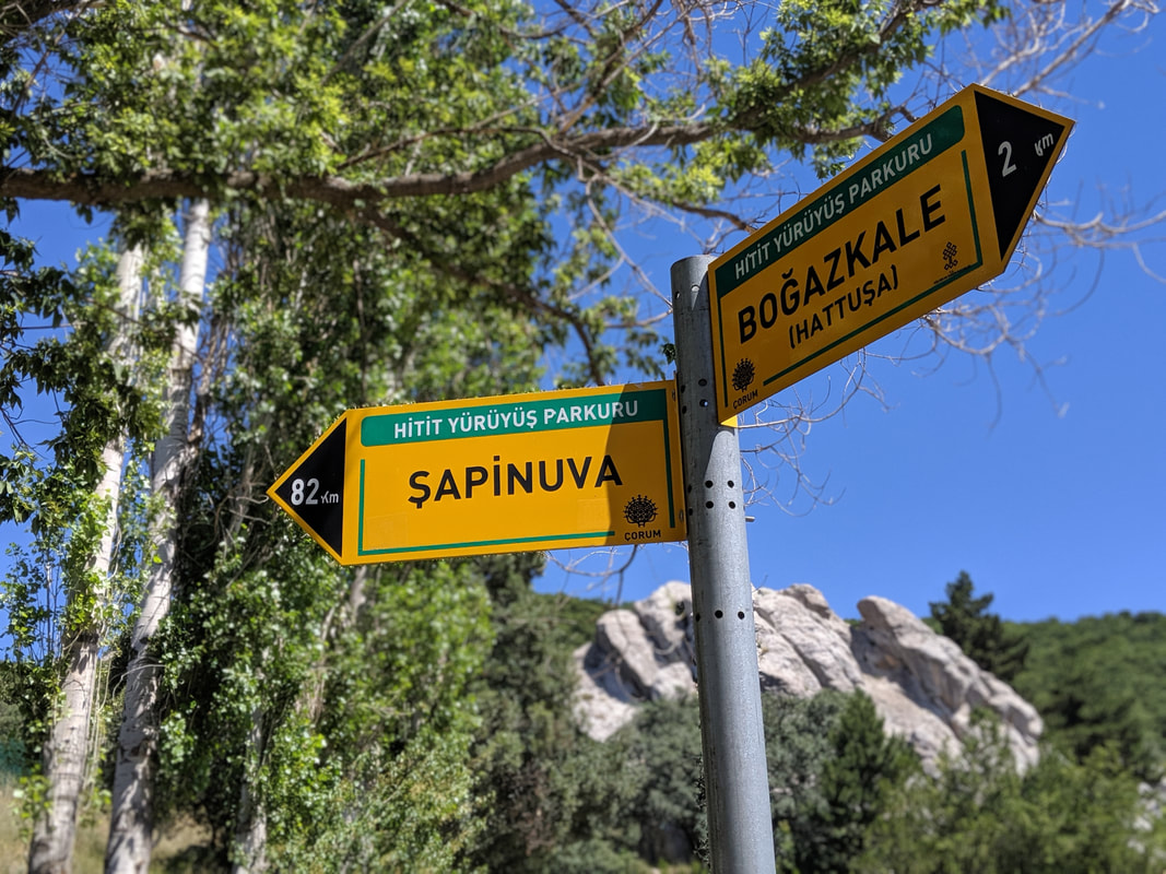
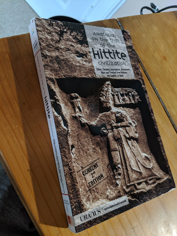
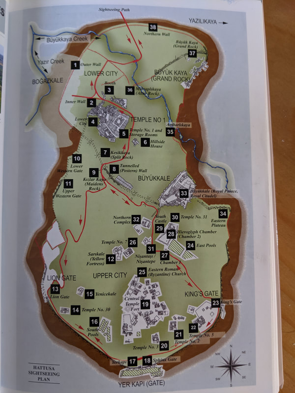
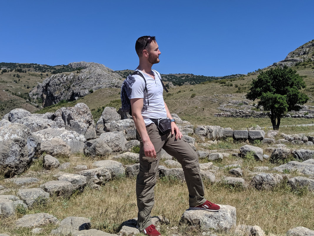
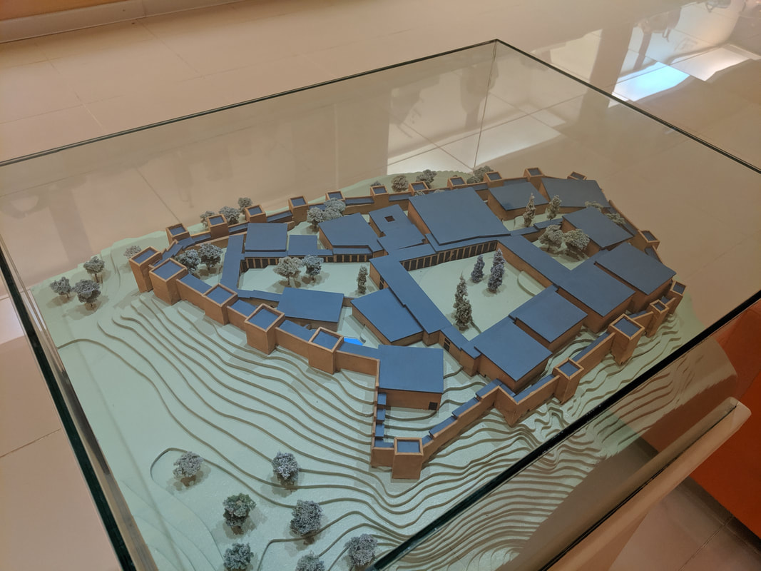
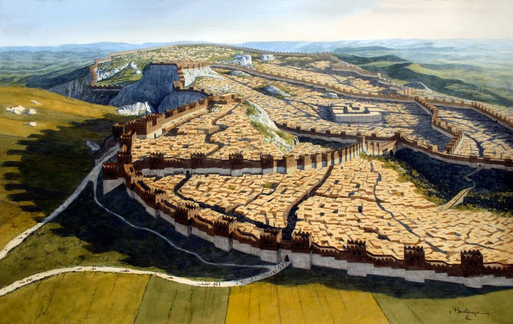 Hattusa in its pomp, as seen from the north. Hattusa. This place had haunted my days and dreams for over six years. I had pieced it together mentally thanks to a variety of maps and photographs online, but I had craved this moment, to be here where 3,000 years ago the Hittite Empire flourished. All the way on the 3 hour bus from Ankara to Sungurlu, then again during the dolmus ride towards the town of Boğazkale, I scoured the horizons, waiting, eager, watching sierras and cliffs rise then peel away as we sped closer and closer. Would I even recognise the mountainside of Hattusa amongst this highland region? But the moment the rolling, rocky masif arose from the eastern skyline, I felt a hot thrill of recognition - a great sense of arrival. 'That's it!' I proclaimed - somewhat startling the elderly Turkish gent in the dolmus seat in front of me. 'Look, see the ravine - that's cut by the Ambarlikaya river. The tor on the right - that's the acropolis. And on the left, that's Tarhunda's Shoulder!' I gibbered away to anyone who was interested.  My first glimpse of the UNESCO World Heritage Site of Hattusa - 3,000 year old Capital of the Hititte Empire. The dolmus pulled into the small town of Boğazkale, situated at the western foot of the mountain ruins. I hopped out, dropped my bags into the excellent Hittite Houses hotel. Sitting in the leafy shade of the hotel gardens, I wolfed down a quick lunch of bread and tomatoes, before arming myself with my backpack - water, headscarf, camera being the usual essentials. And there was one other thing vital to this walking tour: the guide book I had bought in the Ankara Museum of Anatolian Civilizations. It's perfect - containing a route map and concise but informative explanations of the ruins on show at every step.
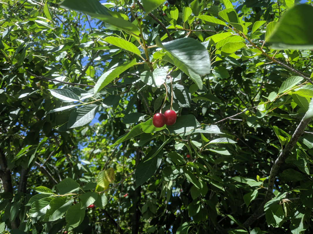
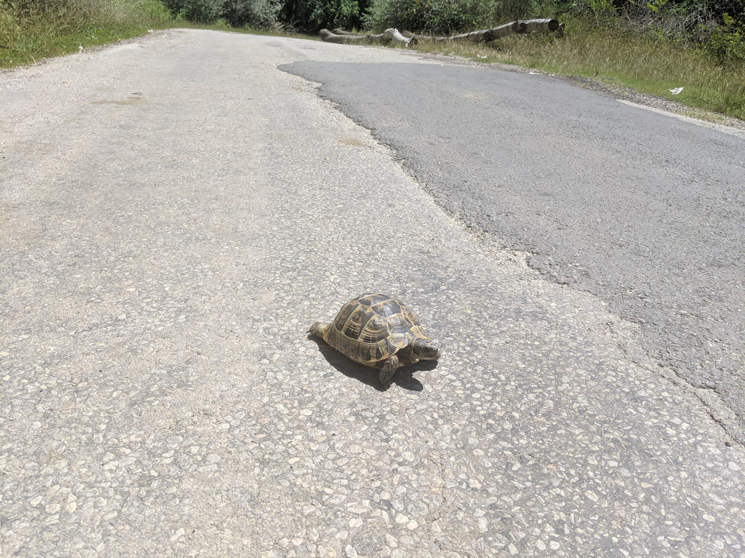
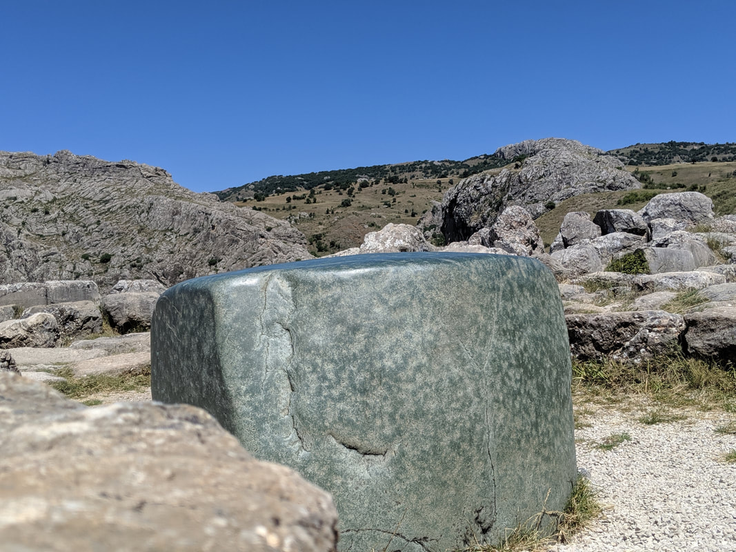
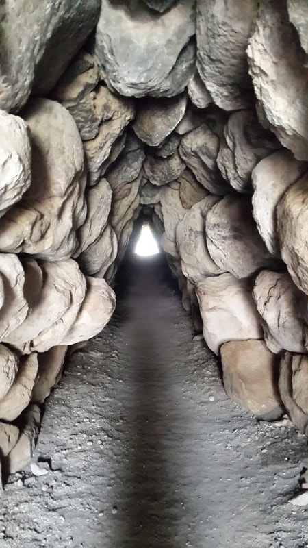
Off I went on the short (~1km) walk up the quiet country road that leads to the ruin site. But like all adventurers, I was waylaid by two almost impassable obstacles. First: a wild cherry tree, heavy with fat, glinting, red and ripe fruit. I simply had to stop and stuff my face with these. Never in my life have I tasted cherries as pleasant as these ones. Next up, I was assailed by a ferocious monster! Not quite. It was actually a wild tortoise, ambling across the middle of the road. I don't know how often traffic passes along this road, but I wasn't minded to leave the wee fella like that, so I lifted him over to the side of the track he was headed for. 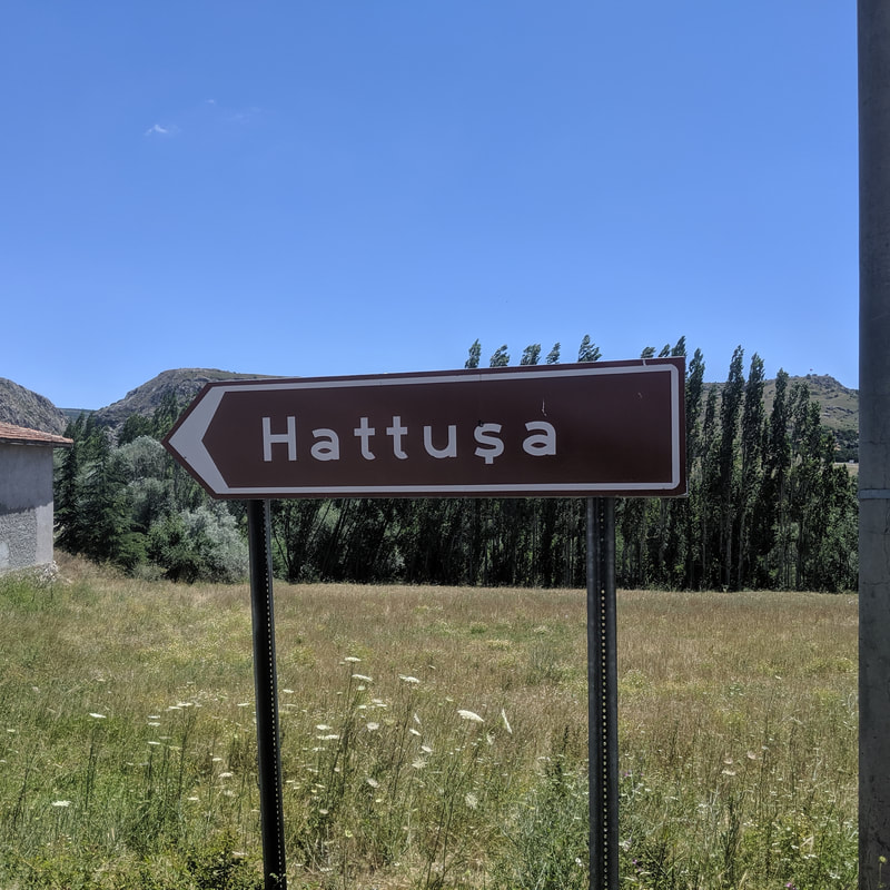
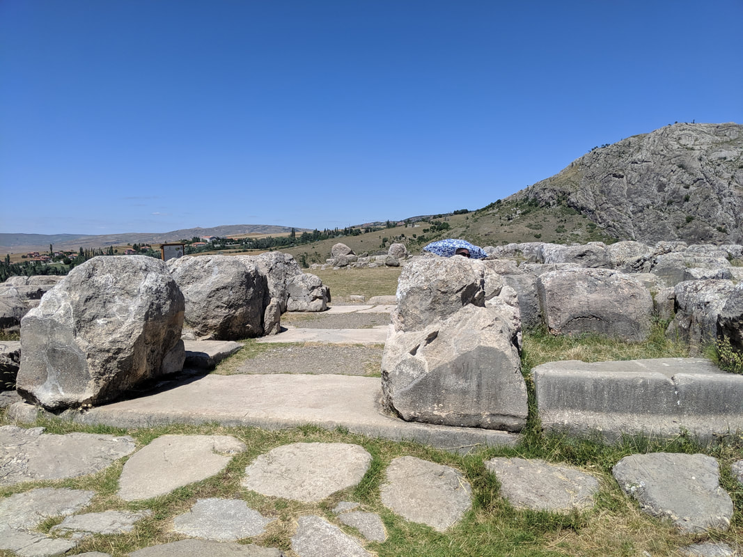
Tortoises tamed and cherries guzzled, I rounded the bend in the track and entered a pleasant stip of shade cast by a stand of pine and birch trees. The sound of a high breeze, sussurating through the branches provided an extra sensation of coolness. But then I heard something else: running water. I knew what this was before I saw it - the Ambarlikaya (or River Ambar, as I call it in Empires of Bronze). This was the waterway - sacred to the Hittites - that ran through their capital all those years ago and still does even now. This is where Prince Hattu and his brother Muwa, swam and played as children. This is where the Wise Women of the Hittite Empire would have prayed and divined. 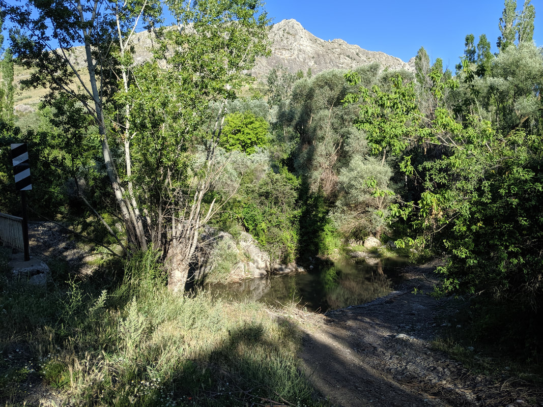 The River Ambar: sacred and ancient. A few hundred yards on the trees opened up and I once saw the site before me. Dominant in the foreground was the stretch of reconstructed lower town walls. These stout defences would have run for some 7 miles all around the mountainside. 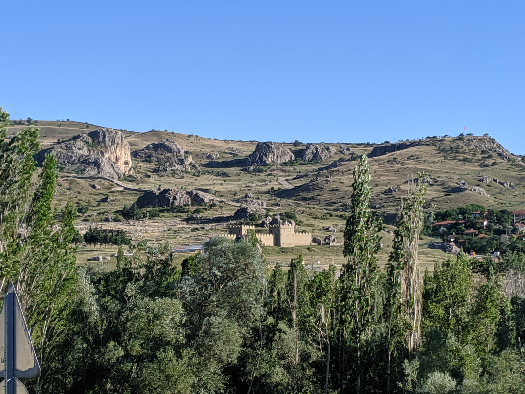 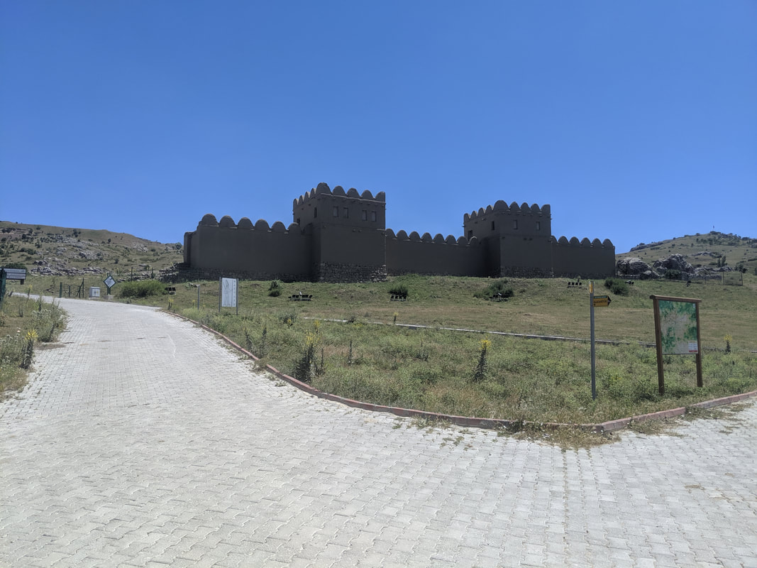 The walls: faithful to the Hittite design, with a foundation of cyclopean rocks to stand strong against flooding, and a high, mud-brick upper. Walking around HattusaSo here I was! Hattusa was first 'discovered' by Charles Texier in 1834. Seemingly he was stunned by the place and it's sheer scale and architectural ambition - and I could see why: the interior wards and fortifications of the city are built on the most precipitous of rocks and crags, and the expanse of the place simply blew me away. Here's a vid of my first impressions: I got my bearings then began to follow the route map in my guide book. First, I came past the Storm Temple - the greatest and most sacred of the many Hittite temples. This one was - as the name suggests - built to honour the Hittite Storm God, Tarhunda. Like all Hittite temples, the focal point was an open-air central plaza, at the corners of which niche-rooms housed statues of Tarhunda himself and his divine wife Arinniti, Goddess of the Sun. More, the temple was ringed by a huge ward of warehouses and workshops, where the clergy and temple artisans lived and worked.
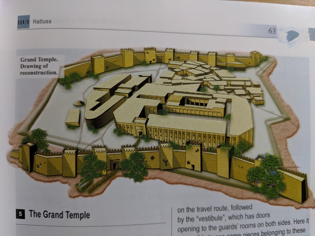 An artist's impression of the Storm Temple as it might have looked in its heyday.
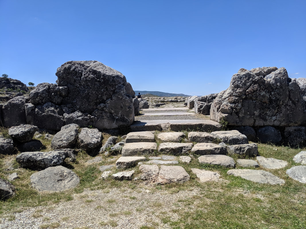
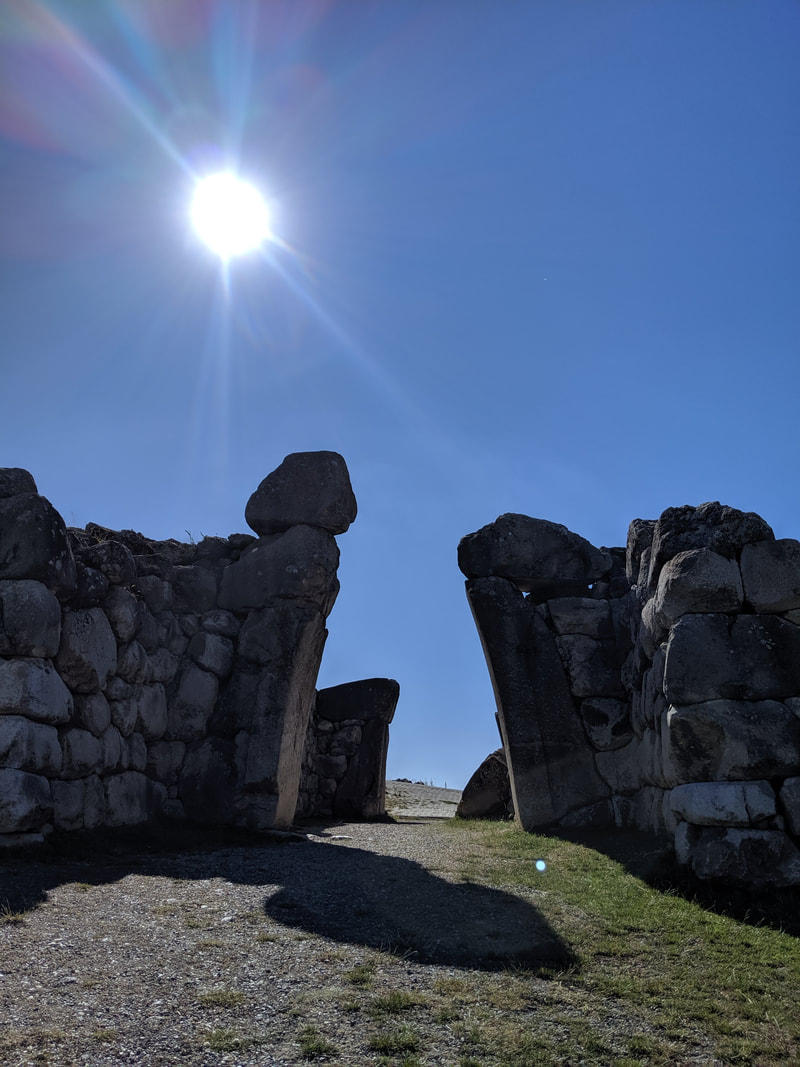
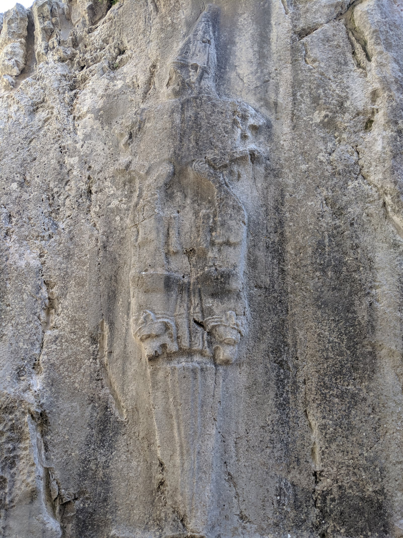
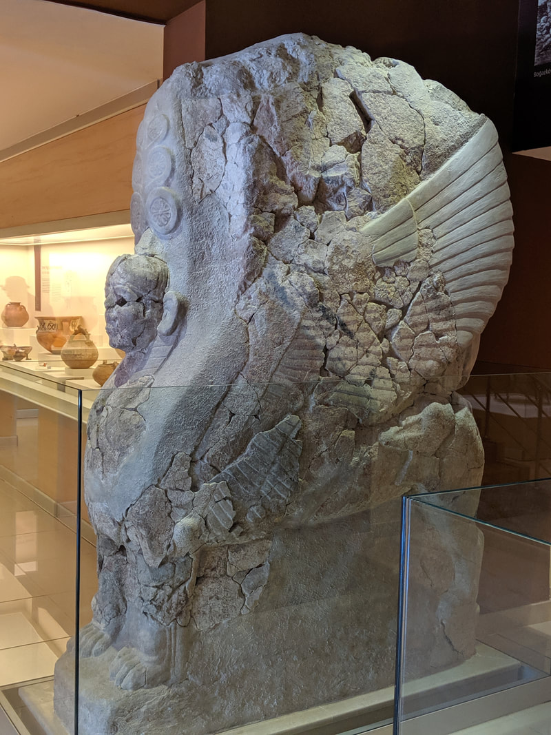
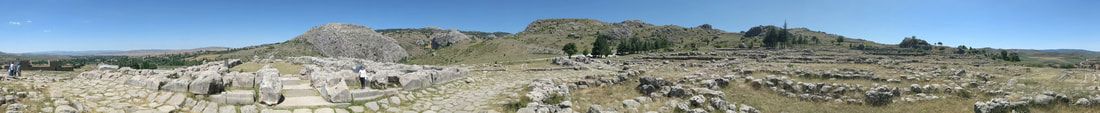 A panoramic from the centre of the Storm Temple ruins. After the Storm Temple, the path leads steeply uphill, through the foundation ruins of the original city's outer walls and ascending to the later 'Upper City'. All the way, the Hititte fondness for ultra-ambitious architecture stunned me. There were gates perched on bluff edges and forts planted up on towering rocky pillars like eagle's eyries. Rather stirring was the sight of a falcon soaring up on the thermals. I felt a true frisson of emotion then, wondering if Hattu might have watched his pet falcons fly like this, right here. 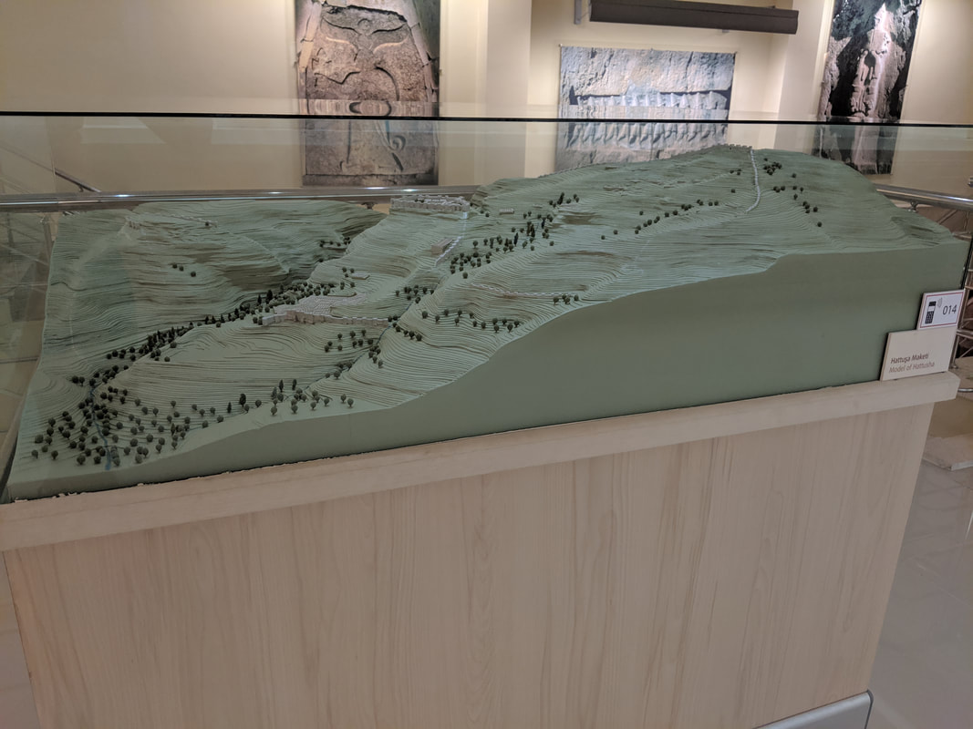 A 3D terrain map of Hattusa. The Ambarlikaya ravine on the left splits the original city, while the right hand of the map is dominated by the Upper City. This map gives a great impression of the absurdness of the terrain. How ambitious were the Hittites for building their capital here?! 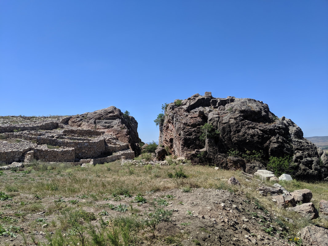 'The Split Rock'. This was used as a quarry in Roman times, but the upper surface still shows evidence of the Hittite structures that once stood there. 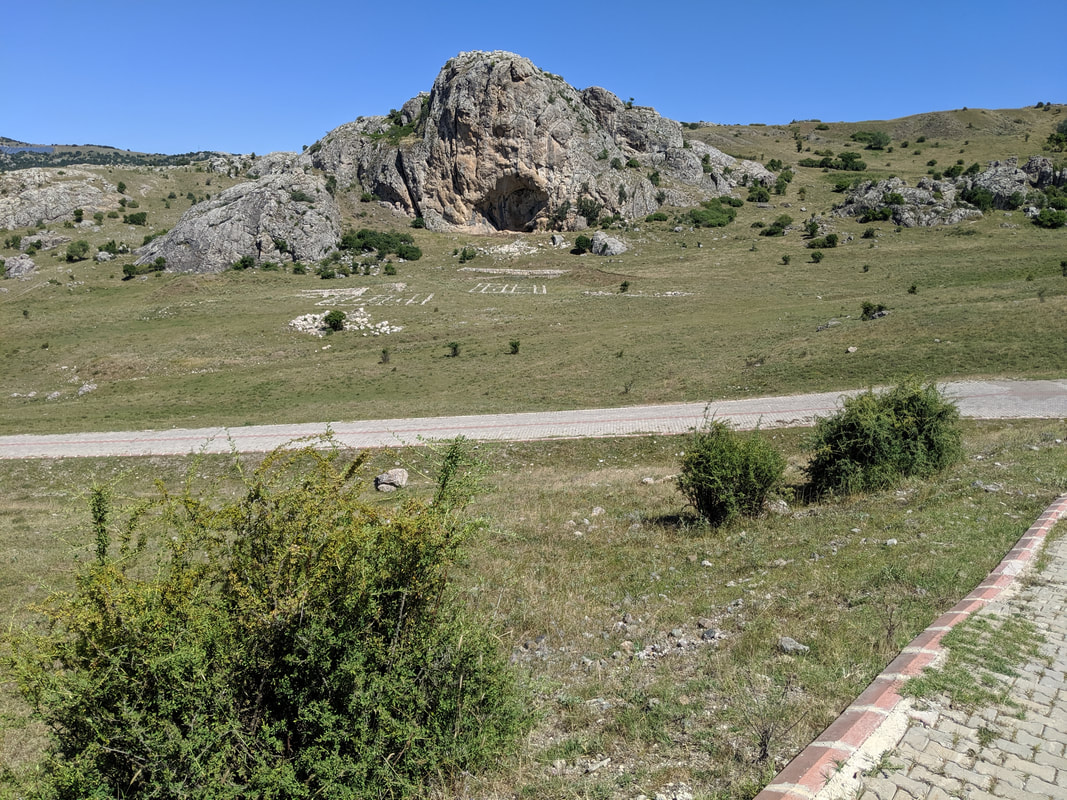 Sarikale - the "Yellow Castle" (so-called because of the yellowish hue of its rock). Which sports the foundations of a Hittite fortress on its apex. One of several fortresses *within* the city. What level of threat did the Hittites foresee? Approaching the high-point of the Upper City's southern reaches, I came to a run of three mighty gateways that took the breath away (or maybe that was just because I was a bit out of puff!) The wind at this height was buffeting but pleasant at least in that it took the edge from the blistering heat of the sun. 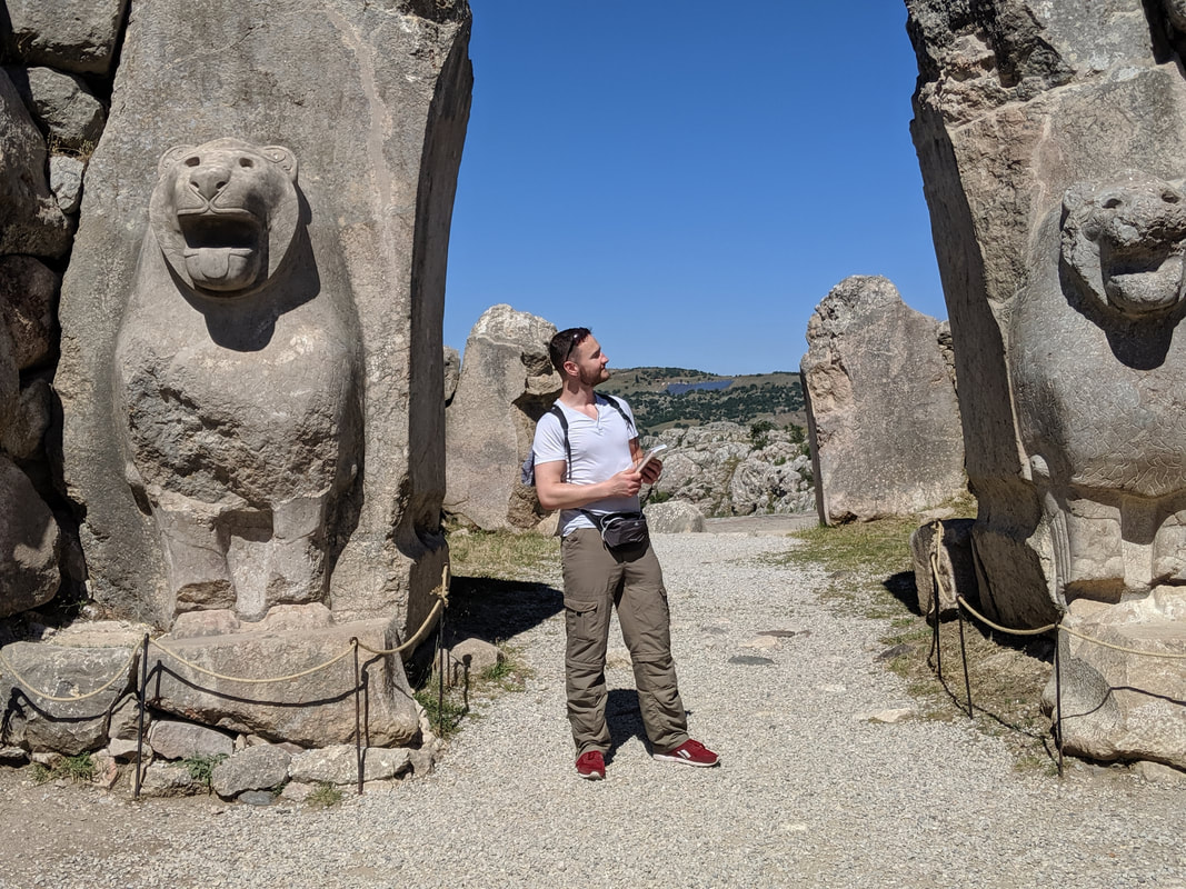 The Lion Gate! Two more of those Hititte lions, roaring out into the countryside from the Upper City's western walls. 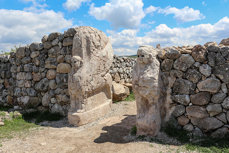 The Sphinx Gate - perched on the highest point in the entire city. interestingly, although the sphinx imagery might have been an influence from Egypt, these Hittite sphinxes are female and winged.
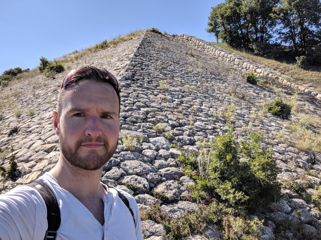 The massive ramp upon which the Sphinx Gate sits.
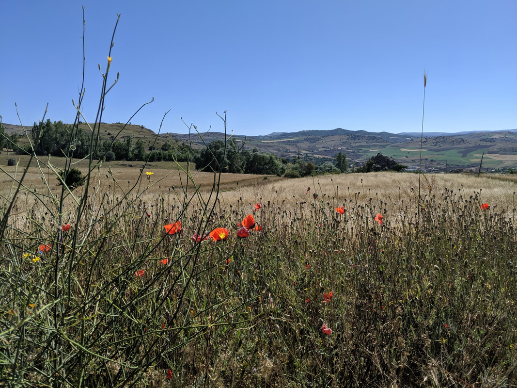
The 'Upper City' was built in the time of our hero, Hattu from Empires of Bronze. This extension to the capital was spread all across the sprawling heights to the south of the original city, doubling the size of the place. The strange thing is, the new ward is comprised almost entirely of temples. Scores of them. And atop the high outcrops of rock between the temples, the Hittites built lofty fortresses. Yerikale and Sarikale (yellow castle) are the two most impressive of these. And the whole Upper City region was encompassed in massive buttress walls - double-layered in places. So why the many temples and fortresses? Why the sudden need to double the city's size? Those are the questions I examine in this next video: Down through past the Upper City's eastern walls we came, past hieroglpyh chambers and more temple ruins, back into the original city before finally approaching the acropolis. This was the centre of the capital - the fortified residence of the Hittite Labarna. Here, foreign kings would have come to pay homage to their Hittite master in a grand hall. Here, Hattu, his ancestors, father, brothers and children would have lived. 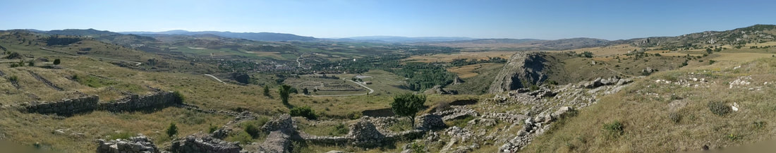 A panoramic from the acropolis' royal palace ruins, looking west over the lower town, out onto what would have been grain fields (now the modern town of Boğazkale). 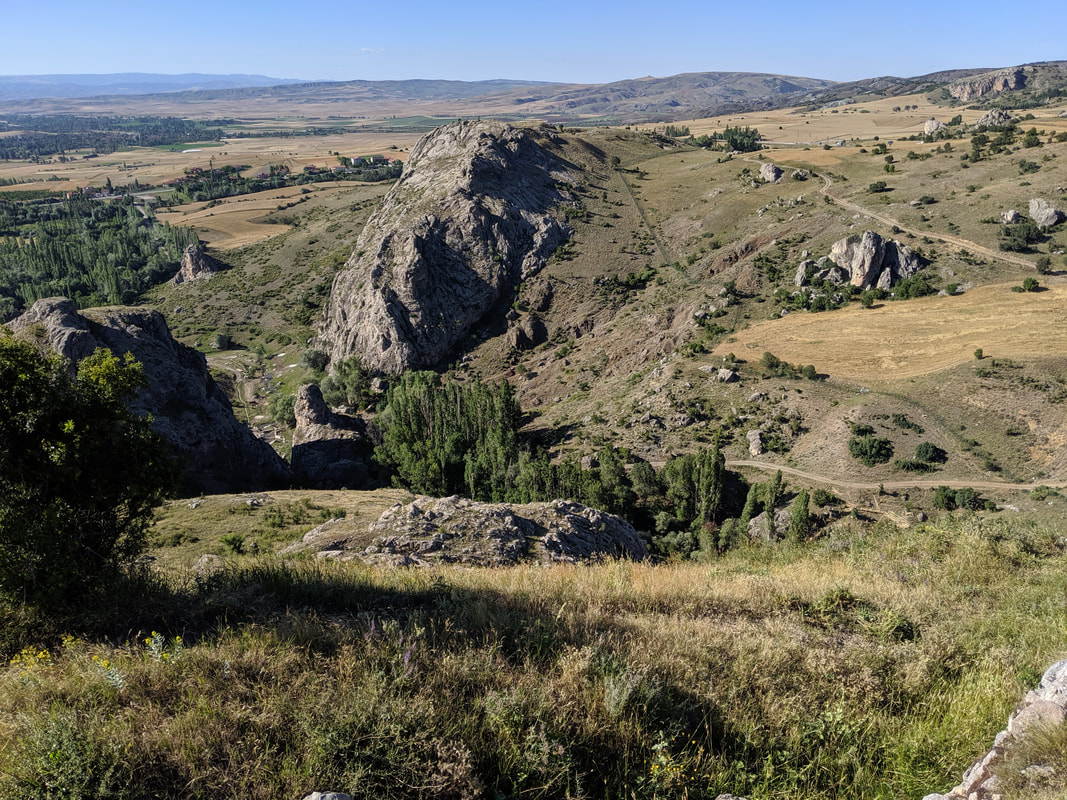 Looking north, across the Ambarlikaya ravine, to the northern and matching tor known in Empires of Bronze as 'Tarhunda's Shoulder'. The photo does not do the sheer height of this acropolis justice. 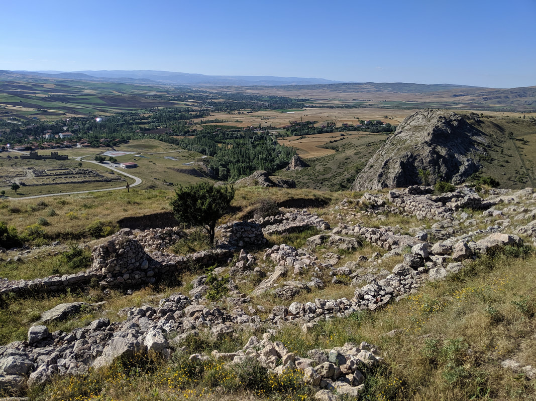 The Hititte Royal Palace ruins in the foreground. Here's my video, taken up on the acropolis. I try to summarise my thoughts and feelings about the place on what had been an incredible day. After so long, I had finally walked the same ground as Hattu and the line of Hittite Kings! After nearly 15k of walking - most of it steeply uphill - I felt surprisingly fresh, But on the way back to my hotel - probably once the adrenalin started to subside - my legs began to ache. When I reached the hotel, Denis, the owner, was running a birthday party for his young son. I sat down in a quiet part of the restaurant, ordering and enjoying a delicious meal of doner and rice with an ice-cold beer. Then Denis came over, kindly bringing me a bowl of popcorn and a giant slice of birthday cake to enjoy :) Off to bed I went, replete, exhausted... and exhilarated. Yazilikaya - The Great Rock ShrineThe next day, I awoke feeling stecky (a Scottish term meaning stiff) but well-rested, I sat on the porch of my room in the morning sunshine, enjoying a traditional Turkish breakfast of tomatoes, cucumber, olives and cheese, along with fresh apricots from Denis' orchard and a super-strength coffee! I was due to leave later on in the day after this all-too-short visit, but I still had time to see two more close-by and crucial Hittite sites. First up, Yazilikaya - the ancient Rock Shrine out in the nearby countryside. The walk from Boğazkale to Yazilikaya is about 3km. not too bad, but in 30 degree heat and with zero shade... and all sharply uphill, you'd be advised to take the usual hat, water and good walking shoes. All that aside, the trek there is pretty special. I did it on a perfectly still summer's day, along the winding tarmac road that rises past Hattusa's northernmost promontory (Tarhunda's Shoulder), giving excellent views of the precipitous battlements on that end of the city, and then splendid vistas across the countryside near Hattusa. I did this in July, and the land to the west was a patchwork of rolling green, gold and hazy terracotta and grey nearer the horizon. The fields were freckled with poppies, buttercups and tulips and misted with a haze of butterflies. East and south was dominated by the Hattusa massif... but northwards was strange - a green and constantly rising land, studded with silvery warts of rock. One of which stood proud, and I knew - just as I knew when I saw Hattusa from a distance - that I had arrived at the famous rock shrine.
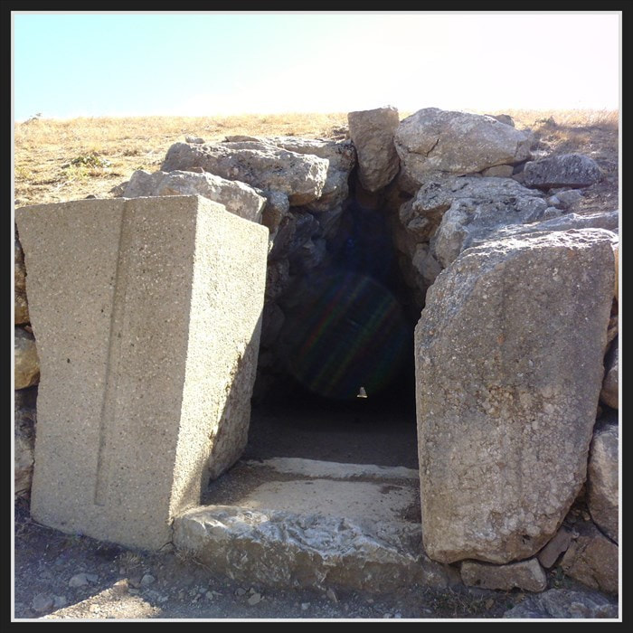
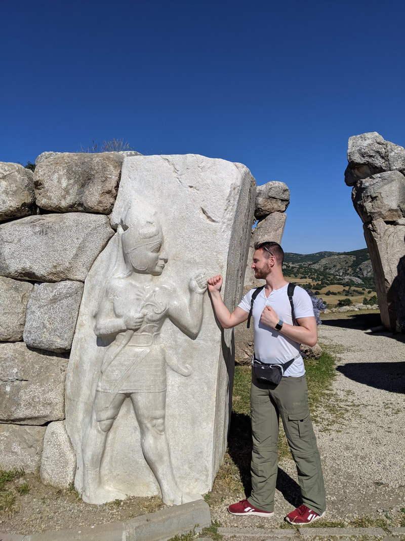
 Archaeological signposts marking out the distance to the nearest Hittite cities! In the background: Yazilikaya - the ancient Hittite Rock Shrine. 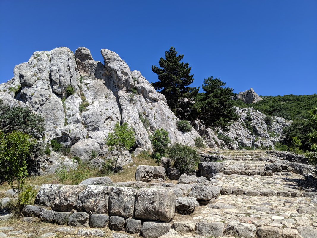 The entrance to Yazilikaya. 3,000 years ago, the Hittites would have trooped here in great processions to celebrate their many religious festivals. Yazilikaya, literally 'The Written Rock' is rather aptly named, for some of the finest extant Hittite reliefs are to be found here. They venerated this place almost as much as the great Storm Temple in Hattusa. During Hittite times the steps (see the image, above) would have been covered with a vestibule of sorts which would have led right up to the jagged 'crown' of rock on the left of the pic. Inside the 'crown' sit two roofless chambers (known as A & B), adorned with images of Hittite Gods, Kings and legends. The place was embellished throughout the reign of the Hittites, with some of the final modifications dated to the very last of the Hittite Kings. 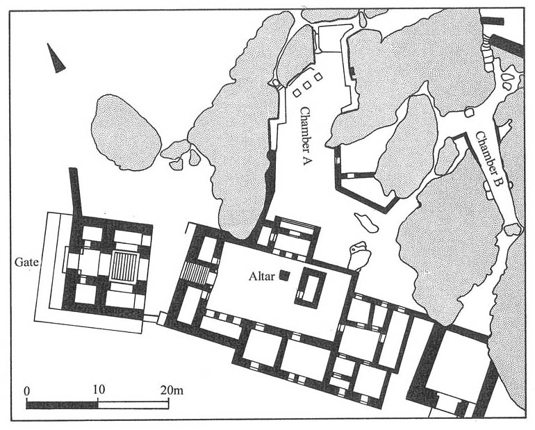 A map of the rock shrine. Here's my video of 'Chamber A', along with some 'Haga-spotting' :) ... and then some pics from within the shrine. 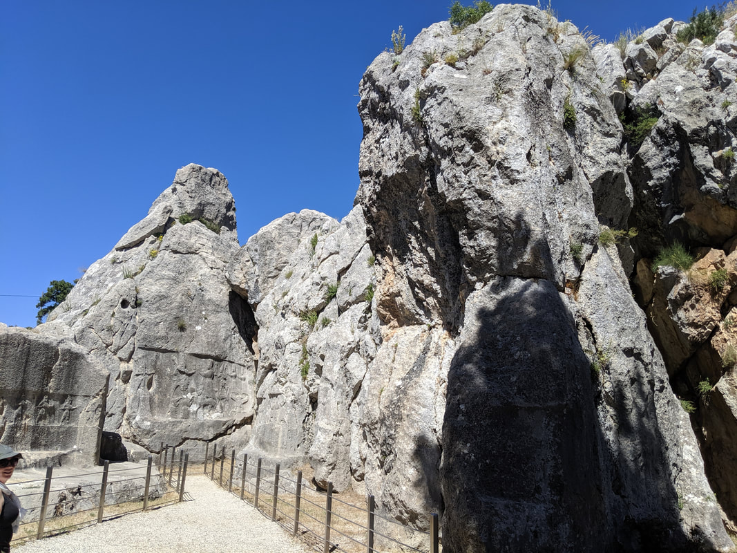 Chamber A, with the main relief at the end and smaller reliefs on the side walls 'walking' towards it.
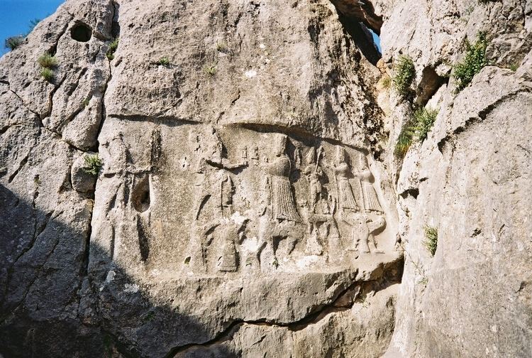 The 'main' relief, showing Tarhunda God of the Storm (L), walking on the backs of Mountain Gods, meeting Arinniti, Goddess of the Sun (R), who walks on the backs of panthers. The Haga is on the bottom right! 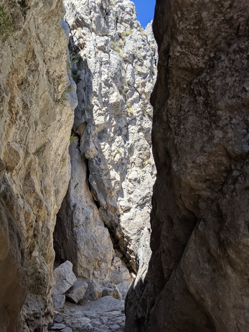 The narrow passageway leading into Chamber B. I will admit I did feel a bit 'Indy' at this point :)
 Chamber B's famous 'Twelve Gods' relief. The Hattusa MuseumAfter Yazilikaya, I headed back into Boğazkale, and to the Hittite Museum there. It is small-ish but thoughtfully laid out inside, and it does a fine job of telling the Hittite 'story' It also houses Roman, Byzantine and Phrygian finds from the local area, but it is first and foremost a Hittite exhibition. Here are some of my best pics:
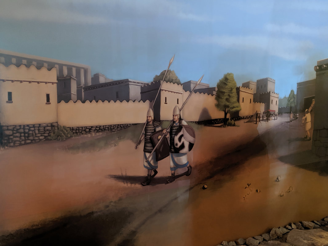 Some evocative artwork showing two Hittite guards on partol around the streets of Hattusa.
 An aerial photograph of the ramp below the Sphinx Gate. Imagine you were an envoy from a rival empire approaching this. How small would you feel? Brimming with facts and ideas, I left the museum behind (dropping off more of my bookmarks on the way out!) and caught a lift to the nearby town of Yerköy, where I was scheduled to catch the famous 'Eastern Express' sleeper train that would take me across Turkey - right through the ancient Hittite heartlands - and to the country's eastern edge. The next part of this blog series will chart my rail-based adventures! Hattusa Travel Tips
A full gallery of my visit to Hattusa is available here on Facebook (Like and follow, please!) Quick navigation:
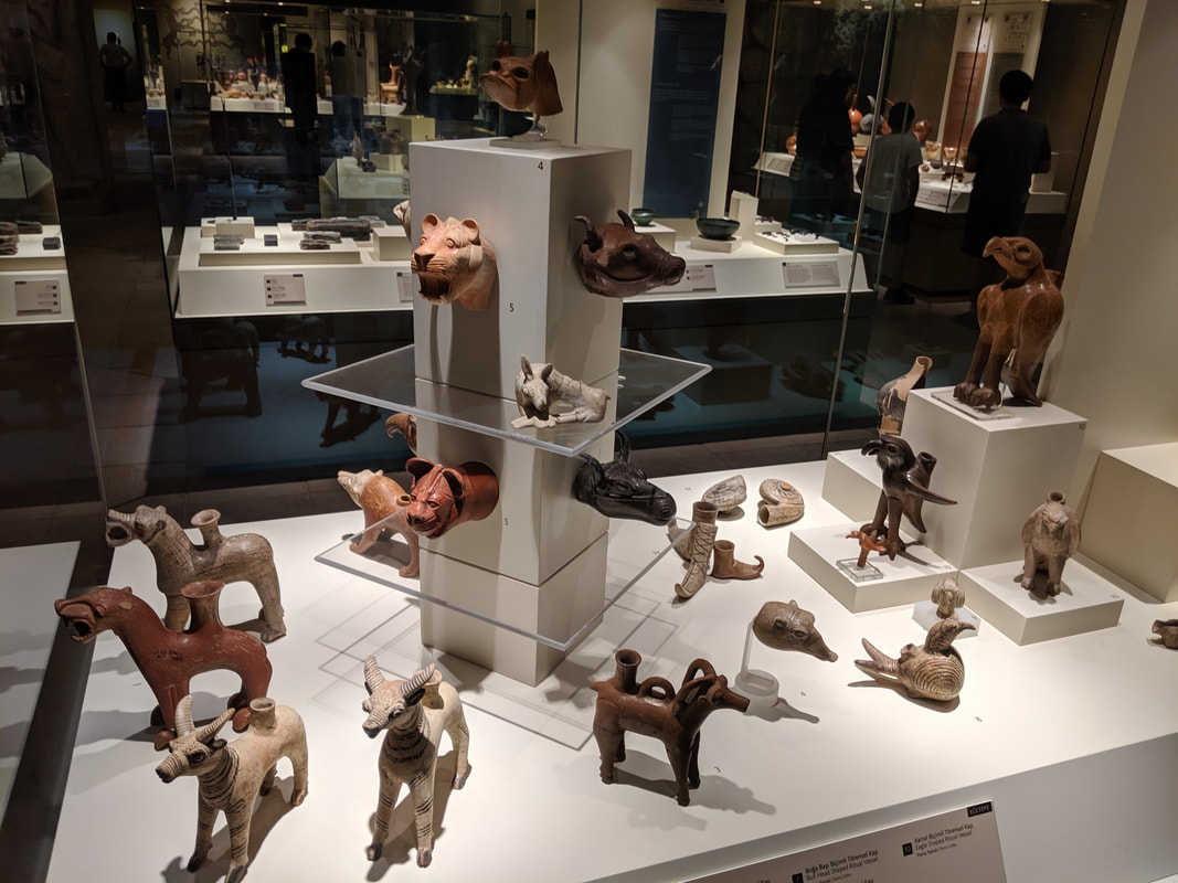
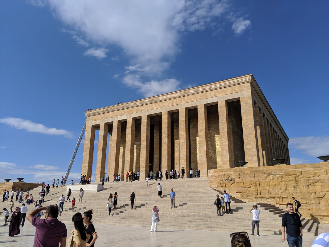 The Anitkabir - an incredible monument at the heart of Turkey's capital. Despite many visits to Turkey, this was my first proper foray across the country's interior, and it began on the high speed train from Istanbul's Karikoy region (the part on the Asian side of the city). We whizzed through the outer suburbs of the city and soon we were in a green, hilly paradise. It brought to mind Seton Lloyd's description of the Turkish landmass: "Anatolia is like an open left hand, palm upturned, with the thumb curled inwards to represent the Taurus Mountains in the southeast. The palm represents the central plateau and the heel of the hand the eastern massif, and the fingers the diminishing ranges which extend westward to find their echo in the islands of the Aegean" 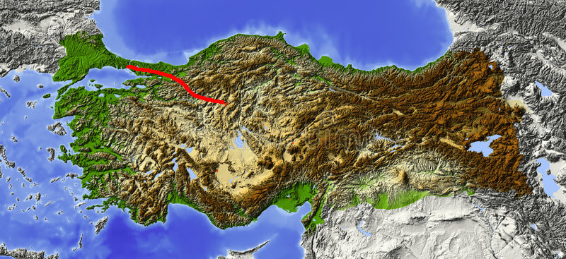 A terrain map of Turkey. Can you see the 'open left hand' pattern Seton Lloyd spoke of? Once you do, you'll never forget it! The train route from Istanbul to Ankara is marked out in red. Hittite Lands, here we come! Speeding towards Ankara on the train, we were traversing the land of valleys and rivers - the 'fingers' of Lloyd's useful mnemonic. With every mile we travelled, we were also climbing - because we were headed towards that central plateau, a rugged land ranging from 2,000-10,000 feet above sea level... the heartland of the Hittite Empire. 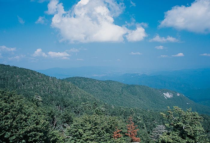 The green valleys of northwestern Turkey - the fingers of Seton Lloyd's 'open left hand'. I settled back, popped in my earphones to listen to an H.G. Wells audiobook (War of the Worlds) and drank in the views of the wooded hills, river vales and hazy summer sky. Having paid a whole 36 Turkish Lira (roughly £4.50) for this 4 hour train trip, I had in my backpack a bottle of water and a rather uninspiring pretzel. After all, this was economy class, so you have to bring your own grub, right? Wrong! The trolley chap came along and started loading food onto my table: fruit juice, fresh bread, dried apricots, olives, salad, cheeses, cakes, coffee... a veritable feast - all complimentary with the economy service. I'm not sure he understood why I started gibbering in gratitude, but thankful I was and I munched away for the next hour of the trip.  Free scran! Well it felt like it anyway. You'd pay £4.50 for a coffee and a biscuit on British trains. Here, you get your ticket and all of this for the same price! As we gradually ascended onto the inner plateau, I was reminded of another traveller's description of the changing landscape. Gertrude Bell, writer and archaeologist said: "Before me stretch wide plains, corn-growing where rainfall and springs permit, often enough barren save for a dry scrub of aromatic herbs, or flecked with shining miles of saline deposit; naked ranges of mountains stand sentinel over this expanse" Very evocative! I really did feel like I was entering a different land - cooler (still sweltering though) higher and differently shaped. And the city of Ankara itself is very different to Istanbul. Smaller - just the 5 million people here! - and with a very different vibe. It isn't as 'pretty' as Istanbul, but it does have its own type of ascetic beauty. Spread across the wide open hills and plains like a defiant outpost it more accurately personifies Turkey as a country. 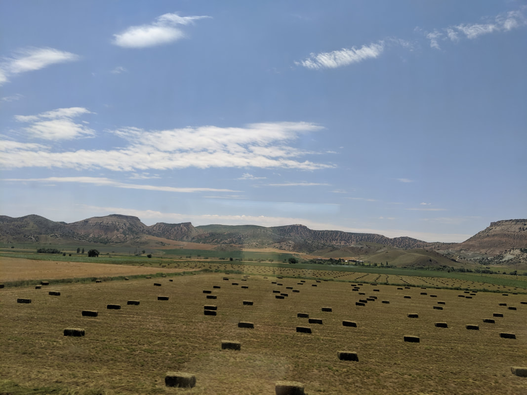 The very different terrain of the inner plateau. 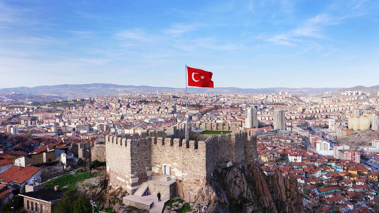 Ankara Castle, originally constructed by the Byzantine Emperor Constans II in the 7th century AD. Another bonus is that the prices here are vastly cheaper than in Istanbul. After arriving in central Ankara, I enjoyed a lunch of tasty doner kebab and cold coke which cost less than 2 quid, and the '2017 hotel' (breakfast included) cost £20 per night - good value for a traveller on a budget. First, I had to visit the Anitkabir - an iconic structure that defines modern Turkey, and has Hittite connections. I'll let my YouTube vid explain: 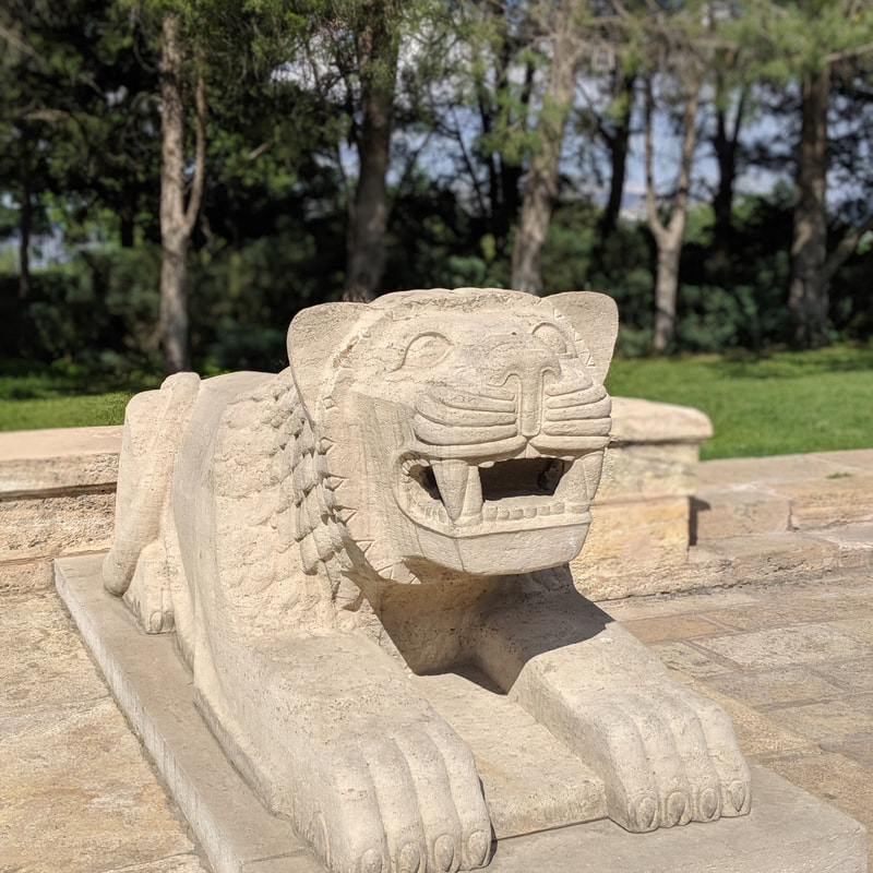 And it was a pleasant surprise to find Hittite lion statues lining the approach to the monument. But the main reason I was here in Ankara was for its famed Museum of Anatolian Civilizations - an absolute treasure trove of history, with exhibits ranging from the stone age, the Hittite period and all the way through to Byzantine times. I wasn't sure just how much Hittite stuff I would find here. What if the Hittite collection amounted to no more than a few bits and pieces? So I was absolutely thrilled to see, on my approach, this giant replica of a Hittite totem (known as a huwasi)... as well as some other rather light-hearted Hittite references...
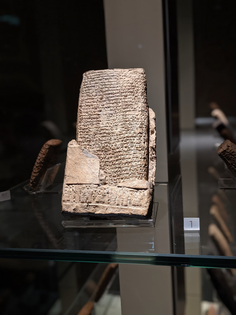
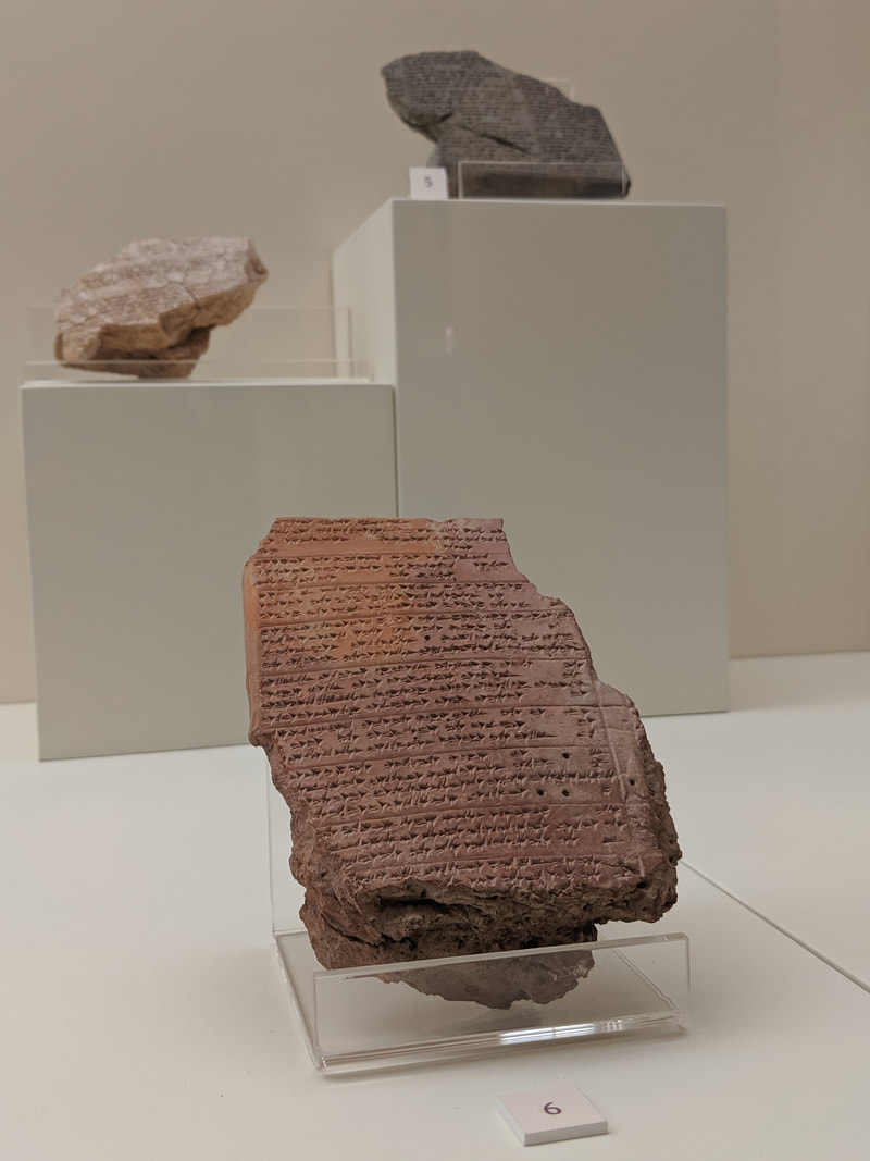
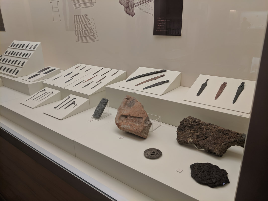
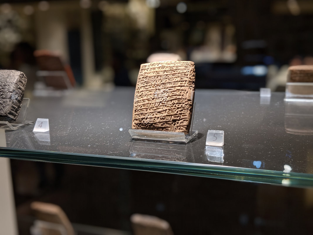
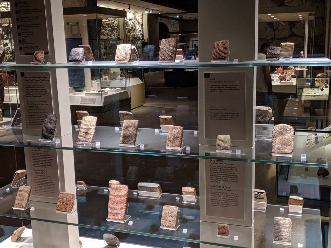
Inside the museum was even better. Laid out in successive epochs, starting with the paleolithic era, it beautifully tells Anatolia's story with a selection of glass-case artefacts, interactive big screens and tableau recreations of ancient homes. I could actually 'see' Hittite culture emerging into history, especially with the variety of sun disc artefacts dating from the late 3rd/early 2nd millenium BC. The sun disc would go on to become a Hittite royal symbol by around 1600 BC. 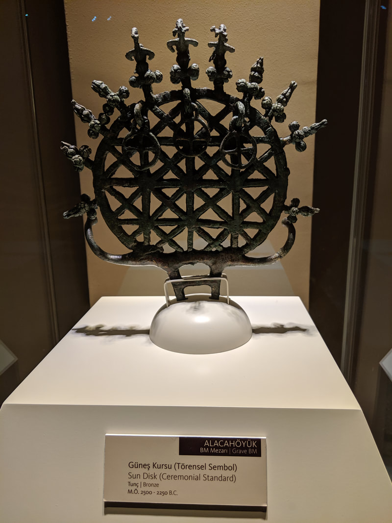 An early Anatolian (pre-Hittite) sun disc. Then I came to the Hittite section proper. The first thing that struck me was the number of tablets. Beautiful and majestic things. Whole and undamaged unlike the Kadesh treaty. There was even one incredible bronze slab, laced with chains, authored by King Tudhaliya IV, son of our hero, Hattu. 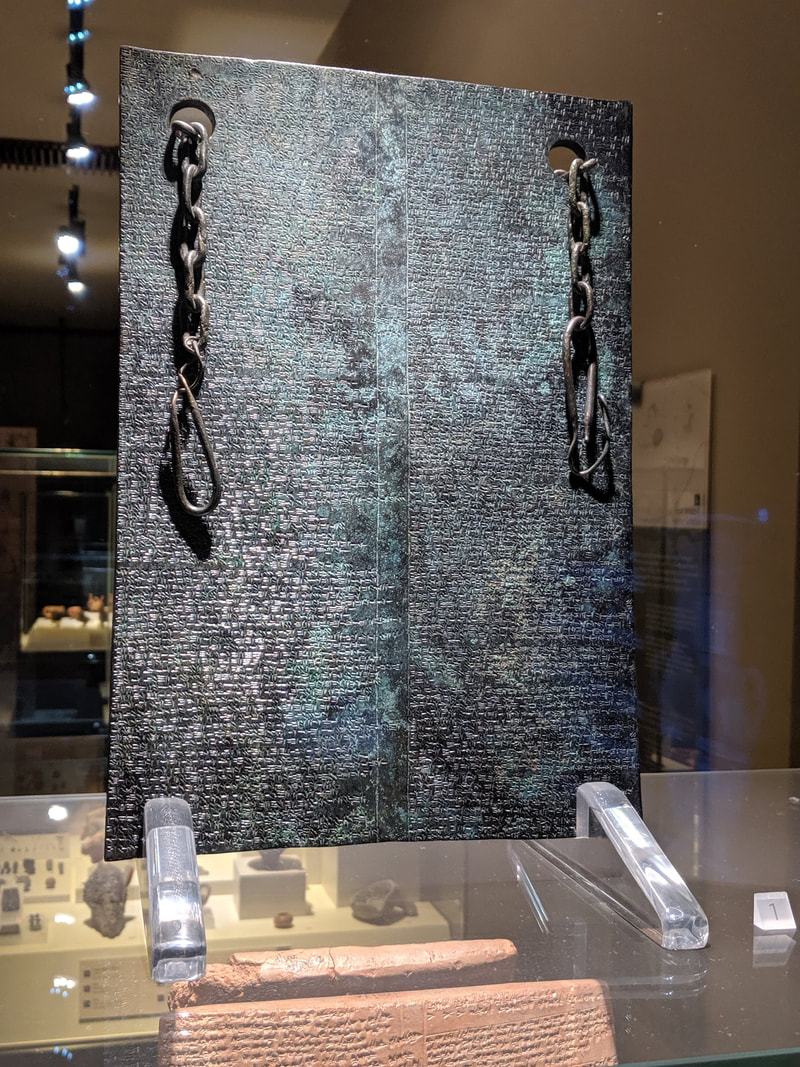 Is this not a breathtaking piece? This intact bronze tablet was discovered near Hattusa's Sphinx Gate. The tablet details a treaty between King Tudhaliya IV and Kurunta, King of Tarhuntassa (a Hittite sub-kingdom).
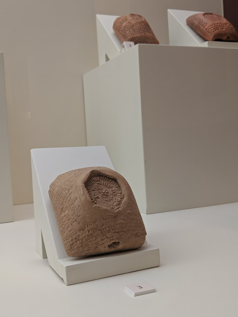
 And how beautiful is this: one clay tablet, still partially wrapped in its clay 'envelope' - which is itself marked along the bottom with heiroglyphs from a cylinder seal. 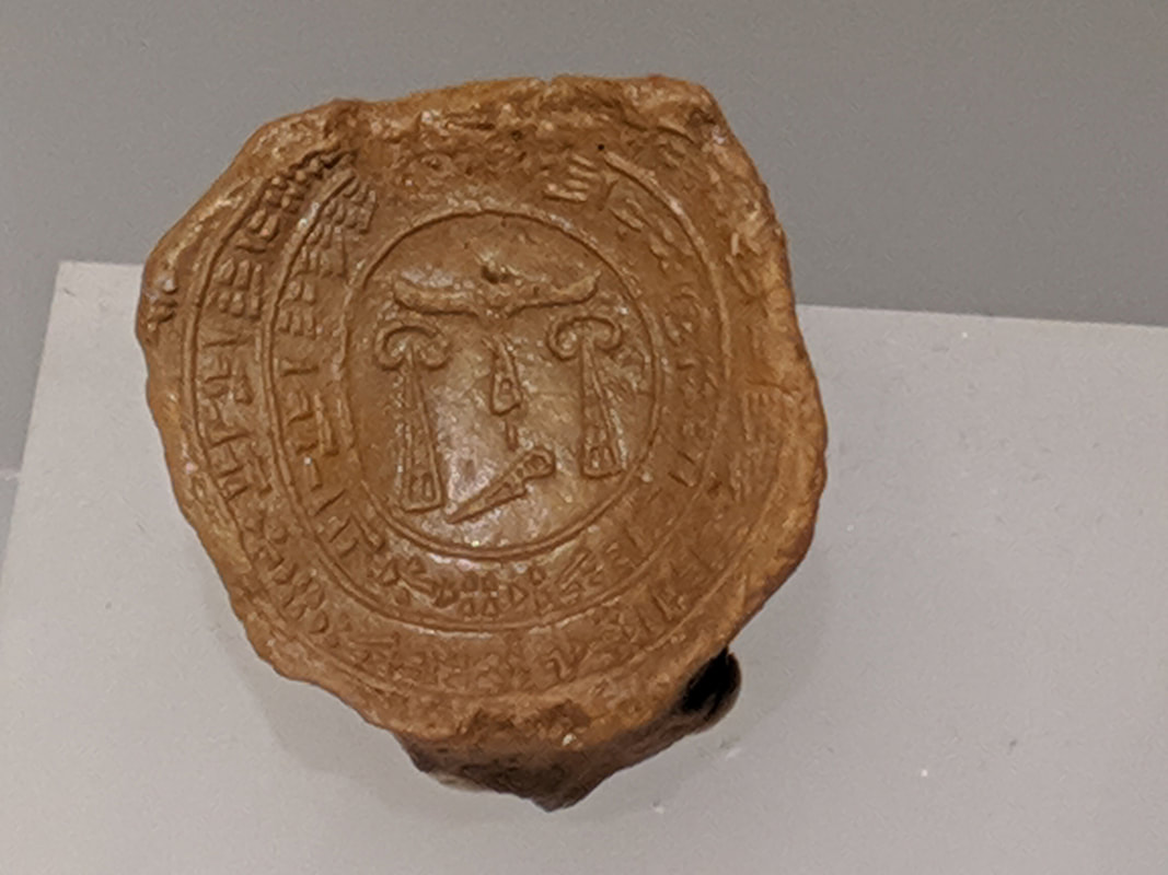 The mark mde by a Hittite royal stamp seal. The Hittite King (the Labarna) would press his seal into the soft clay to 'sign' important tablets before they were baked hard. Note the mix of cuneiform a-script around the edges of the seal-marking, and the hieroglyphs in the centre. This is why we know it is a royal seal, as only Hittite Kings were allowed to use script and glyphs. The hieroglyphs show a winged sun disc. Below each wing tip we see the great king symbol. The tall triangle represents an ordinary king, and the kidney-shape on top makes it a 'great' king. Also... this seal probably belonged to a certain King Urhi-Teshub... There were statues of the sacred twin Hittite bulls too - Serris and Hurris. There were drinking vessels, seals, brooches, rather detailed wedding night manuals* painted in the sides of vases. The world that had existed in my head until now was real, tangible... right before my eyes. *I'll leave the details to your imagination :) 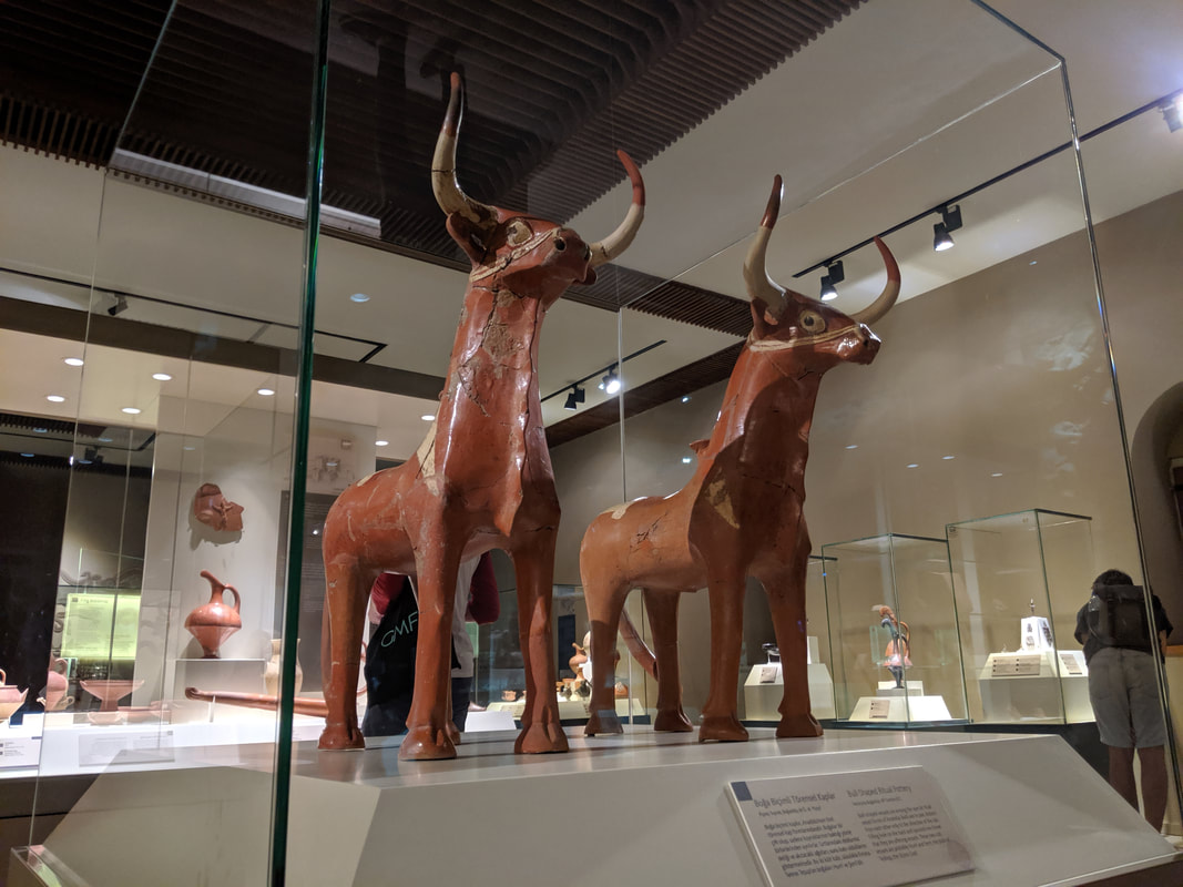 These two bulls are Serris and Hurris. Tarhunda, Hittite God of Thunder, would walk on these creatures' backs.
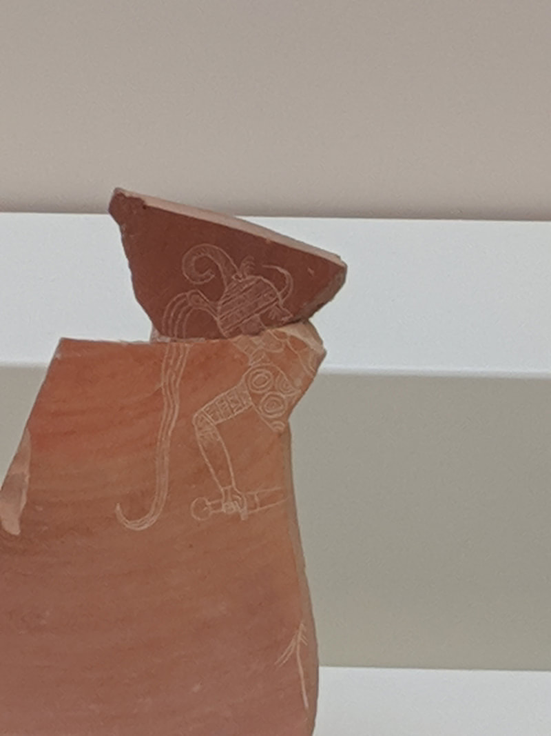
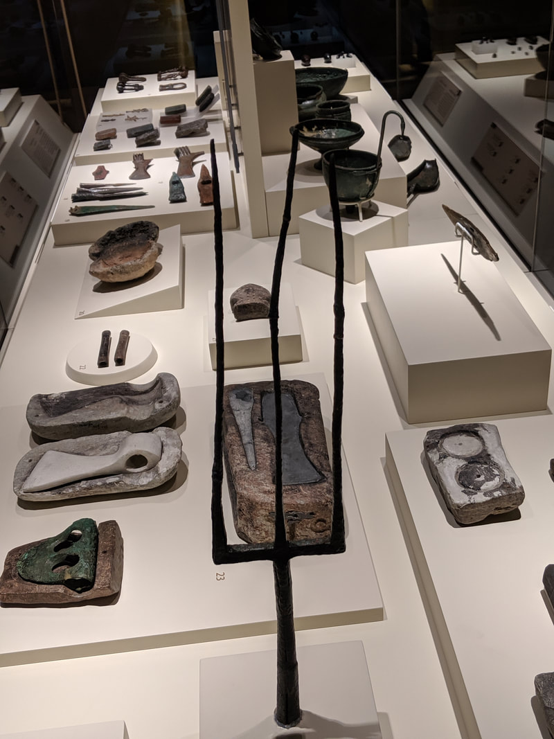
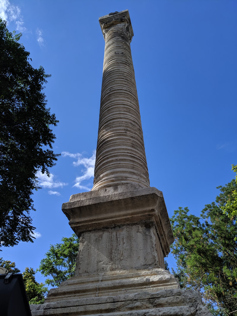
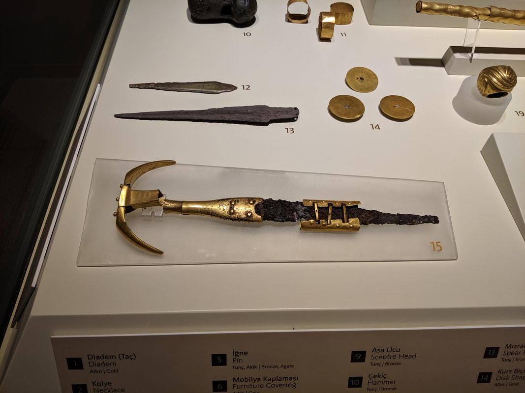 A bronze handled sword with an iron blade. A very interesting find and one that stokes the old 'did the Hittites use iron weapons' debate. And then there were the architectural pieces. Great monoliths carved with the figures of Hittite Gods. Orthostats (stone slabs that once clad Hittite walls and gates) engraved with scenes of ancient legends such as Gilgamesh, or depictions of marching Hittite warriors, More lions, griffins and winged bulls too. I happily snapped away with my camera, all the while thinking just how close the next stop of my adventure was. Hattusa, capital of the Hittites, where many of these treasures came from, was but a few hours away ;) 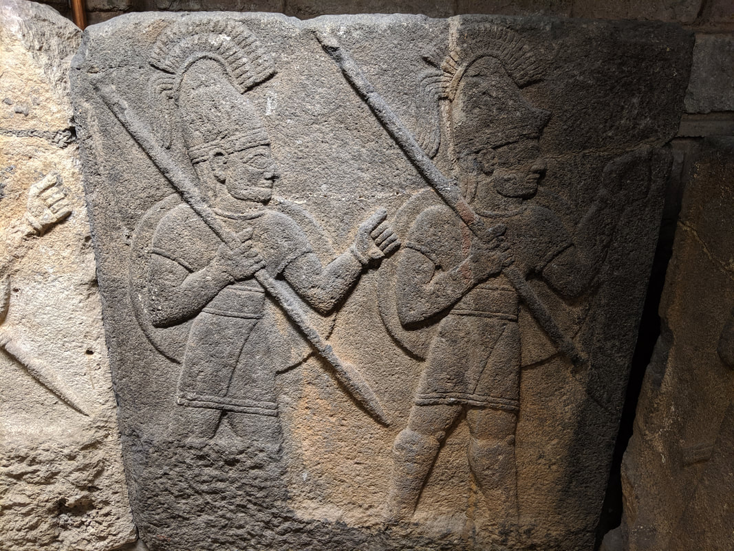 Orthostats (stone cladding from city walls) showing Hittite - possibly neo-Hittite - royal guards marching. 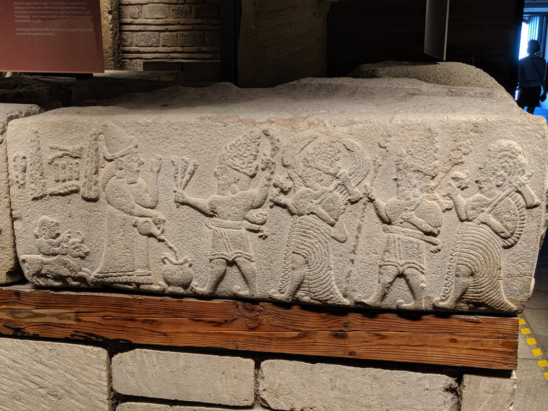 More incredible orthostats from the city of Aslantepe ("Lion Hill"): a scene of libation to the gods. Tarhunda, God of the Storm, leads a procession of deities on the right, while a Hittie King pours wine into a vessel on the left, and a bull is sacrificed behind him. 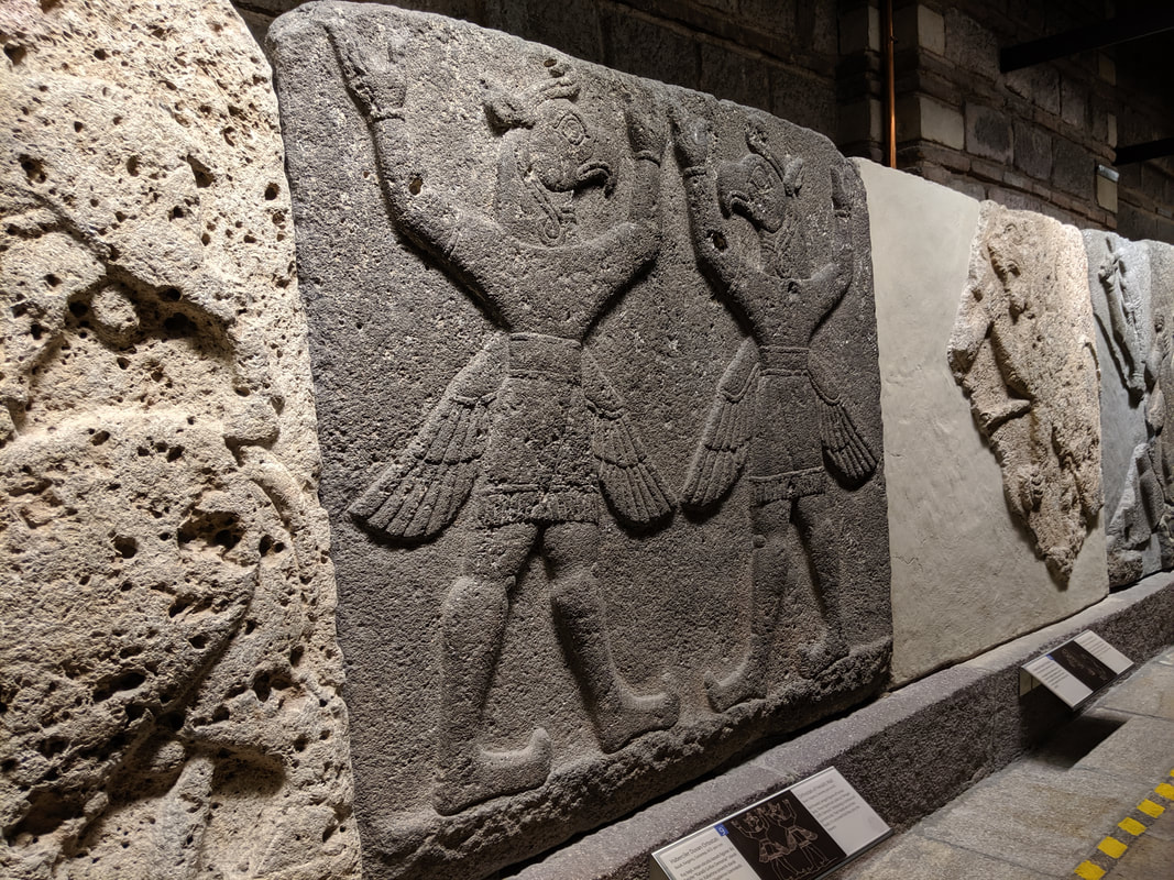 Winged griffin-demons from the walls of Carchemish (Gargamis in Empires of Bronze). 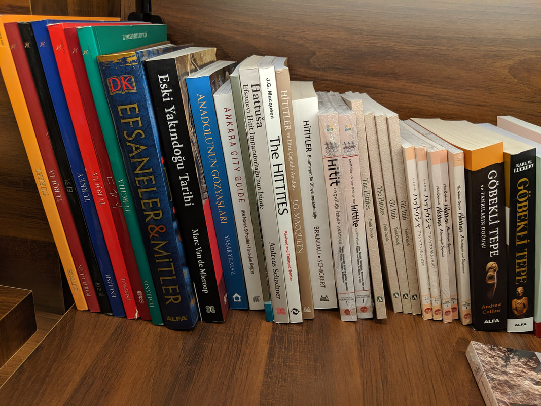 A nice selection of literature in the museum shop. I picked up a copy of "Anatolia: on the trail of the Hittite Civilization" (in the middle), as it included a perfect guide to a walking visit around Hattusa... the next leg of my adventure! I also left a pile of Empires of Bronze bookmarks with the staff here :) But first, a little bit of Roman research...Before heading to Hattusa, I had to see what other historical gems I could spot here in Ankara. In this respect, a stroll into downtown Ankara is well worth it if you have the time. I found the Column of Julian the Apostate, the Temple of Augustus and the Great Baths of Caracalla (infuriatingly closed minutes before I arrived, but I still managed to get a few shots through the fence). Check it out: 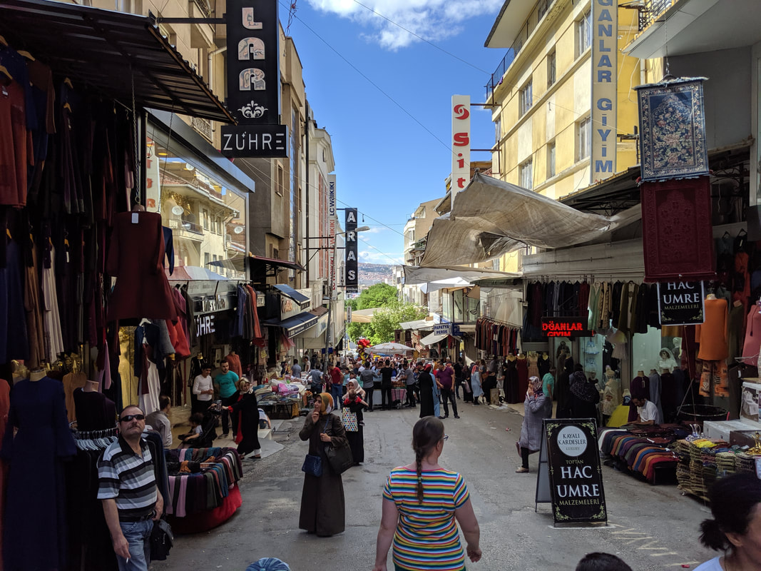 Market day! Ankara's back streets are packed with bargains. Even better, it's less touristy than Istanbul so you don't get hassled and can browse in peace.
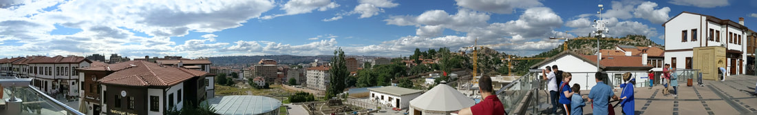 A nice panoramic from the mount of the Temple of Augustus. 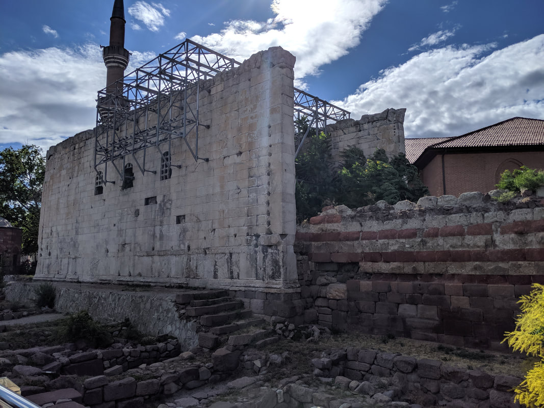 The surviving 1st century AD walls of the Temple of Augustus, with the abutting pink and white stonework of the later mosque. Famously, the wall sof this place have one of the best-surviving inscriptions of Emperor Augustus' work "Res Gestae" ("things I did") in both Greek and Latin.
All of the above sightseeing was spliced pleasantly with turkish coffee and baklava in the shade of street side cafes. A lovely way to round up the Ankara leg of the trip. Next up... Hattusa, the heart of the Hittite Empire! Ankara Travel Tips
A full gallery of my visit to Ankara is available here on Facebook (Like and follow, please!) Quick navigation:

Gordon Doherty is the author of the Empires of Bronze series, available in eBook, paperback and audiobook formats.
|
AuthorGordon Doherty: writer, history fan, explorer. 
My Latest Book
Archives
March 2023
Categories |


 RSS Feed